
The Zambezi Region is one of the 14 regions of Namibia. It is located in the north-eastern part of the country. It is largely concurrent with the major Zambezi River after which it was named. The region has eight constituencies and its capital is the town of Katima Mulilo. The self-governed village Bukalo is also situated in this region. The Zambezi Region had a population of 90,596 in 2011. As of 2020, it had 47,884 registered voters.

Oshana is one of the fourteen regions of Namibia, its capital is Oshakati. The towns of Oshakati, Ongwediva and Ondangwa, all situated with this region, form an urban cluster with the second largest population concentration in Namibia after the capital Windhoek. As of 2020, Oshana had 113,112 registered voters.

Omusati is one of the fourteen regions of Namibia, its capital is Outapi. The towns of Okahao, Oshikuku and Ruacana as well as the self-governed village Tsandi are situated in this region. As of 2020, Omusati had 148,834 registered voters.
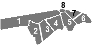
Kabbe was a constituency in the Zambezi Region of Namibia. Most of the area is situated in the flood area of the Zambezi River. It contained the former German colonial residence of Schuckmannsburg, as well as several other villages. Its population in 2010 was 14,979.

Tsumeb is a city of 15,000 inhabitants and the largest town in the Oshikoto region in northern Namibia. Tsumeb is known as the "gateway to the north" of Namibia. It is the closest town to the Etosha National Park. Tsumeb used to be the regional capital of Oshikoto until 2008 when Omuthiya was proclaimed a town and the new capital. The area around Tsumeb forms its own electoral constituency and has a population of 44,113. The town is the site of a deep mine that in its heyday was known as "TCL", but has since been renamed the Ongopolo Mine.

Orange Farm ("Farma") is a township located approximately 45 km (28 mi) from Johannesburg in the Gauteng Province of South Africa. It is the southernmost township of the City of Johannesburg Metropolitan Municipality. Its name, a misnomer given that oranges are grown in orchards instead of farms, has Dutch origins. It is one of the youngest townships in South Africa, with the original inhabitants, laid-off farm workers, taking up residency in 1988. Support for the population came slowly mostly from people who were tenants at the larger township of Soweto.

Kang is a village in Kgalagadi District of Botswana. It is situated in the Kalahari Desert and lies on the Trans-Kalahari Highway between Ghanzi in the north and Sekoma in the south. Kang also provides access to the Kgalagadi Transfrontier Park in the south-west and the Central Kalahari Game Reserve in the north-east. The route via Ghanzi takes one to the Namibian border, whilst that to Sekoma leads to Gaborone, the capital of Botswana. The population was 5,985 according to the 2011 census. Kang also falls under the Kgalagadi North constituency whose Member of Parliament is Hon. Talita Monnakgotla. The village is divided into seven wards which are; Gasekgalo, Gamonyemana, Gamotshoto, Gapanyana, Gamoriti, Kaatshwene and Tshwaragano ward. The village is led by a female chief, Kgosi Basadi Seipone who is the daughter to the late former chief Churchill Pego Seipone who died in 2010. The village's key development areas include the Central Roads Depot, Central Transport Organisation, Airstrip/Landing ground, mini Rural Administration Centre/ Service Centre, Botswana Open University Regional Campus, Brigade Centre, Police Station, Health Clinic, Magistrate Court, Department Road Transport Service offices, Wildlife offices, Botswana Power Corporation Offices, Water Utilities Corporation offices, Facility Management offices, Senior Secondary, Junior Secondary School and two primary schools.

Katima Mulilo or simply Katima is the capital of the Zambezi Region in Namibia. It had 28,362 inhabitants in 2010, and comprises two electoral constituencies, Katima Mulilo Rural and Katima Mulilo Urban. It is located on the B8 national road on the banks of the Zambezi River in the Caprivi Strip in lush riverine vegetation with tropical birds and monkeys. The town receives an annual average rainfall of 654 millimetres (25.7 in).

Siglap is a neighbourhood located south-west of Bedok in the East Region of Singapore. The area encompasses the Frankel and Opera Estates and their names have sometimes been used interchangeably to refer to the approximate same area. The planning subzone area of Siglap, as defined by the Urban Redevelopment Authority (URA), is confusingly and inaccurately referred to as the small strip of land between Victoria Junior College and Bedok South Avenue 1.

Otjiwarongo is a city of 28,000 inhabitants in the Otjozondjupa Region of Namibia. It is the district capital of the Otjiwarongo electoral constituency and also the capital of Otjozondjupa.

Luanshya is a town in Zambia, in the Copperbelt Province near Ndola. It has a population of 117,579. The town is situated in an area which was under Chief Mushili of the Lamba people.
Zhombe, originally known as Jombe, is a rural communal area in Kwekwe District, Midlands Province, Zimbabwe. It is an area of mixed Shona and Northern Ndebele People. It lies along the Mnyathi border line between Midlands and Mashonaland Provinces. There are a few commercial farms within its borders and a handful of resettlement areas. Most of it is within the Zhombe Constituency. Its administrative centre is the Zhombe Joel Growth Point, and it is under the Zibagwe Rural District Council.

Luhonono, until 2013 Schuckmannsburg, is a settlement in the Caprivi Strip in northeastern Namibia with a population of about 800. It belongs to the Kabbe North electoral constituency of the Zambezi Region. During the time of German colonialism, it was the capital of the Caprivi Strip.
Mathangwane is a village in the Central District of Botswana administered under Tutume Sub-district Council. The village is located at the confluence of Shashe and Vukwi rivers, 25 kilometres west of the City of Francistown along the A3 highway and almost entirely on the left bank of Shashe River. The population of the village was 5,075 in the 2011 national population and housing census. The village is characterised by many river valleys, mostly tributaries to Shashe River and used for identifying the village community wards (dikgotlana) boundaries.

Okaku Constituency is an electoral constituency in the Oshana Region of Namibia. It had 19,262 inhabitants in 2004 and 10,384 registered voters in 2020. Its district capital is the settlement of Okaku. Okaku falls under the Ondonga Traditional Authority.
Ondobe Yomunghudi is a village situated in northern Namibia in the Ohangwena Region. The village is named after tree species called Omunghudi that was in pan nearby during its discovery, an elderly revealed. Situated on the very edge of the Owambo region. The first thing that unique about this village is the abundance of people, unlike the rest of the country. People, livestock, shebeens (bars) and markets are everywhere, seemingly all existing harmoniously in unplanned order.
Oshindobe is a village situated in the northern part of Namibia in the Ohangwena Region. The village is named after the lake Ondobe during its discovery as revealed by an elder. It is situated at the very edge of the Owambo region. Oshindobe is located on the Cuvelai-Etosha basin, which is part of transboundary catchment shared by Angola and Namibia. The climate in this village is semi-arid and impacted by high rainfall variability which leads to regular droughts and floods. The two main sources of water for this region emanate from Angola: 1) from the upper part of the Cuvelai Basin and 2) Epumbu-Omadenga water pipeline, which occasionally provides drinking water. In most cases, people are dependent on hand-dug wells, 'omifimas', and seasonal flows of shallow water (Efundja) in Oshana between Oshindobe Village and Eengwena. In 1992, Community people of Oshindobe village and Eengwena village managed to dig a lake between these two villages that will store water until the next rainy season, despite the lake facing higher evaporation rates. The Oshindobe village is also faced with soil degradation, loss of grazing area, and unequal land distribution.
Ogongo is a settlement in the Omusati Region, in the central North of Namibia. Its neighbouring places include Outapi, Elim and Oshikuku.
Brendan Kongongolo Simbwaye (1934–1972?) was a Namibian anti-apartheid activist who was president of the Caprivi African National Union (CANU). Simbwaye became the vice-president of the South West Africa People's Organization (SWAPO) in 1964 after the two organizations merged. Simbwaye's life and political career was cut short in 1972 when he disappeared without trace.