Ikirun

Last updated

Ikirun
Town
Ikirun Post Office - Osun State.jpg
SeatOsun state

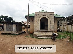
Ikirun is a town in Osun State, Nigeria. It is the headquarters of the Ifelodun Local Government Area. The population of the town is estimated to be 1,000,000. [1]

Contents

Geography

Ikirun bordered to the north by Inisa, to the south by Osogbo, to the east by Iragbiji, and to the west by the town Eko-Ende. The town is located in a valley surrounded by two hills: Obagun to the north and Aafo to the south. The Alaroka and Idi-olo mountains are to the east.

History

The town was founded by Akinorun, from whom the name Ikirun derives. Akinorun had two sons, Akinbiyi and Akinyemi, who also ruled the site.

Climate

In Ikirun, the wet season brings warm, oppressive, and overcast conditions, while the dry season is characterized by hot, muggy weather with occasional cloud cover. Throughout the year, the temperature typically ranges from 64 °F to 91 °F, seldom dropping below 58 °F or rising above 97 °F. [2]

The period of high temperatures in Ikirun spans approximately 2.1 months, occurring from January 23 to March 28. During this time, the daily high temperatures consistently exceed 89 °F. March stands out as the hottest month in Ikirun, with an average high of 90 °F and a low of 72 °F. [3]

Conversely, the cooler season in Ikirun lasts for around 3.8 months, extending from June 16 to October 10. Throughout this period, the daily high temperatures remain below 83 °F on average. August is recognized as the coldest month of the year in Ikirun, with an average low temperature of 69 °F and a high of 81 °F. [4]

Schools

Among the school that is in the town is federal government college ikirun a federal own school. [5] we also have Akinorun grammar, a senior secondary school in the Town. [6]

Culture

Every July, the Irele festival is held in Ikirun. It coincides with the harvest of new yams. The festival is celebrated in commemoration of Irele, the companion of Akinorun. Another celebration is the Egungun festival, which is held annually in May and lasts seven days. The Ikirun Day Celebration is a festival that commemorates the progress of the town, as well as a reunion for those who moved away from Ikirun.

Related Research Articles

<span class="mw-page-title-main">Osun State</span> State of Nigeria

Osun State, occasionally known as the State of Osun by the state government, is a state in southwestern Nigeria; bounded to the east by Ekiti and Ondo states for 84 km and for 78 km respectively, to the north by Kwara State for 73 km, to the south by Ogun State for 84 km and to the west by Oyo State, mostly across the River Osun. Named for the River Osun—a vital river which flows through the state—the state was formed from the southeast of Oyo State on 27 August 1991 and has its capital as the city of Osogbo.

<span class="mw-page-title-main">Lafia</span> Capital city of Nasarawa State, Nigeria

Lafia is a city in Nigeria's North Central region. It is the capital and largest city of Nasarawa State, with a population of 330,712 inhabitants as of the 2006 census.

Suleja is a city in Niger State, Nigeria, pop. (2016) local government area, 260,240, just north of Abuja, capital of the Suleja Emirate. It is sometimes confused with the nearby city of Abuja, due to its proximity, and the fact that it was originally called Abuja before the Nigerian government adopted the name from the then Emir Sulayman Bal for its new federal capital in 1976.

Bida is a Local Government Area in Niger State, Nigeria and a city on the A124 highway which occupies most of the area.

Offa is a city in Kwara State of Nigeria, with a population of about 166,112 inhabitants. The town is noted for its weaving and dyeing trade, using vegetable dyes made from locally grown indigo and other plants. Offa is well known for the cultivation of sweet potatoes and maize which also formed part of the favourite staple foods for the indigenes in the town. Cattle, goats and sheep are also raised there. The main religions practiced in the town are Islam, Christianity and traditional religions.

Ankpa is a Local Government Area in Kogi State, Nigeria. Its headquarters are in the town of Ankpa on the A233 highway in the west of the area at7°22′14″N7°37′31″E.

<span class="mw-page-title-main">Ganye</span> LGA and town in Adamawa State, Nigeria

Ganye is a town and Local Government Area of Adamawa State, Nigeria. Jada and Toungo Local Governments were carved out from Ganye local government area of Adamawa state Nigeria. Ganye is bordered by Jada Local Government Area to the North and East, Toungo Local Government Area to the South and Taraba State to the West. It is the headquarter of the Sama (Chamba) people worldwide.

Gombi is the Local Government Headquarter of Gombi Local Government Area of Adamawa State, Nigeria.

<span class="mw-page-title-main">Mubi North</span> LGA in Adamawa State, Nigeria

Mubi North is a Local Government Area of Adamawa State, Nigeria. The town is the location of the Adamawa State University and the Federal Polytechnic, Mubi.

<span class="mw-page-title-main">Kaltungo</span> LGA and town in Gombe State, Nigeria

Kaltungo is one among the 11 Local Governments Area of Gombe State, Nigeria. Its headquarters is in the town of Kaltungo in the western part of the Local Government Area on the A345 highway at 9°48′51″N11°18′32″E.

Karu is a Local Government Area in Nasarawa State, central Nigeria. It is close in proximity to the Federal Capital Territory of Nigeria. It has an area of 2,640 km2. Karu local government has its headquarters in New Karu town. It was originally built to house the capital's civil servants and lower income families, but had no running water or good sanitation system. Karu has grown in population beyond its original planned capacity. Ensure Administrative convenience and bring government closer to the grass root people, Karshi Development Area was created with its administrative secretariat at Uke.

Rijau is a Local Government Area in Niger State, Nigeria. Its headquarters are in the town of Rijau.

Ife South is a Local Government Area in Osun State, Nigeria. Its headquarters are in the town of Ifetedo at 7°11′00″N4°42′00″E.

Ede North is a Local Government Area in Osun State, Nigeria. Its headquarters as Abere.

Ileogbo is the headquarters of Aiyedire Local Government in Osun State, Nigeria. It is situated midway between Ibadan and Osogbo, the capitals of Oyo and Osun State. Ibadan is about 44 km to the south of Ileogbo while Osogbo is about 42 km to its north, Oyo 40 km to its west, while Gbongan and Ife are located to the east of the town.

Omu-Aran the Head Post of Igbomina land, is a town in the Nigerian state of Kwara. It originated from Ife and currently the local government headquarters of Irepodun local government. Omu-Aran is 86.3km from Ilorin, Kwara State Capital, along Ilorin-Kabba Federal Highway.

Osu is a town in Osun State, Nigeria.

Iperindo town is situated in the Osun region. Osogbo (Osogbo), the capital of Osun, lies about 42 kilometers from Iperindo. Iperindo and Abuja, the capital of Nigeria, are separated by a distance of roughly 341 kilometers.

Apomu is a medium-sized town in the Osun state. It has a population of about 71,656 people.

Bode Osi is a town in Osun State, Nigeria. It is located around 36 kilometres (22 mi) away from Osogbo, the capital of Osun State, and 370 kilometres (230 mi) from Abuja, the capital of Nigeria. Bode Osi is also the headquarters of Ola Oluwa Local Government Area.

References

  1. National Population Census, Ikirun
  2. "Ikirun Climate, Weather By Month, Average Temperature (Nigeria) - Weather Spark". weatherspark.com. Retrieved 27 October 2023.
  3. "Weather Ikirun". meteoblue. 27 October 2023. Retrieved 27 October 2023.
  4. "Ikirun, Osun, NG Climate Zone, Monthly Averages, Historical Weather Data". weatherandclimate.com. Retrieved 27 October 2023.
  5. "Federal Government College, Ikirun". fgcikirun.sch.ng. Retrieved 8 October 2023.
  6. "Osun State". osun.csm.ng. Retrieved 24 October 2023.