This article relies largely or entirely on a single source .(May 2019) |

Ilocos collectively refers to two provinces in the Philippines: Ilocos Norte and Ilocos Sur which used to be a single province. Inhabitants are called Ilocanos and they speak the language Iloko, also called Ilocano.
The Provinces of the Philippines are the primary political and administrative divisions of the Philippines. There are 81 provinces at present, further subdivided into component cities and municipalities. The National Capital Region, as well as independent cities, are independent of any provincial government. Each province is governed by an elected legislature called the Sangguniang Panlalawigan and by an elected governor.

The Philippines, officially the Republic of the Philippines, is an archipelagic country in Southeast Asia. Situated in the western Pacific Ocean, it consists of about 7,641 islands that are categorized broadly under three main geographical divisions from north to south: Luzon, Visayas, and Mindanao. The capital city of the Philippines is Manila and the most populous city is Quezon City, both part of Metro Manila. Bounded by the South China Sea on the west, the Philippine Sea on the east and the Celebes Sea on the southwest, the Philippines shares maritime borders with Taiwan to the north, Vietnam to the west, Palau to the east, and Malaysia and Indonesia to the south.

Ilocos Norte is a province of the Philippines located in the Ilocos Region. Its capital is Laoag City, located in the northwest corner of Luzón Island, bordering Cagayan and Apayao to the east, and Abra to the southeast, and Ilocos Sur to the southwest. Ilocos Norte faces the West Philippine Sea to the west and the Luzon Strait to the north.
The Ilocos Region, containing four provinces, is named after Ilocos. 56 percent of the inhabitants of the region are Pangasinan people, who belong to a different ethnolinguistic group from the Ilocanos. Ilocos may also refer to the former province before Ilocos Norte and Ilocos Sur were divided.

The Ilocos Region is an administrative region of the Philippines, designated as Region I, occupying the northwestern section of Luzon. It is bordered by the Cordillera Administrative Region to the east, the Cagayan Valley to the northeast and southeast, and the Central Luzon to the south. To the west lies the South China Sea.
The Pangasinan people, also known as Pangasinense, are a ethnolinguistic group native to the Philippines. Numbering about 1.50 million, they are the ninth largest ethnolinguistic group in the country. They live mainly in their native province of Pangasinan and the adjacent provinces of La Union and Tarlac, as well as Benguet, Nueva Ecija, Zambales, and Nueva Vizcaya. Smaller groups are found elsewhere in the Philippines and worldwide in the Filipino diaspora.
In the 330 pages “The Ilocos Heritage” (the 27th book written by Visitacion de la Torre), the boy legacy and the life of the Ilocano – are described as - "the browbeaten, industrious, cheerful, simple soul who has shown a remarkable strain of bravery and a bit of wanderlust." The Ilocano history reveals his struggles and victories – in battles for colonial independence from Spain and America, to Philippine leadership. The new Ilocano searched for greener pastures towards new lands local and foreign - Palawan, Mindanao, Hawaii, the United States and Greece. The Ilocano material culture and spirituality can be seen in the past - images of Spanish santo (saints), antique but intricate wooden furniture and quality local fiber. The native Ilocano is a weaver, wood carver and pottery expert. The Ilocano cuisine – ranges from the exotic "abu-os" (ant eggs) to vegetable broth "dinengdeng," the sticky "tinubong" to the "poqui-poqui" (eggplant salad). Ilocandia is filled with colonial churches, the legacy of Spanish Catholicism. [1]

Palawan, officially the Province of Palawan is an archipelagic province of the Philippines that is located in the region of MIMAROPA. It is the largest province in the country in terms of total area of jurisdiction. Its capital is the city of Puerto Princesa, but the city is governed independently from the province as a highly urbanized city.
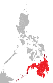
Mindanao or still commonly known as Southern Philippines, is the second largest island in the Philippines. Mindanao and the smaller islands surrounding it make up the island group of the same name. Located in the southern region of the archipelago, as of the 2010 census, the main island was inhabited by 20,281,545 people, while the entire Mindanao island group had an estimated total of 25,537,691 (2018) residents.

Hawaii is the 50th and most recent state to have joined the United States, having received statehood on August 21, 1959. Hawaii is the only U.S. state located in Oceania, the only U.S. state located outside North America, and the only one composed entirely of islands. It is the northernmost island group in Polynesia, occupying most of an archipelago in the central Pacific Ocean.