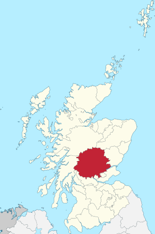
Perthshire, officially the County of Perth, is a historic county and registration county in central Scotland. Geographically it extends from Strathmore in the east, to the Pass of Drumochter in the north, Rannoch Moor and Ben Lui in the west, and Aberfoyle in the south; it borders the counties of Inverness-shire and Aberdeenshire to the north, Angus to the east, Fife, Kinross-shire, Clackmannanshire, Stirlingshire and Dunbartonshire to the south and Argyllshire to the west. It was a local government county from 1890 to 1930.

The Stirling council area is one of the 32 council areas of Scotland, and has a population of about 94,330. It was created under the Local Government etc (Scotland) Act 1994 with the boundaries of the Stirling district of the former Central local government region, and it covers most of Stirlingshire and the south-western portion of Perthshire. Both counties were abolished for local government purposes under the Local Government (Scotland) Act 1973.

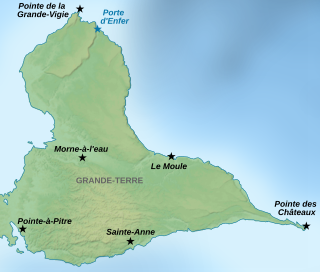
Grande-Terre Island is the name of the eastern-half of Guadeloupe proper, in the Lesser Antilles. It is separated from the other half of Guadeloupe island, Basse-Terre, by a narrow sea channel called Rivière Salée. Pointe de la Grande Vigie, in Grande-Terre, is the northernmost point of Guadeloupe island. To the east lies La Désirade, to the south lies Marie Galante

Loch Tay is a freshwater loch in the central highlands of Scotland, in the Perth and Kinross and Stirling council areas. It is the largest body of fresh water in Perth and Kinross, and the sixth largest loch in Scotland. The watershed of Loch Tay traditionally formed the historic province of Breadalbane.

The Augsburg Eiskanal is an artificial whitewater river in Augsburg, Germany, constructed as the canoe slalom venue for the 1972 Summer Olympics in nearby Munich.

The École Supérieure de Commerce de Pau is a French business school created in 1969.

Meikle Auchengree is a hamlet near Kilbirnie and Longbar in North Ayrshire, Scotland.

Killin (; is a village in Perthshire in the central highlands of Scotland. Situated at the western head of Loch Tay, it is administered by the Stirling Council area. Killin is a historic conservation village and sits within the Loch Lomond and The Trossachs National Park. It is the central settlement of the historic region of Breadalbane.

The River Dochart is in Perthshire, Scotland.

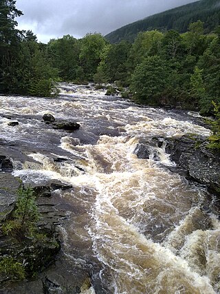
The Falls of Dochart are a cascade of waterfalls situated on the River Dochart at Killin in Perthshire, Scotland, near the western end of Loch Tay. The Bridge of Dochart, first constructed in 1760, crosses the river at Killin offering a view of the falls as they cascade over the rocks and around the island of Inchbuie, which is the ancient burial place of the MacNab clan.

Kinloch Rannoch is a village in Perth and Kinross, Scotland, at the eastern end of Loch Rannoch, 18 miles (29 km) west of Pitlochry, on the banks of the River Tummel. The village is a tourist and outdoor pursuits centre. It has a small population and is fairly remote.
There are over 30 lakes named Mud Lake within the U.S. state of Washington.
The Killin Railway was a locally promoted railway line built to connect the town of Killin to the Callander and Oban Railway main line nearby. It opened in 1886, and carried tourist traffic for steamers on Loch Tay as well as local business. The directors and the majority of the shareholders were local people, and the little company retained its independence until 1923.

Glen Ogle extends 7 miles north westwards from Lochearnhead to Lix Toll, where it opens into Glen Dochart.
Glen Dochart in Perthshire, Scottish Highlands is a glen which runs from Crianlarich eastwards to Killin, following the course of the River Dochart as it flows through Loch Dochart and Loch Iubhair. It is met by Glen Ogle at Lix Toll. Lochan Saorach lies within the glen and was once famous for its Floating island.

Love, Shelby is the seventh studio album by American country artist Shelby Lynne. Released on November 13, 2001 through Island Records, the album serves as a follow-up to her critically acclaimed I Am Shelby Lynne which came out a year before in the US. Producer Glen Ballard, mostly known for producing Alanis Morissette's breakthrough album Jagged Little Pill as well as recordings by the Dave Matthews Band, worked with Lynne on the album. Shifting from what was established by its predecessor, the album brings mostly a pop rock-oriented sound, but maintains the personal lyrics from I Am. Critically, it struggled to make an impact, receiving mostly mixed to positive reviews. As of sales, the album charted very moderately, peaking at number 109 on the Billboard 200 chart.
The Window Cliffs State Natural Area covers 275 acres (111 ha) in Putnam County, Tennessee, near Cookeville. The Window Cliffs is the name of a prominent group of natural bridges in a narrow 200-foot-tall (61 m) ridge in the neck of a meander of Cane Creek. The day-use area is only accessible by hiking a 2.7 miles (4.3 km) trail. The Window Cliffs was an acclaimed destination in the nineteenth and early twentieth centuries. The area contains several state-listed endangered plants.
The Inverarnan Canal was a short length of canal terminating at Garbal, close to the hamlet of Inverarnan, Scotland. This waterway once linked the old coaching inn, now the Drovers Inn, at Inverarnan, on the Allt Arnan Burn to the River Falloch and passengers could continue southward to Loch Lomond and finally to Balloch. From Inverarnan stagecoaches ran to various destinations in the north of Scotland.


