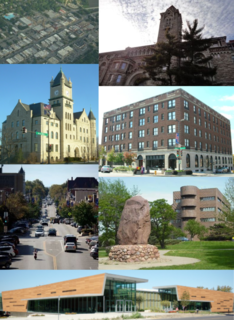
Lawrence is the county seat of Douglas County and sixth-largest city in Kansas. It is in the northeastern sector of the state, astride Interstate 70, between the Kansas and Wakarusa Rivers. As of the 2010 census, the city's population was 87,643; by 2018 the estimated population had risen to 98,193. Lawrence is a college town and the home to both the University of Kansas and Haskell Indian Nations University.

Lecompton is a city in Douglas County, Kansas, United States. As of the 2010 census, the city population was 625.

John White Geary was an American lawyer, politician, Freemason, and a Union general in the American Civil War. He was the final alcalde and first mayor of San Francisco, a governor of the Kansas Territory, and the 16th governor of Pennsylvania.

Bleeding Kansas, Bloody Kansas, or the Border War was a series of violent civil confrontations in the United States between 1854 and 1861 which emerged from a political and ideological debate over the legality of slavery in the proposed state of Kansas. The conflict was characterized by years of electoral fraud, raids, assaults, and retributive murders carried out in Kansas and neighboring Missouri by pro-slavery "Border Ruffians" and anti-slavery "Free-Staters".

The Sacking of Lawrence occurred on May 21, 1856, when proslavery settlers and terrorists, led by Douglas County Sheriff Samuel J. Jones, attacked and ransacked Lawrence, Kansas, a town which had been founded by antislavery settlers from Massachusetts who were hoping to make Kansas a free state. The incident fueled the irregular conflict in Kansas Territory that later became known as Bleeding Kansas.

The Thirty-fourth United States Congress was a meeting of the legislative branch of the United States federal government, consisting of the United States Senate and the United States House of Representatives. It met in Washington, D.C., from March 4, 1855, to March 4, 1857, during the last two years of Franklin Pierce's presidency. The apportionment of seats in the House of Representatives was based on the Seventh Census of the United States in 1850. The Whig Party, one of the two major parties of the era, had largely collapsed, although many former Whigs ran as Republicans or as members of the "Opposition Party." The Senate had a Democratic majority, and the House was controlled by a coalition of Representatives led by Nathaniel P. Banks, a member of the American Party.

Pawnee is a ghost town in Geary County, Kansas, United States, which briefly served as the first official capital of the Kansas Territory in 1855. Pawnee was the territorial capital for exactly five days – the legislature met there from July 2 to July 6 – before legislators voted to move the capital to Shawnee Mission, which is located in present-day Fairway. It may be the shortest-lived capital of any U.S. state or territory.
The Battle of Osawatomie was an armed engagement that occurred on August 30, 1856, when 250–400 pro-slavery Border Ruffians led by John W. Reid attacked the town of Osawatomie, Kansas, which at the time was settled largely by anti-slavery Free-Staters. Reid was intent on destroying the Free-State settlement and then moving on to Topeka and Lawrence to do more of the same. Notorious abolitionist John Brown first learned of the raiders when they shot his son Frederick. With just 40 or so men, Brown tried to defend the town against the pro-slavery partisans, but ultimately was forced to withdraw; five Free-Staters were killed in the battle, and the town of Osawatomie was subsequently looted and burned by Reid's men. The battle was one of a series of violent clashes between abolitionists and pro-slavery partisans in Kansas and Missouri during the Bleeding Kansas era.
The timeline of Kansas details past events that happened in what is present day Kansas. Located on the eastern edge of the Great Plains, the U.S. state of Kansas was the home of sedentary agrarian and hunter-gatherer Native American societies, many of whom hunted American bison. The region first appears in western history in the 16th century at the time of the Spanish conquest of Mexico, when Spanish conquistadores explored the unknown land now known as Kansas. It was later explored by French fur trappers who traded with the Native Americans. It became part of the United States in the Louisiana Purchase of 1803. In the 19th century, the first American explorers designated the area as the "Great American Desert."

Prairie City was a town site in southeast Douglas County, Kansas near present-day Baldwin City.

The John Brown Museum, also known as the John Brown Museum State Historic Site and John Brown Cabin, is located in Osawatomie, Kansas. The site is operated by the Kansas Historical Society, and includes the log cabin of Reverend Samuel Adair and his wife, Florella, who was the half-sister of the abolitionist John Brown. Brown lived in the cabin during the twenty months he spent in Kansas and conducted many of his abolitionist activities from there. The museum's displays tell the story of John Brown, the Adairs and local abolitionists, and include the original cabin, Adair family furnishings and belongings, and Civil War artifacts.
Dunavant is an unincorporated community in Jefferson County, Kansas, United States.
Franklin was a small town established in 1854 in Douglas County, Kansas Territory. Established as a proslavery stronghold, the town played a key role in the "Bleeding Kansas" conflict that troubled the territory in the 1850s.
Franklin's Fort was a small fortification that had been erected in Franklin, Douglas County, Kansas by pro-slavery settlers. During the "Bleeding Kansas" period, the fort was the site of two minor battles between pro- and anti-slavery factions.
The Battle of Fort Titus was a battle that occurred during conflicts in the Kansas Territory between abolitionist and pro-slavery militias prior to the American Civil War. The era is known as Bleeding Kansas.
Fort Saunders, 4 miles (6.4 km) southeast of Clinton, Kansas, and 12 miles (19 km) southwest of Lawrence, Kansas, was owned by James D. Saunders, a militia captain. What little was left of Clinton disappeared during construction of the Clinton Lake in the 1960s; only an outbuilding that was converted into a museum remains.
New Georgia's Fort was located in Miami County, Kansas, southeast of Osawatomie. During the partisan warfare in Kansas Territory in 1856, a colony of Southerners, possibly all Georgians, established New Georgia. This colony was located on the Marias des Cygnes River. A blockhouse fort was constructed there and entrenchments were begun but the fort destroyed before the entrenchments could be completed. Northern settlers in the area claimed settlers at New Georgia harassed them. In reality, some settlers from both the North and South had groups who caused trouble with their neighbors.
Fort Titus was the fortress residence of pro-slavery advocate Henry T. Titus, built in Kansas in April 1856, during a period when forces aligned with Titus came into conflict with free-state settlers. The wider conflict, which emerged from a political and ideological debate over the legality of slavery in the proposed state of Kansas, became known as Bleeding Kansas.
Newell W. Spicer was a Union Army lieutenant colonel of volunteers during the American Civil War and a commander of the 1st Regiment Kansas Volunteer Infantry. He was also a leader of pro-abolitionist forces during Bleeding Kansas, a violent period in the history of Kansas when factions fought over proposals to abolish slavery in that state.

Samuel J. Reader (1836–1914) was an American diarist and artist who wrote about his experiences living in Bleeding Kansas and the American Civil War.
