Related Research Articles

Skynet is a family of military communications satellites, now operated by Airbus Defence and Space on behalf of the United Kingdom's Ministry of Defence (MoD). They provide strategic and tactical communication services to the branches of the British Armed Forces, the British intelligence agencies, some UK government departments and agencies, and to allied governments. Since 2015 when Skynet coverage was extended eastward, and in conjunction with an Anik G1 satellite module over America, Skynet offers near global coverage.

MBDA is a European multinational developer and manufacturer of missiles. It was created in December 2001 after the merger of the main French, British and Italian missile systems companies. They were the missile businesses of Aérospatiale-Matra, BAE Systems and Finmeccanica. "MBDA" is an initialism of the names of said missile businesses: Matra, BAe Dynamics and Alenia. The company's headquarters are located in Le Plessis-Robinson, France.

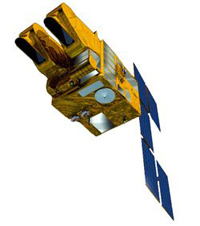
SPOT is a commercial high-resolution optical Earth imaging satellite system operating from space. It is run by Spot Image, based in Toulouse, France. It was initiated by the CNES in the 1970s and was developed in association with the SSTC and the Swedish National Space Board (SNSB). It has been designed to improve the knowledge and management of the Earth by exploring the Earth's resources, detecting and forecasting phenomena involving climatology and oceanography, and monitoring human activities and natural phenomena. The SPOT system includes a series of satellites and ground control resources for satellite control and programming, image production, and distribution. Earlier satellites were launched using the European Space Agency's Ariane 2, 3, and 4 rockets, while SPOT 6 and SPOT 7 were launched by the Indian PSLV.

Spot Image, a public limited company created in 1982 by the French Space Agency, Centre National d'Etudes Spatiales (CNES), the IGN, and Space Manufacturers is a subsidiary of Airbus Defence and Space (99%). The company is the commercial operator for the SPOT Earth observation satellites.
AfriStar is a satellite formerly owned and operated by the company 1worldspace and now owned and operated by Yazmi USA. The satellite was built by EADS Astrium and Alcatel Space. Based on Astrium's Eurostar E2000+ bus design, the geostationary orbit satellite broadcast digital radio programs in the L-Band frequency.
TerraSAR-X, an imaging radar Earth observation satellite, is a joint venture being carried out under a public-private-partnership between the German Aerospace Center (DLR) and EADS Astrium. The exclusive commercial exploitation rights are held by the geo-information service provider Astrium. TerraSAR-X was launched on 15 June 2007 and has been in operational service since January 2008. With its twin satellite TanDEM-X, launched 21 June 2010, TerraSAR-X acquires the data basis for the WorldDEM, the worldwide and homogeneous DEM available from 2014.
Badr-4 is an EADS Astrium-built communications satellite operated by Arabsat, launched 8 November 2006 on a Proton-M/Briz-M rocket. It provides fixed satellite communications services in C- and Ku-bands from the 26° East orbital position.

Vulcain is a family of European first stage rocket engines for Ariane 5 and the future Ariane 6. Its development began in 1988 and the first flight was completed in 1996. The updated version of the engine, Vulcain 2, was first successfully flown in 2005. Both members of the family use liquid oxygen/liquid hydrogen cryogenic fuel. The new version under development for Ariane 6 will be called Vulcain 2.1.
Astrium was an aerospace manufacturer subsidiary of the European Aeronautic Defence and Space Company (EADS) that provided civil and military space systems and services from 2006 to 2013. In 2012, Astrium had a turnover of €5.8 billion and 18,000 employees in France, Germany, the United Kingdom, Spain and the Netherlands. Astrium was a member of Institute of Space, its Applications and Technologies.

Nilesat is an Egyptian company and the name of a series of Egyptian communications satellites. It was established in 1996 with the purpose of operating Egyptian satellites and their associated mission control center and ground stations. The company is owned by the Egyptian Radio & Television Union with a 40 per cent share, the Arab Organization for Industrialization with a 10 per cent share, the Egyptian Company for Investment Projects with a 9 per cent share and the rest is owned by the general public, Egyptian financial institutions and other investors. The company has two ground stations, a primary one in 6th of October City and a secondary ground station in Alexandria. The two ground stations were built by EADS Astrium. Nilesat operates multiple geosynchronous communications satellites, all of which are stationed at 7 degrees West. Nilesat includes as of 17 April 2022 1091 video channels, most of which are free-to-air.

The Airbus Defence and Space Spaceplane, also called EADS Astrium TBN according to some sources, is a suborbital spaceplane concept for carrying space tourists, proposed by EADS Astrium, the space subsidiary of the European consortium EADS. A full-size mockup was officially unveiled in Paris, France, on June 13, 2007, and is now on display in the Concorde hall of the Musée de l'Air et de l'Espace. The project is the first space tourism entry by a major aerospace contractor.
HYLAS is a British satellite in geostationary orbit. HYLAS, which is an acronym for Highly Adaptable Satellite, is a communications satellite and was launched by the European Ariane 5 launch vehicle from the Guyana Space Centre at Kourou in French Guiana. It is located at the orbital location of 33.5 degrees west and will provide new and innovative services including High Definition Television (HDTV) and interactive satellite delivered broadband services. The satellite will help address the issue of poor broadband coverage in many parts of Europe which have less developed ground infrastructure.

Alphabus is a family of heavy geostationary communications satellites developed by a joint venture between Thales Alenia Space and EADS Astrium Satellites in France, with support of the Centre national d'études spatiales (CNES), the French space agency and the European Space Agency (ESA).

KA-SAT is a high-throughput geostationary telecommunications satellite owned by Viasat. The satellite provides bidirectional broadband Internet access services across Europe and a small area of the Middle East, and additionally the Saorsat TV service to Ireland. It is positioned at 9°E, joining the Eurobird 9A Ku band satellite. KA-SAT was manufactured by EADS Astrium, based on the Eurostar E3000 platform, with a total weight of 6 tons. It was launched by Proton in December 2010. The satellite is named after the Ka band frequency, which is used on the spacecraft.

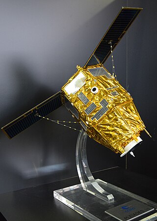
The Pléiades constellation is composed of two very-high-resolution optical Earth-imaging satellites. Pléiades-1A and Pléiades-1B provide the coverage of Earth's surface with a repeat cycle of 26 days. Designed as a dual civil/military system, Pléiades will meet the space imagery requirements of European defence as well as civil and commercial needs.

Airbus SE is a European multinational aerospace corporation. Airbus designs, manufactures and sells civil and military aerospace products worldwide. The company has three divisions: Commercial Aircraft , Defence and Space, and Helicopters, the third being the largest in its industry in terms of revenues and turbine helicopter deliveries. As of 2019, Airbus is the world's largest airliner manufacturer.
Vizada is a worldwide satellite communications service provider which operates earth ground stations that connect satellite communications to terrestrial telecommunications and IP networks. Vizada provides both mobile and fixed satellite telecommunications to a wide array of markets including merchant shipping, defense and government, fishing and yachting, oil and gas, mining, and non-governmental organizations. The product offering covers maritime, land, and aeronautical services. In 2011, the Vizada Group was acquired by EADS, to be integrated as a subsidiary of Astrium.
Landmap was a service based at the University of Manchester, England, which provided UK academia with a free-of-charge spatial data download service, using Open Geospatial Consortium (OGC) standards for maximum interoperability, which was enhanced and supported by a range of teaching and learning materials. The service was hosted at the Mimas datacentre from 2007 until 2013, and was funded by the government via Jisc.
Airbus Defence and Space is the division of Airbus SE responsible for the development and manufacturing of the corporation's defence and space products, while also providing related services. The division was formed in January 2014 during the corporate restructuring of European Aeronautic Defence and Space (EADS), and comprises the former Airbus Military, Astrium, and Cassidian divisions. It is the world's second-largest space company after Boeing and one of the top ten defence companies in the world.
Today's Airbus SE is the product of international consolidation in the European aerospace industry tracing back to the formation of the Airbus Industrie GIE consortium in 1970. In 2000, the European Aeronautic Defence and Space Company (EADS) NV was established. In addition to other subsidiaries pertaining to security and space activities, EADS owned 100% of the pre-existing Eurocopter SA, established in 1992, as well as 80% of Airbus Industrie GIE. In 2001, Airbus Industrie GIE was reorganised as Airbus SAS, a simplified joint-stock company. In 2006, EADS acquired the remaining 20% shares of Airbus Industrie GIE from BAE Systems. EADS NV was renamed Airbus Group NV and SE in 2014, and 2015, respectively. Due to the commercial aircraft division's prominence within Airbus SE with it representing the largest part of the corporation's activities, Airbus S.A.S was simply merged into the parent company in January 2017. Airbus SE itself therefore became the commercial aircraft division, while also being the parent company of the other two divisions Airbus Defence and Space and Airbus Helicopters. The company was given its present name in April 2017.
References
- ↑ "Infoterra Limited". Archived from the original on 2010-12-26. Retrieved 2010-07-17.
- ↑ "Infoterra - Aid Forum Online". Archived from the original on 2010-12-27. Retrieved 2010-07-17.
- ↑ "Views from space help oil prospectors see deep underground".
- ↑ "Infoterra : Inspire LeicesterShire". Archived from the original on 2010-11-14. Retrieved 2010-07-17.