Inkomati Water Management Area

Last updated

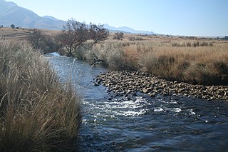
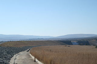
Inkomati WMA, or Inkomati Water Management Area (coded: 5), [1] in South Africa is situated in the north-eastern part of South Africa in the Mpumalanga Province, with a small area in the Limpopo Province. It borders on Mozambique in the east and on Swaziland in the south-east. The water management area extends over several parallel river catchments which all drain in a general easterly direction, and flow together at the border with Mozambique or within Mozambique, to form the Incomati River which discharges into the Indian Ocean immediately north of Maputo. A special situation is presented by the Komati River, the most southern tributary of the Incomati River, which rises in South Africa and flows into Swaziland, then re-enters South Africa where it is joined by the Crocodile River at the border with Mozambique, before flowing into Mozambique as the Incomati River. The Sabie River is the other main river in the water management area and flows into Corumuna Dam in Mozambique just downstream of the border with South Africa, and upstream of its confluence with the Inkomati River.

South Africa Republic in the southernmost part of Africa

South Africa, officially the Republic of South Africa (RSA), is the southernmost country in Africa. It is bounded to the south by 2,798 kilometres (1,739 mi) of coastline of Southern Africa stretching along the South Atlantic and Indian Oceans; to the north by the neighbouring countries of Namibia, Botswana, and Zimbabwe; and to the east and northeast by Mozambique and Eswatini (Swaziland); and it surrounds the enclaved country of Lesotho. South Africa is the largest country in Southern Africa and the 25th-largest country in the world by land area and, with over 57 million people, is the world's 24th-most populous nation. It is the southernmost country on the mainland of the Old World or the Eastern Hemisphere. About 80 percent of South Africans are of Sub-Saharan African ancestry, divided among a variety of ethnic groups speaking different African languages, nine of which have official status. The remaining population consists of Africa's largest communities of European (White), Asian (Indian), and multiracial (Coloured) ancestry.

Mpumalanga Province of South Africa

Mpumalanga is a province of South Africa. The name means "east", or literally "the place where the sun rises" in the Swazi, Xhosa, Ndebele and Zulu languages. Mpumalanga lies in eastern South Africa, bordering Swaziland and Mozambique. It constitutes 6.5% of South Africa's land area. It shares borders with the South African provinces of Limpopo to the north, Gauteng to the west, the Free State to the southwest, and KwaZulu-Natal to the south. The capital is Mbombela (Nelspruit).

Limpopo The northernmost province of South Africa

Limpopo is the northernmost province of South Africa. It is named after the Limpopo River, which forms the province's western and northern borders. The name "Limpopo" has its etymological origin in the Northern Sotho language word diphororo tša meetse, meaning "strong gushing waterfalls". The capital is Polokwane.

Contents

Topographical features

The most important topographical feature in the Inkomati water management area is the Great Escarpment, which divides the water management area into the Plateau area in the west (elevation of more than 2 000 m above sea level) and the Lowveld in the east. Largely attributable to the topography, distinct differences in climate occur, from temperate Highveld in the west to sub-tropical in the eastern Lowveld. Rainfall is strongly seasonal and occurs mainly in summer. Light snow occasionally falls in the vicinity of the southwestern divide in winter. The mean annual rainfall is in the range from 400 mm to 1 000 mm over most of the water management area, reaching close to 1 500 mm in the mountainous areas along the escarpment. The north-eastern part of the water management area falls within the world-renowned Kruger National Park. The Sabie River which flows through the park, is one of the ecologically most important rivers in the country, whilst the Crocodile River forms the southern border to the park. Several private game reserves adjoin the Kruger National Park, with other conservation areas throughout in the water management area.

Great Escarpment, Southern Africa Major topographical feature in southern Africa

The Great Escarpment is a major topographical feature in Africa that consists of steep slopes from the high central Southern African plateau downward in the direction of the oceans that surround Southern Africa on three sides. While it lies predominantly within the borders of South Africa, in the east it extends northwards to form the border between Mozambique and Zimbabwe, continuing on beyond the Zambezi River valley to form the Muchinga Escarpment in eastern Zambia. In the west, it continues northwards into Namibia and Angola.

Highveld Natural region in South Africa

The Highveld is the portion of the South African inland plateau which has an altitude above roughly 1500 m, but below 2100 m, thus excluding the Lesotho mountain regions to the south-east of the Highveld. It is home to some of the country's most important commercial farming areas, as well as its largest concentration of metropolitan centres, especially the Gauteng conurbation, which accommodates one-third of South Africa's population.

Kruger National Park First national park in South Africa

Kruger National Park is one of the largest game reserves in Africa. It covers an area of 19,485 square kilometres (7,523 sq mi) in the provinces of Limpopo and Mpumalanga in northeastern South Africa, and extends 360 kilometres (220 mi) from north to south and 65 kilometres (40 mi) from east to west. The administrative headquarters are in Skukuza. Areas of the park were first protected by the government of the South African Republic in 1898, and it became South Africa's first national park in 1926.

Sub-management areas

4 sub-management area are made, they are:

Komati River river

The Komati River is a river in South Africa, Eswatini and Mozambique. It is 480 kilometres (298 mi) long, with a drainage basin 50,000 square kilometres (19,300 sq mi) in size. Its mean annual discharge is 111 m3/s at its mouth. The name Komati is derived from inkomati (siSwati), meaning "cow", as its perennial nature is compared to a cow that always has milk.

Crocodile River (Mpumalanga) river, tributary of the Komati, in South Africa

The Crocodile River, also referred to as Crocodile River (East), is a large river traversing Mpumalanga province of South Africa.

Dams Included

The WMA Includes the following major rivers: the Nwanedzi River, Sabie River, Crocodile (East) River and Komati River, and covers the following Dams:

Sabie River river in South Africa and Mozambique

The Sabie River is a river in South Africa that forms part of the Komati River System. The catchment area of the Sabie-Sand system is 6,320 km2 in extent. The Sabie is one of the most biologically diverse rivers in South Africa, with generally good water quality.

Da Gama Dam, is an earthfill/gravity-type dam on the Witwaters River, near White River, Mpumalanga, South Africa. It was established in 1971 and its main purpose is for irrigation. Its hazard potential has been ranked to be high.

Driekoppies Dam is a gravity/earth-fill type dam on the Lomati River, near Malelane, Mpumalanga, South Africa. It was established in 1998 and its primary purpose is for irrigation.

Kwena Dam Dam in Mpumalanga South Africa

Kwena Dam is a combined gravity & arch type dam located on the Crocodile River, near Lydenburg, Mpumalanga province, South Africa. It was established in 1984 and it serves mainly for irrigation purposes. The hazard potential of the dam has been ranked high (3).

Boundaries

Primary drainage region X.

See also

Water Management Areas (WMAs) are parts of South Africa that are managed by the Water Boards.


Related Research Articles

Limpopo River river in central southern Africa

The Limpopo River rises in South Africa, and flows generally eastwards to the Indian Ocean in Mozambique. The term Limpopo is derived from Rivombo (Livombo/Lebombo), a group of Tsonga setters led by Hosi Rivombo who settled in the mountainous vicinity and named the area after their leader. The river is approximately 1,750 kilometres (1,087 mi) long, with a drainage basin 415,000 square kilometres (160,200 sq mi) in size. The mean discharge measured over a year is 170 m3/s at its mouth. The Limpopo is the second largest river in Africa that drains to the Indian Ocean, after the Zambezi River.

Geography of South Africa geography of South Africa

South Africa occupies the southern tip of Africa, its coastline stretching more than 2,850 kilometres from the desert border with Namibia on the Atlantic (western) coast southwards around the tip of Africa and then northeast to the border with Mozambique on the Indian Ocean. The low-lying coastal zone is narrow for much of that distance, soon giving way to a mountainous escarpment that separates the coast from the high inland plateau. In some places, notably the province of KwaZulu-Natal in the east, a greater distance separates the coast from the escarpment. Although most of the country is classified as semi-arid, it has considerable variation in climate as well as topography.

Maputo Province Province in Mozambique

Maputo is a province of Mozambique; the province excludes the city of Maputo. The province has an area of 22,693 km² and a population of 1,205,709. Its capital is the city of Matola.

Komatipoort Place in Mpumalanga, South Africa

Komatipoort is a town situated at the confluence of the Crocodile and Komati Rivers in Mpumalanga province, South Africa. The town is 8 km from the Crocodile Bridge Gate into the Kruger Park, and just 5 km from the Mozambique border and 65 km from the Eswatini border.

Olifants River (Limpopo) river in South Africa

The Olifants River, Lepelle or Obalule is a river in South Africa and Mozambique, a tributary of the Limpopo River. It falls into the Drainage Area B of the Drainage basins of South Africa. The historical area of the Pedi people, Sekhukhuneland, is located between the Olifants River and one of its largest tributaries, the Steelpoort River.

WAFLEX

WAFLEX is a spreadsheet-based model. It can be used to analyse upstream-downstream interactions, dam management options and water allocation and development options.

Blyde River Canyon Nature Reserve Biosphere reserve in South Africa | designated in 2001

Blyde River Canyon Nature Reserve is situated in the Drakensberg escarpment region of eastern Mpumalanga, South Africa. The reserve protects the Blyde River Canyon, including sections of the Ohrigstad and Blyde Rivers and the geological formations around Bourke's Luck Potholes, where the Treur River tumbles into the Blyde below. Southwards of the canyon, the reserve follows the escarpment, to include the Devil's and God's Window, the latter a popular viewpoint to the lowveld at the reserve's southern extremity.

Elands River (Mpumalanga) river in Mpumalanga, South Africa

Elands River is a river of the Komati River basin in Mpumalanga province, South Africa.

Crocodile (West) and Marico WMA, or Crocodile (West) and Marico Water Management Area , in South Africa is sub-divided into 6 sub-management areas each corresponding with a (part) river drainage area, and include the following major rivers: the Crocodile River and Marico River, sub divided into an upper Crocodile River sub-management area and a lower Crocodile River sub-management area. The Marico River sub-management area, the upper Molopo River sub-management area, The Elands River sub-management area, and the Apies River / Pienaars River sub-management area.

Bronkhorst Spruit

The Bronkhostspruit,, is a river in Gauteng, province South Africa. It is a tributary of the Wilge River, Olifants River basin that gives its name to Bronkhorstspruit town.

Marico River river in Botswana

The Marico River or Madikwe is a river in Southern Africa. There are a number of dams in its basin. Groot Marico town is named after the Marico River. After it is joined on its right bank by the Crocodile River it is known as the Limpopo River.

Elands River (Olifants) river in Gauteng and Mpumalanga, South Africa

The Elands River is a river in the former Transvaal area, South Africa. It is a tributary of the Olifants River, part of the Limpopo River basin.

Shingwedzi River river in Mozambique and South Africa

The Shingwedzi River, is a river in Limpopo Province, South Africa and Gaza Province, Mozambique. It is a left hand tributary of the Olifants River (Rio dos Elefantes) and the northernmost river of its catchment area, joining it at the lower end of its basin. The Shingwedzi is a seasonal river whose riverbed is dry for prolonged periods.

Mozambique–South Africa border international border

The border between Mozambique and South Africa is divided into two segments, separated by the kingdom of Swaziland. The northern segment, which is 410 kilometres (255 mi) long, runs north-south along the Lebombo Mountains from Zimbabwe to Swaziland. The southern segment, which is 81 kilometres (50 mi) long, runs east-west across Maputaland from Swaziland to the Indian Ocean.

References

  1. "Hydrological Services - Surface Water Home". Dwaf.gov.za. 2008-09-03. Archived from the original on 2015-03-26. Retrieved 2015-05-03.