
Interstate 70 (I-70) is a major east–west Interstate Highway in the United States that runs from I-15 near Cove Fort, Utah, to I-695 and Maryland Route 570 (MD 570) in Woodlawn, just outside Baltimore, Maryland.

Interstate 29 (I-29) is an Interstate Highway in the Midwestern United States. I-29 runs from Kansas City, Missouri, at a junction with I-35 and I-70, to the Canada–US border near Pembina, North Dakota, where it connects with Manitoba Provincial Trunk Highway 75 (PTH 75), which continues on to Winnipeg. The road follows the course of three major rivers, all of which form the borders of US states. The southern portion of I-29 closely parallels the Missouri River from Kansas City northward to Sioux City, Iowa, where it crosses and then parallels the Big Sioux River. For the northern third of the highway, it closely follows the Red River of the North. The major cities that I-29 connects to includes Council Bluffs, Iowa; Sioux City, Iowa; Sioux Falls, South Dakota; Fargo, North Dakota; and Grand Forks, North Dakota. I-29 also serves as a road connection between the four largest public universities in the Dakotas: the University of North Dakota, North Dakota State University, the University of South Dakota, and South Dakota State University.

Interstate 35 (I-35) is a major Interstate Highway in the central United States. As with most primary Interstates that end in a five, it is a major cross-country, north–south route. It stretches from Laredo, Texas, near the Mexican border to Duluth, Minnesota, at Minnesota State Highway 61 and 26th Avenue East. The highway splits into I-35E and I-35W in two separate places, the Dallas–Fort Worth metroplex in Texas and at the Minnesota twin cities of Minneapolis–Saint Paul.

Interstate 49 (I-49) is a north–south Interstate Highway with multiple segments. The original portion is entirely within Louisiana with an additional signed portion extending from I-220 in Shreveport to the Arkansas state line, three newer sections are in Arkansas, and one section in Missouri. Its southern terminus is in Lafayette, Louisiana, at I-10 while its northern terminus is in Kansas City, Missouri, at I-435 and I-470. Future plans include portions of the remaining roadway in Louisiana, Arkansas, and Texas, to link Kansas City, Missouri with New Orleans.

U.S. Route 50 or U.S. Highway 50 (US 50) is a major east–west route of the U.S. Highway system, stretching 3,019 miles (4,859 km) from Interstate 80 (I-80) in West Sacramento, California, to Maryland Route 528 in Ocean City, Maryland, on the Atlantic Ocean. Until 1972, when it was replaced by Interstate Highways west of the Sacramento area, it extended to San Francisco, near the Pacific Ocean. The Interstates were constructed later and are mostly separate from this route. It generally serves a corridor south of I-70 and I-80 and north of I-64 and I-40.

U.S. Route 24 or U.S. Highway 24 (US 24) is one of the original United States Numbered Highways of 1926 which runs east and west for most of its routing. It originally ran from Pontiac, Michigan, in the east to Kansas City, Missouri, in the west. Today, the highway's eastern terminus is in Independence Township, Michigan, at an intersection with Interstate 75 (I-75), and its western terminus is near Minturn, Colorado, at an intersection with I-70. The highway transitions from north–south to east–west signage at the Ohio–Michigan state line.

Interstate 435 (I-435) is an Interstate Highway beltway that encircles much of the Kansas City metropolitan area within the states of Kansas and Missouri in the United States.

U.S. Route 71 or U.S. Highway 71 is a major north–south United States highway that extends for over 1500 miles (2500 km) in the central United States. This original 1926 route has remained largely unchanged by encroaching Interstate highways. Currently, the highway's northern terminus is in International Falls, Minnesota at the Canada–US border, at the southern end of the Fort Frances-International Falls International Bridge to Fort Frances, Ontario. U.S. Route 53 also ends here. On the other side of the bridge, Trans-Canada Highway is an east–west route while Ontario Highway 71 is a north–south route. US 71's southern terminus is between Port Barre and Krotz Springs, Louisiana at an intersection with U.S. Route 190. For the entirety south of Kansas City, Missouri, US 71 runs parallel and concurrent with the existing and future Interstate 49. North of Kansas City, US 71 runs halfway between Interstate 29 and Interstate 35, which they split in the city at an interchange with Interstate 70.
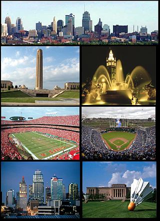
The Kansas City metropolitan area is a bi-state metropolitan area anchored by Kansas City, Missouri. Its 14 counties straddle the border between the U.S. states of Missouri and Kansas. With 8,472 square miles (21,940 km2) and a population of more than 2.2 million people, it is the second-largest metropolitan area centered in Missouri and is the largest metropolitan area in Kansas, though Wichita is the largest metropolitan area centered in Kansas. Alongside Kansas City, Missouri, these are the suburbs with populations above 100,000: Overland Park, Kansas; Kansas City, Kansas; Olathe, Kansas; Independence, Missouri; and Lee's Summit, Missouri.

U.S. Highway 159 (US 159) is a 83.6-mile-long (134.5 km) auxiliary route of US 59. It travels from Nortonville, Kansas at US 59 to New Point, Missouri, also at US 59. The highway permits through traffic on US 59 to bypass the cities of Atchison, Kansas and Saint Joseph, Missouri, traveling instead through Falls City, Nebraska and Hiawatha, Kansas.

U.S. Route 169 is a north-south U.S highway that currently runs for 966 miles (1,555 km) from the city of Virginia, Minnesota, to Tulsa, Oklahoma, at Memorial Drive.
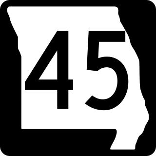
Route 45 is a highway in northwest Missouri, US in Buchanan County and Platte County which is largely in the bottom land alongside the Missouri River.

Interstate 635 (I-635) is a connector highway between I-35 in Overland Park, Kansas, and I-29 in Kansas City, Missouri, Not to be Confused with Interstate 635 in texas approximately 12 miles (19 km) long. It is mostly in the US state of Kansas, servicing the city of Kansas City, Kansas, but extends into Kansas City, Missouri, as well. The freeway's southern terminus is at a stack interchange with I-35. South of this, the mainline becomes an expressway carrying U.S. Route 69 (US 69).
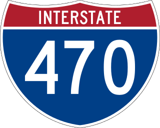
Interstate 470 (I-470) is a 16.72-mile (26.91 km) loop of the Interstate Highway System that links southeast Kansas City to Independence via Lee's Summit in Jackson County, Missouri. The western terminus of the freeway is at the Grandview Triangle interchange with I-49, I-435, U.S. Route 50 (US 50), and US 71 while the northern terminus is a cloverleaf interchange with I-70. The freeway travels west to east through southern Kansas City, curving toward the north at the Lee's Summit Municipal Airport and becoming concurrent with Route 291 as the highway travels north toward Independence.

Forgottonia, also spelled Forgotonia, is the name given to a 16-county region in Western Illinois in the late 1960s and early 1970s. This geographic region forms the distinctive western bulge of Illinois that is roughly equivalent to "The Tract", the Illinois portion of the Military Tract of 1812, along and west of the Fourth Principal Meridian. Since this wedge-shaped region lies between the Illinois and Mississippi rivers, it has historically been isolated from the eastern portion of Central Illinois.

K-5 is a 24-mile-long (39 km) state highway in northeastern Kansas. Remaining completely in the Kansas City metropolitan area, it connects Leavenworth to Kansas City.
Interstate 29 (I-29) is a north–south Interstate Highway in the Midwestern United States that begins in Missouri. It travels through the Kansas City and St. Joseph metropolitan areas before exiting the state and entering Iowa. Almost all of I-29 in Missouri lies in an area called the Platte Purchase that was not originally part of Missouri when the state entered the Union in 1821.
Interstate 70 (I-70) in the US state of Missouri is generally parallel to the Missouri River. This section of the transcontinental interstate begins at the Kansas state line on the Lewis and Clark Viaduct, running concurrently with U.S. Route 24 (US 24), US 40 and US 169, and the east end is on the Stan Musial Veterans Memorial Bridge in St. Louis.
Interstate 35 (I-35) is an Interstate Highway that stretches from Laredo, Texas, in the south to Duluth in the north. The portion of it through Missouri travels nearly 115 miles (185 km) from just south of Kansas City, through the Downtown Loop, and across the Missouri River before leaving the downtown area. North of Kansas City, the highway travels north-northeast toward the Iowa state line near Eagleville, paralleling U.S. Route 69 (US 69).

U.S. Route 69 (US-69) is a major north-south U.S. Highway that runs from Port Arthur, Texas to Albert Lea, Minnesota. In Kansas, the highway runs in the far eastern part of the state, usually within five miles of the Missouri state line. Most of the highway north of Fort Scott runs as a freeway.
