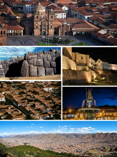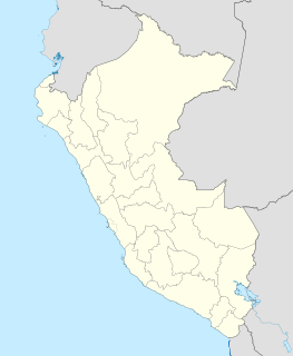
Cusco, often spelled Cuzco[ˈkusko], is a city in southeastern Peru near the Urubamba Valley of the Andes mountain range. It is the capital of the Cusco Region and of the Cusco Province. The city is the seventh most populous in Peru and, in 2017, had a population of 428,450. Its elevation is around 3,400 m (11,200 ft).

Machu Picchu is a 15th-century Inca citadel, located in the Eastern Cordillera of southern Peru, on a 2,430-metre (7,970 ft) mountain ridge. It is located in the Machupicchu District within Urubamba Province above the Sacred Valley, which is 80 kilometres (50 mi) northwest of Cuzco. The Urubamba River flows past it, cutting through the Cordillera and creating a canyon with a tropical mountain climate.

Pachacuti Inca Yupanqui was the ninth Sapa Inca (1418–1471/1472) of the Kingdom of Cusco which he transformed into the Inca Empire. Most archaeologists now believe that the famous Inca site of Machu Picchu was built as an estate for Pachacuti.

The Sacred Valley of the Incas, or the Urubamba Valley, is a valley in the Andes of Peru, 20 kilometres (12 mi) at its closest north of the Inca capital of Cusco. It is located in the present-day Peruvian region of Cusco. In colonial documents it was referred to as the "Valley of Yucay." The Sacred Valley was incorporated slowly into the incipient Inca Empire during the period from 1000 to 1400 CE.

Huayna Picchu, Quechua: Wayna Pikchu, is a mountain in Peru which the Urubamba River bends. It is located in the Cusco Region, Urubamba Province, Machupicchu District. It rises over Machu Picchu, the so-called lost city of the Incas. The Incas built a trail up the side of the Huayna Picchu and built temples and terraces on its top. The peak of Huayna Picchu is 2,693 metres (8,835 ft) above sea level, or about 260 metres (850 ft) higher than Machu Picchu.

Llaqtapata (Quechua) llaqta place, pata elevated place / above, at the top / edge, bank, shore, pronounced 'yakta-pahta', hispanicized Llactapata) is an archaeological site about 5 km (3.1 mi) west of Machu Picchu. The complex is located in the Cusco Region, La Convención Province, Santa Teresa District, high on a ridge between the Ahobamba and Santa Teresa drainages.

The Inca Bridge or Inka Bridge refers to one of two places related to access to Machu Picchu, in Peru.

Coricancha, Koricancha, Qoricancha or Qorikancha was the most important temple in the Inca Empire. It is located in Cusco, Peru, which was the capital of the empire.

Choquequirao is an Incan site in southern Peru, similar in structure and architecture to Machu Picchu. The ruins are buildings and terraces at levels above and below Sunch'u Pata, the truncated hill top. The hilltop was anciently leveled and ringed with stones to create a 30 by 50 m platform.

Calca Province is one of thirteen provinces in the Cusco Region in the southern highlands of Peru. Its seat is Calca.

Inti Punku or Intipunku is an archaeological site in the Cusco Region of Peru that was once a fortress of the sacred city, Machu Picchu. It is now also the name of the final section of the Incan Trail between the Sun Gate complex and the city of Machu Picchu. It was believed that the steps were a control gate for those who enter and exited the Sanctuary.

Patallacta, Llactapata or Q'ente Marka is an archaeological site in Peru located in the Cusco Region, Urubamba Province, Machupicchu District. It is situated southeast of the site Machu Picchu, at the confluence of the rivers Cusichaca and Vilcanota on a mountain named Patallacta.

Intihuatana at the archaeological site of Machu Picchu is a notable ritual stone associated with the astronomic clock or calendar of the Inca in South America. Machu Picchu was thought to have been built c. 1450 by the Sapa Inca Pachacuti as a country estate, although it is equally likely that the Inca discovered much older ruins and opted to build this majestic estate on older foundations.. In the late 16th century, the Viceroy Francisco de Toledo and the clergy destroyed those Intihuatana which they could find. They did so as they believed that the Incas' religion was a blasphemy and the religious significance of the Intihuatana could be a political liability. The Intihuatana of Machu Picchu was found intact by Bingham in 1911, indicating that the Spanish conquerors had not found it.

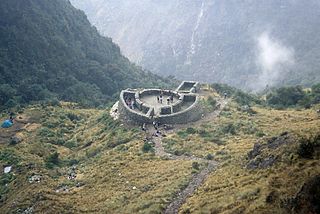
Runkuraqay or Runku Raqay is an archaeological site on a mountain of the same name in Peru located in the Cusco Region, Urubamba Province, Machupicchu District. It is situated southeast of the archaeological site Machu Picchu and south of the Vilcanota river. The ruins lie on the southern slope of the mountain Runkuraqay near the Runkuraqay pass, northeast of the archaeological site Sayacmarca and southeast of the site Qunchamarka.

Qunchamarka is an archaeological site in Peru located in the Cusco Region, Urubamba Province, Machupicchu District, southwest of the mountain Runkuraqay. It lies between the archaeological sites Sayaqmarka and Phuyupatamarka on the Inca Trail to Machu Picchu.
Inti Watana may refer to:
Machu Q'inti is an archaeological site in Peru. It is situated in the Cusco Region, Urubamba Province, Machupicchu District. Machu Q'inti is situated above the left bank of the Willkanuta River, near the archaeological sites of Wayna Q'inti, Willkaraqay and Patallaqta which is also named Q'inti Marka.
Wayna Q'inti is an archaeological site in Peru. It is situated in the Cusco Region, Urubamba Province, Machupicchu District. Wayna Q'inti is situated above the left bank of the Willkanuta River, near the archaeological sites of Machu Q'inti, Willkaraqay and Patallaqta which is also named Q'inti Marka.

Inti Watana or Intiwatana (Quechua) is an archaeological site in Peru. It lies in the Cusco Region, Calca Province, Pisac District.

The Inca complex at Pisac is a large Incan complex of agricultural terraces, residences, guard posts, watchtowers and a ceremonial/religious centre located along a mountain ridge above the modern town of Pisac in the Sacred Valley of Peru. In 1983 the Pisac National Archeological Park was established to recognize the importance of and to protect the remains of the complex.


