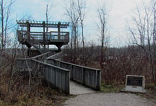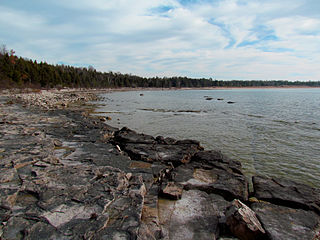
Kincardine is a municipality located on the shores of Lake Huron in Bruce County in the province of Ontario, Canada. The current municipality was created in 1999 by the amalgamation of the Town of Kincardine, the Township of Kincardine, and the Township of Bruce.

Bruce County is a county in Southwestern Ontario, Canada. It has eight lower-tier municipalities with a total 2016 population of 66,491. It is named for James Bruce, 8th Earl of Elgin and 12th Earl of Kincardine, the sixth Governor General of the Province of Canada. The Bruce name is also linked to the Bruce Trail and the Bruce Peninsula.

Wingham is a community located in the municipality of North Huron, Ontario, Canada, which is located in Huron County. Wingham became part of North Huron in 2001 when the Ontario government imposed amalgamation on the former township of East Wawanosh, the village of Blyth, and the town of Wingham.

Tiverton is a community in the Municipality of Kincardine, Bruce County, Ontario, Canada. It is near the shore of Lake Huron on Highway 21 between Port Elgin and Kincardine.

Bruce Nuclear Generating Station is a nuclear power station located on the eastern shore of Lake Huron in Ontario, Canada. It occupies 932 ha of land. The facility derives its name from Bruce Township, the local municipality when the plant was constructed, now Kincardine due to amalgamation. With eight CANDU pressurized heavy-water reactors, it was the world's largest fully operational nuclear generating station by total reactor count and the number of currently operational reactors until 2016, when it was exceeded in nameplate capacity by South Korea's Kori Nuclear Power Plant. The station is the largest employer in Bruce County, with over 4000 workers.

Southampton is a community on the shores of Lake Huron in Bruce County, Ontario, Canada. It is close to Port Elgin and is located at the mouth of the Saugeen River in the Saugeen Ojibway Nation Territory. The size of the town is 6.44 square kilometres. The permanent population in 2016 was 3,678, but the summer population is higher since cottagers and campers spend vacation time in the area.

Huron Wind is the first commercial wind farm in Ontario. It is located in the village of Inverhuron, Ontario near Tiverton, and consists of 5 Vestas V80-1.8MW wind turbines. It is next to the Bruce Power Visitor Centre, within sight of the Bruce Nuclear Generating Station, and adjacent to the larger Enbridge Ontario Wind Farm. Groundbreaking was on July 11, 2002, and it was declared officially in service on December 1, 2002.

Southwestern Ontario is a secondary region of Southern Ontario in the Canadian province of Ontario. It occupies most of the Ontario Peninsula bounded by Lake Huron, including Georgian Bay, to the north and northwest; the St. Clair River, Lake St. Clair, and Detroit River, to the west; and Lake Erie to the south. To the east, on land, Southwestern Ontario is bounded by Central Ontario and the Golden Horseshoe.

Saugeen Shores is a town in Bruce County, Ontario, Canada, formed in 1998. In addition to the two main population centres of Southampton and Port Elgin, the town includes a portion of the village of Burgoyne and the North Bruce area, straddling the municipal eastern and southern boundary respectively. In 2016, the permanent population of Saugeen Shores was 13,715, in a land area of 171.05 square kilometres (66.04 sq mi).

MacGregor Point Provincial Park is a park located on Lake Huron, off of Bruce Road 33 near Port Elgin, Ontario, Canada.

Port Elgin is a community in the town of Saugeen Shores, Ontario, Canada. Its location is in the traditional territory of the Saugeen Ojibway Nation. Originally named Normanton the town was renamed Port Elgin when it was incorporated in 1874, after James Bruce, 8th Earl of Elgin, a former Governor General of the Province of Canada.

Bruce Power Limited Partnership is a Canadian business partnership composed of several corporations. It exists as a partnership between TC Energy (31.6%), BPC Generation Infrastructure Trust (61.4%), the Power Workers Union (4%) and The Society of United Professionals (1.2%). It is the licensed operator of the Bruce Nuclear Generating Station, located on the shores of Lake Huron, roughly 250 kilometres northwest of Toronto, between the towns of Kincardine and Saugeen Shores. It is the third-largest operating nuclear plant in the world by capacity.

Inverhuron Provincial Park is a provincial park located on the shores of Lake Huron beside the small village of Inverhuron, Ontario, near Tiverton, Ontario, Canada. The park opened in 1956.

Huron-Kinloss is a township in the Canadian province of Ontario, located within Bruce County. The township had a population of 7,069 in the Canada 2016 Census.

Sauble Falls Provincial Park is located in the town of South Bruce Peninsula, Bruce County in southwestern Ontario, Canada, 36 kilometres (22 mi) west of Owen Sound. It is in the lower drainage basin of the Sauble River, which flows into Lake Huron. The campground consists of two sections divided by County Road 13. The west section of the site is a quiet zone. Group camping is available in the east section. Many sites along the east portion of the park back up against the Sauble River. The park is also the downstream terminus of the Rankin River canoe route.
The Underwood Wind Farm is a wind farm located in Bruce County, Ontario, near the shores of Lake Huron. It was developed by Enbridge Inc., a Canadian corporation better known for involvement in fossil fuels and their distribution.
The Deep Geologic Repository Project (DGR) was a proposal by Ontario Power Generation (OPG) in 2002 for the site preparation, construction, operation, decommissioning and abandonment of a deep geological radioactive waste disposal facility for low and intermediate-level radioactive waste (L&ILW). In 2005, the municipality of Kincardine, Ontario volunteered to host the facility located on the Bruce nuclear generating station adjacent to OPG's Western Waste Management Facility (WWMF). The facility would have managed L&ILW produced from the continued operation of OPG-owned nuclear generating stations at the Bruce, Pickering Nuclear Generating Station and Darlington Nuclear Generating Station in Ontario. In May 2020, after 15 years of environmental assessment, OPG withdrew its application for a construction license on Saugeen Ojibway Nation Territory.

Kincardine is a community and former town, located in the municipality of Kincardine on the shores of Lake Huron in Bruce County in the province of Ontario, Canada. The namesake town is located at the mouth of the Penetangore River, and was founded in 1848 by the name of Penetangore. The current municipality was created in 1999 by the amalgamation of the Town of Kincardine, the Township of Kincardine, and the Township of Bruce. The former town is Ward 1 within the current municipal boundaries.
The Wellington, Grey and Bruce Railway (WG&BR) was a railway in Ontario, Canada. It ran roughly northwest from Guelph to the port town of Southampton on Lake Huron, a distance of 101 miles (163 km). It also had a 66-mile (106 km) branch line splitting off at Palmerston and running roughly westward to Kincardine, another port town. A branch running south from Southampton was built during the construction of the Bruce Nuclear Generating Station in the 1970s.


