
U.S. Route 65 is a north–south United States highway in the southern and midwestern United States. The southern terminus of the route is at U.S. Route 425 in Clayton, Louisiana. The northern terminus is at Interstate 35 just south of Interstate 90 in Albert Lea, Minnesota. Parts of its modern route in Iowa and historic route in Minnesota follow the old Jefferson Highway.
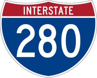
Interstate 280 (I-280) is an auxiliary Interstate Highway that makes up the western and southern portions of the beltway around the Quad Cities of Illinois and Iowa. The freeway starts at I-80 near Davenport, Iowa, and ends at I-80 near Colona, Illinois; its eastern part runs concurrent with I-74 to return to I-80. I-280 forms the southern part of a circle around the Quad Cities as well as forming part of a bypass for US Route 61 (US 61) around Davenport. This road is 26.98 miles (43.42 km) long.

Interstate 235 (I-235) in Iowa is an auxiliary Interstate Highway that runs just north of downtown Des Moines through the heart of the Des Moines metropolitan area. I-235 runs from the junction of I-35 and I-80 in West Des Moines to the separation of the same two Interstates in Ankeny. The highway is approximately 14 miles (23 km) long.

Iowa Highway 92 (Iowa 92) is a state highway that runs from east to west across the state of Iowa. Iowa 92 is 279 miles (449 km) long and is part of a continuous 886-mile (1,426 km) four-state "Highway 92" which begins in Torrington, Wyoming, goes through Nebraska and Iowa and ends in La Moille, Illinois. It begins at the Missouri River in Council Bluffs, where it is a continuation of Nebraska Highway 92. It stretches across the state and serves to roughly demarcate the southern one-third of Iowa. It ends at the Mississippi River in Muscatine where it continues into Illinois as Illinois Route 92. Iowa 92 was designated in 1939 replacing the entirety of the original Iowa 2.

Iowa Highway 28 is a 21.73-mile-long (34.97 km) state highway located in south central Iowa. The route begins at Iowa Highway 92 at Martensdale and ends at Interstate 35 / Interstate 80 in Johnston. It is the first major north–south highway east of Interstate 35 in the Des Moines metropolitan area.

Interstate 680 (I-680) in Nebraska and Iowa is the northern bypass of the Omaha–Council Bluffs metropolitan area. I-680 spans 16.49 miles (26.54 km) from its southern end in western Omaha, Nebraska, to its eastern end near Crescent, Iowa. The freeway passes through a diverse range of scenes and terrains—the urban setting of Omaha, the Missouri River and its valley, the rugged Loess Hills, and the farmland of Pottawattamie County, Iowa.

Iowa Highway 224 (Iowa 224) is a state highway in central Iowa. It begins at Iowa 224 eight miles (13 km) north of Kellogg and ends 2 miles (3.2 km) south of Kellogg at exit 173 along Interstate 80 (I-80). It intersects U.S. Highway 6 (US 6) near Kellogg. The highway, in conjunction with Iowa 14, is the most direct route from I-80 to Marshalltown.

Iowa Highway 1 (Iowa 1) is a state highway in the U.S. state of Iowa that extends from Keosauqua to Anamosa. It travels nearly 120 miles (190 km), mainly through rich farmland and small communities. Iowa 1 provides an important link to Iowa City and the University of Iowa as it passes through campus. Portions of the route today date back to the late 1830s, when Martin Van Buren was president, making Iowa 1 one of the oldest routes in the state, pre-dating the current primary highway system by nearly eighty years. The highway was seriously damaged by the Cedar River in the Iowa flood of 2008, which closed the highway for seven weeks.

Interstate 80 (I-80) is a part of the Interstate Highway System that runs from San Francisco, California, to Teaneck, New Jersey. I-80 enters Illinois from Iowa in the west, southwest of Rapids City, and runs generally eastward through East Moline, LaSalle, and Joliet, before entering Indiana in Lansing. The Interstate runs for approximately 163.52 miles (263.16 km) through the state.

U.S. Highway 6 (US 6) is an east–west United States Numbered Highway which runs 322 miles (518 km) across the U.S. state of Iowa. The route is signed in places as the Grand Army of the Republic Highway. Like all state highways in Iowa, it is maintained by the Iowa Department of Transportation. The route begins at the Missouri River crossing at Council Bluffs. From there, it travels east through Oakland and Atlantic. North of Atlantic, the highway overlaps Interstate 80 (I-80) until De Soto. Between De Soto and Adel, the highway overlaps US 169 before splitting off to the east toward Des Moines. Through the Des Moines area, the highway runs about one mile (1.6 km) north or south of the I-35/I-80 corridor.

Iowa Highway 117 is a north–south route in Jasper County. The length of the highway is 18 miles (29 km). In addition to serving several communities directly, Highway 117 also provides a shortcut between U.S. Route 65 and Interstate 80 east of Des Moines.

Iowa Highway 330 is a 47-mile-long (76 km) state highway that travels northeasterly from Altoona past Albion, to just north of Marshalltown in Marshall County. Originally the two-lane, unpaved road was numbered Iowa 88. It became part of Iowa 64 in the 1903s and it received its current route number in 1969. Iowa 330 is mostly a four-lane, divided expressway along much of its length. In conjunction with U.S. Route 65 (US 65), Iowa 14 and US 20, Iowa 330 is commonly used as a connector between Des Moines and the Waterloo–Cedar Falls area.

Interstate 35 (I-35) is a north–south Interstate Highway in the United States that runs from Laredo, Texas, to Duluth, Minnesota. In Iowa, the highway runs from south to north through the center of the state, roughly parallel to U.S. Highway 69 (US 69) and US 65. It enters the state near Lamoni from Missouri and continues north through the southern Iowa drift plain. In the Des Moines area, I-35 runs concurrently with I-80, and the two highways bypass Des Moines to the west and north. I-235, the only auxiliary route of I-35 in the state, serves the suburbs and downtown Des Moines; it begins and ends at the two interchanges where I-35 and I-80 meet. Near Mason City and Clear Lake, US 18 and Iowa Highway 27 (Iowa 27) overlap with I-35. Shortly after, US 18 splits off to the west in Clear Lake, while Iowa 27 runs with I-35 until they reach the Minnesota state line.
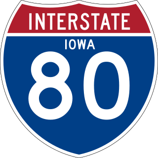
Interstate 80 (I-80) is a transcontinental Interstate Highway in the United States, stretching from San Francisco, California, to Teaneck, New Jersey. In Iowa, the highway travels west to east through the center of the state. It enters the state at the Missouri River in Council Bluffs and heads east through the southern Iowa drift plain. In the Des Moines metropolitan area, I-80 meets up with I-35 and the two routes bypass Des Moines together. On the northern side of Des Moines, the Interstates split and I-80 continues east. In eastern Iowa, it provides access to the University of Iowa in Iowa City. Northwest of the Quad Cities in Walcott is Iowa 80, the world's largest truck stop. I-80 passes along the northern edge of Davenport and Bettendorf and leaves Iowa via the Fred Schwengel Memorial Bridge over the Mississippi River into Illinois.

Iowa Highway 160 (Iowa 160) is a short state highway that runs east and west in central Iowa. Its begins at Iowa 415 in Ankeny and ends at exit 90 of Interstate 35 (I-35) in Ankeny. Originally ending at a Y intersection, south of the current intersection with Iowa 415, the route has been straightened to run west and east. Iowa 160 passes Des Moines Area Community College near its intersection with U.S. Highway 69 (US 69).

Iowa Highway 152 (Iowa 152) was a very short route which connected Interstate 35 (I-35) and U.S. Route 69 (US 69) near Osceola, Iowa. Through Iowa, I-35 and US 69 are mostly parallel routes; Iowa 152 connected the two routes at the narrowest location between them. The route was formed in 1980 from a portion of Clarke County Road R35 and did not undergo any changes in alignment while it was designated. The highway was relinquished to Clarke County and the City of Osceola in 2014.
The bypass around Des Moines, Iowa, is a 25-mile-long (40 km) freeway around the south and east of the Des Moines metropolitan area. The route is made up of two state highways – Iowa Highway 5 (Iowa 5) and U.S. Highway 65 (US 65). The bypass begins in southwestern West Des Moines at Iowa 5's interchange with Interstate 35 (I-35). It heads to the east and then curves to the north near the southeastern side of Des Moines. It ends at the interchange of US 65 and I-80 in Altoona.

Iowa Highway 46 (Iowa 46) was a state highway in Polk County, Iowa. It began at an intersection with Iowa 5 near Avon. It traveled north and west through the industrial section of southeastern Des Moines. It ended at Iowa 163, also known as E. University Avenue, in Des Moines next to the Iowa State Fairgrounds.
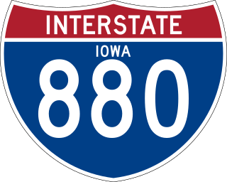
Interstate 880 (I-880) is an auxiliary Interstate Highway in Iowa. Its route was created in 2019 from a section of I-680 in order to facilitate the movement of I-29 traffic around Council Bluffs in the event of Missouri River flooding. It follows the same routing as Interstate 80N (I-80N), which originally connected I-29 and I-80 from 1966 to 1973.

U.S. Highway 63 (US 63) is a United States Highway that runs through the eastern third of Iowa. It begins at the Missouri state line southwest of Bloomfield and travels north through Ottumwa, Oskaloosa, Tama, Waterloo, and New Hampton. It ends at the Minnesota state line at Chester. Between Ottumwa and Oskaloosa, the highway is a four-lane controlled-access highway. Through Waterloo and New Hampton, it is partially controlled; that is, the road as both grade-separated interchanges and at-grade intersections. The rest of the highway is largely a two-lane rural highway.

