Related Research Articles

Ipswich is a town and borough in the county of Suffolk, England. Ipswich is the county town of Suffolk and is the largest settlement in the county, followed by Lowestoft and Bury St Edmunds. It is situated in East Anglia. Ipswich is the second-largest population centre in East Anglia, Norwich being the largest. It is 67 miles (108 km) northeast of London. The Ipswich built-up area is the fourth-largest in the East of England region and the 42nd-largest in England and Wales. It includes the towns and villages of Kesgrave, Woodbridge, Bramford and Martlesham Heath.

Central Suffolk and North Ipswich is a constituency represented in the House of Commons of the UK Parliament since 2010 by Dan Poulter, a Conservative.

The Suffolk and Ipswich Football League is a football competition based in Suffolk, England. The league has a total of eight divisions; the Senior Division and Divisions 1–3 for first teams, three divisions for reserve teams, and Division 4, which is for open to both first teams and reserves and is subordinate to both Division 3 and League C. The Senior Division is at step 7 of the National League System. The league was founded in 1896 as the Ipswich & District League changing its name in 1978.

The demography of London is analysed by the Office for National Statistics and data is produced for each of the Greater London wards, the City of London and the 32 London boroughs, the Inner London and Outer London statistical sub-regions, each of the Parliamentary constituencies in London, and for all of Greater London as a whole. Additionally, data is produced for the Greater London Urban Area. Statistical information is produced about the size and geographical breakdown of the population, the number of people entering and leaving country and the number of people in each demographic subgroup. The total population of London as of 2021 is 8,799,800.

The demography of Birmingham, England, is analysed by the Office for National Statistics and data produced for each of the wards that make up the city, and the overall city itself, which is the largest city proper in England as well as the core of the third most populous urban area, the West Midlands conurbation.

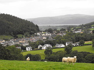
Tal-y-bont is a village in Ceredigion, Wales, located on the A487 road about halfway between Aberystwyth and Machynlleth. At the 2011 census the population was 662 with 63% born in Wales. Tal-y-bont is in the community of Ceulanamaesmawr.

Deben Rural District was a rural district in the county of East Suffolk, England. It was created in 1934 by the merger of parts of the disbanded Bosmere and Claydon Rural District, the disbanded Plomesgate Rural District and the disbanded Woodbridge Rural District, under a County Review Order. It was named after the River Deben and administered from Woodbridge.

Foxhall is a civil parish in the East Suffolk district of Suffolk, England a few miles east of Ipswich. It is adjacent to the parishes of Kesgrave to the north, Martlesham to the northeast, Brightwell to the east, Purdis Farm to the south and the borough of Ipswich to the west. The three parishes of Brightwell, Foxhall and Purdis Farm have a common council. The 2001 population was 151 persons in 57 households according to the census, the population having increased at the 2011 Census to 200.

Bradford, England is an ethnically and culturally diverse city. The City of Bradford metropolitan borough is the sixth most populous local authority district in the United Kingdom, and includes not only Bradford but also the towns and villages of Keighley, Shipley, Bingley, Ilkley, Haworth, Silsden, Queensbury, Thornton and Denholme.

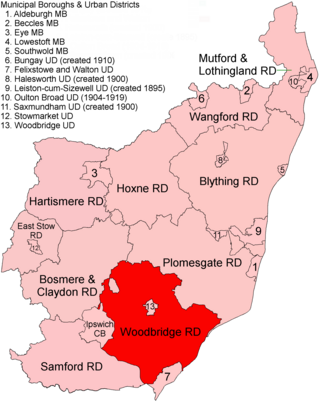
Woodbridge Rural District was a rural district within the administrative county of East Suffolk between 1894 and 1934. It was created out of the earlier Woodbridge rural sanitary district. It surrounded the town of Woodbridge, which had earlier been created as an urban district.

East Suffolk is a local government district in Suffolk, England, which was established on 1 April 2019, following the merger of the existing Suffolk Coastal and Waveney districts. At the 2011 census, the two districts had a combined population of 239,552.

The Acrrington/Rossendale Built-up area is an urban area which extends from the town of Accrington to the towns of Haslingden, Rawtenstall, Waterfoot and Bacup in Lancashire, England. The area takes in parts of the boroughs of Hyndburn and Rossendale and includes villages and hamlets that surround Accrington, Rawtenstall and Bacup. The area was recorded at having a population of 125,059. The area was two separate urban areas according to the 2001 census but were combined into one for the 2011 census. According to the 2001 census the Accrington urban area had a population of 71,000 whilst the Rossendale Urban Area had a population of 49,000.
The Rhyl/Prestatyn Built-up area is an urban area which extends from the coastal town of Rhyl to Prestatyn in Denbighshire, Wales. The area takes part of the county of Denbighshire. The area includes the villages of Meliden and Dyserth. The population was recorded at being 46,267.
The Norwich Built-up Area is an urban area which extends from the city of Norwich to Taverham, Horsham St Faith and Cringleford in Norfolk, England. The area takes in the district of the City of Norwich, and parts of Broadland and South Norfolk districts. The area was recorded at having a population of 213,166.

The Wrexham Built-up area is an area of land defined by the United Kingdom Office for National Statistics (ONS) for population monitoring purposes. It is an urban conurbation fully within Wrexham County Borough and consists of the urban area centred on the city of Wrexham. Until the 2021 census, it also included the historically industrial settlements to the west including Gwersyllt, Rhostyllen, Brymbo, Bradley and New Broughton.

Central Lincolnshire is the name given to a region of Lincolnshire in the East Midlands, England. The area covers the districts of North Kesteven and West Lindsey as well as the City of Lincoln. The name is used for the planning and development of a part of Lincolnshire surrounding Lincoln, North Hykeham, Sleaford, Market Rasen, Caistor and Gainsborough as well as other outlying villages and hamlets.

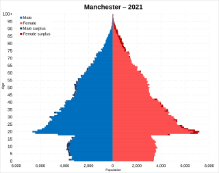
Manchester is a populous city in the North West of England. Its total population as of 2021 is 551,938.
References
- ↑ "Major Towns and Cities and Built-up Areas Swipe Map". geoportal.statistics.gov.uk.
- ↑ "Custom report - Nomis - Official Labour Market Statistics". www.nomisweb.co.uk.
- ↑ "Custom report - Nomis - Official Labour Market Statistics". www.nomisweb.co.uk.
- ↑ KS01 Usual resident population
52°03′25″N1°09′10″E / 52.057066°N 1.1528322°E