Related Research Articles

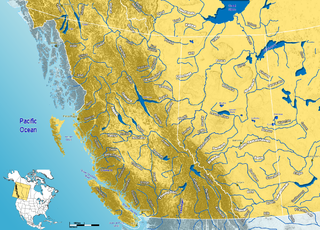
The South Saskatchewan River is a major river in the Canadian provinces of Alberta and Saskatchewan. The river begins at the confluence of the Bow and Oldman Rivers in southern Alberta and ends at the Saskatchewan River Forks in central Saskatchewan. The Saskatchewan River Forks is the confluence of the South and North Saskatchewan Rivers and is the beginning of the Saskatchewan River.

Athabasca Pass is a high mountain pass in the Canadian Rockies on the border between Alberta and British Columbia. In fur trade days it connected Jasper House on the Athabasca River with Boat Encampment on the Columbia River.
Blackfalds is a town in central Alberta, Canada. It is located along Highway 2A 13.5 km north of Red Deer. The town's name, Waghorn, changed in 1903 to Blackfalds, after Blackfalds, a Scottish hamlet.
The County of Paintearth No. 18 is a municipal district in east central Alberta, Canada. Located in Census Division No. 7, its municipal office is located southeast of the Town of Castor near the intersection of Highway 12 and Highway 36.
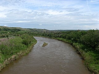
Battle River is a river in central Alberta and western Saskatchewan, Canada. It is a major tributary of the North Saskatchewan River.
Petitot is a river in northern Alberta and British Columbia, as well as in southern Dehcho Region of the Northwest Territories of Canada. It is a tributary of the Liard River.

Beaver River is a large river in east-central Alberta and central Saskatchewan, Canada. It flows east through Alberta and Saskatchewan and then turns sharply north to flow into Lac Île-à-la-Crosse on the Churchill River which flows into Hudson Bay.
Alhambra is a hamlet in Alberta, Canada within Clearwater County. It is located close to the David Thompson Highway, east of Rocky Mountain House.

Red Earth Creek is a hamlet in Alberta, Canada within the Municipal District of Opportunity No. 17. It is located east of Highway 88, between the town of Slave Lake and the hamlet of Fort Vermilion, and has an elevation of 520 metres (1,710 ft).
The Wood River, which flows in a southwesterly direction, is in the East Kootenay region of southeastern British Columbia. The former confluence was near the top of the Big Bend of the Columbia River. After the enlarged Kinbasket Lake formed the Mica Dam reservoir, the flow entered Wood Arm.
Chungo Creek is a large creek close to Nordegg in Western Alberta, Canada. It starts at a mountain lake called Upper Mons Lake, and eventually empties into the Blackstone River (Alberta).

Salt River is a river in Canada whose source is McNeil Lake in Wood Buffalo National Park in northern Alberta. It enters the Slave River north of Fort Smith, Northwest Territories.
Buckton Creek is a stream in Alberta, Canada.
Bullpound Creek is a stream in Alberta, Canada.
Cameron Creek is a stream in Alberta, Canada. Cameron Creek is named after D. R. Cameron, a government surveyor.
Castor Creek is a stream in Alberta, Canada. It is a tributary of the Battle River.
Cavell Creek is a stream in Alberta, Canada.
George Creek is a stream in Alberta, Canada. It is a tributary of the Blackstone River.
Habel Creek is a stream in Alberta, Canada.
Haynes Creek is a stream in Alberta, Canada.
References
- ↑ "Iron Creek". Geographical Names Data Base . Natural Resources Canada.
- ↑ Place-names of Alberta. Ottawa: Geographic Board of Canada. 1928. p. 68.
52°42′55″N111°13′59″W / 52.7152778°N 111.2330556°W