Abel Janszoon Tasman was a Dutch seafarer and explorer, best known for his voyages of 1642 and 1644 in the service of the Dutch East India Company (VOC). He was responsible for the naming of New Zealand, as well as being the namesake for Tasmania.

The Dutch West India Company or WIC was a chartered company of Dutch merchants as well as foreign investors, formally known as GWC. Among its founders were Reynier Pauw, Willem Usselincx (1567–1647), and Jessé de Forest (1576–1624). On 3 June 1621, it was granted a charter for a trade monopoly in the Dutch West Indies by the Republic of the Seven United Netherlands and given jurisdiction over Dutch participation in the Atlantic slave trade, Brazil, the Caribbean, and North America.

New Amsterdam was a 17th-century Dutch settlement established at the southern tip of Manhattan Island that served as the seat of the colonial government in New Netherland. The initial trading factory gave rise to the settlement around Fort Amsterdam. The fort was situated on the strategic southern tip of the island of Manhattan and was meant to defend the fur trade operations of the Dutch West India Company in the North River. In 1624, it became a provincial extension of the Dutch Republic and was designated as the capital of the province in 1625. New Amsterdam became a city when it received municipal rights on February 2, 1653.

The maritime European exploration of Australia consisted of several waves of European seafarers who sailed the edges of the Australian continent. Dutch navigators were the first Europeans known to have explored and mapped the Australian coastline. The first documented encounter was that of Dutch navigator Willem Janszoon, in 1606. Dutch seafarers also visited the west and north coasts of the continent, as did French explorers.

Cornelis de Houtman was a Dutch merchant seaman who commanded the first Dutch expedition to the East Indies. Although the voyage was difficult and yielded only a modest profit, Houtman showed that the Portuguese monopoly on the spice trade was vulnerable. A flurry of Dutch trading voyages followed, eventually leading to the displacement of the Portuguese and the establishment of a Dutch monopoly on spice trading in the East Indies.

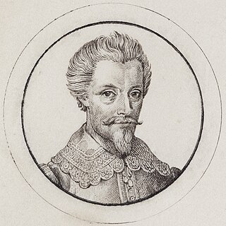
Jacob Le Maire was a Dutch mariner who circumnavigated the Earth in 1615 and 1616. The strait between Tierra del Fuego and Isla de los Estados was named the Le Maire Strait in his honour, though not without controversy. It was Le Maire himself who proposed to the council aboard Eendracht that the new passage should be called by his name and the council unanimously agreed with Le Maire. The author or authors of The Relation took Eendracht captain Willem Schouten's side by proclaiming:

Willem Cornelisz Schouten was a Dutch navigator for the Dutch East India Company. He was the first to sail the Cape Horn route to the Pacific Ocean.

Petrus Plancius was a Dutch-Flemish astronomer, cartographer and clergyman. Born, in Dranouter, now in Heuvelland, West Flanders, he studied theology in Germany and England. At the age of 24 he became a minister in the Dutch Reformed Church.

Halve Maen was a Dutch East India Company jacht that sailed into what is now New York Harbor in September 1609. She had a length of 21 metres and was commissioned by the VOC Chamber of Amsterdam in the Dutch Republic to covertly find a northern passage to Asia. The ship was captained by Henry Hudson, an Englishman in the service of the Dutch Republic.

Willem Janszoon Blaeu, also abbreviated to Willem Jansz. Blaeu, was a Dutch cartographer, atlas maker, and publisher. Along with his son Johannes Blaeu, Willem is considered one of the notable figures of the Netherlandish or Dutch school of cartography during its golden age in the 16th and 17th centuries.
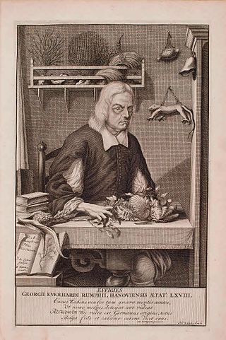
Georg Eberhard Rumphius was a German-born botanist employed by the Dutch East India Company in what is now eastern Indonesia, and is best known for his work Herbarium Amboinense produced in the face of severe personal tragedies, including the death of his wife and a daughter in an earthquake, going blind from glaucoma, loss of his library and manuscripts in major fire, and losing early copies of his book when the ship carrying it was sunk.

Jan Huygen van Linschoten was a Dutch spy, merchant, traveller and writer.
Dutch Ceylon was a governorate established in present-day Sri Lanka by the Dutch East India Company. Although the Dutch managed to capture most of the coastal areas in Sri Lanka, they were never able to control the Kingdom of Kandy located in the interior of the island. Dutch Ceylon existed from 1640 until 1796.
Gerard Reynst was a Dutch merchant and later the second Governor-General of the Dutch East Indies.
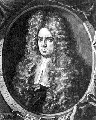
Nicolaes Witsen was a Dutch statesman who was mayor of Amsterdam thirteen times, between 1682 and 1706. In 1693, he became administrator of the Dutch East India Company (VOC). In 1689, he was extraordinary-ambassador to the English court and became Fellow of the Royal Society. In his free time, he was cartographer, maritime writer, and an authority on shipbuilding. His books on the subject are important sources on Dutch shipbuilding in the 17th century. Furthermore, he was an expert on Russian affairs. He was the first to describe Siberia, the Far East and Central Asia in his study Noord en Oost Tartarye [North and East Tartary].

Amsterdam, capital of the Netherlands, has more than 100 kilometers (62 mi) of grachten (canals), about 90 islands and 1,500 bridges. The three main canals, dug in the 17th century during the Dutch Golden Age, form concentric belts around the city, known as the Grachtengordel. Alongside the main canals are 1550 monumental buildings. The 17th-century canal ring area, including the Prinsengracht, Keizersgracht, Herengracht and Jordaan, were listed as UNESCO World Heritage Site in 2010, contributing to Amsterdam's fame as the "Venice of the North".
Joris Carolus was a Dutch cartographer and explorer who was employed by the Noordsche Compagnie and the Dutch East India Company.
De Graaf is a Dutch occupational surname. With over 21,000 people, it was the 24th most common name in the Netherlands in 2007. In modern Dutch de graaf means the count, but in the past it also referred to the head of the municipal council called schepen. A common variant form is De Graaff, with 4632 people in 2007. In Belgium, the form De Graef is most common, with 1017 people in 2018. People with the surname include:
Hendrik Becker was the Governor of Ceylon from 1707 until 1716.

David de Meyne was a Dutch cartographer, painter, publisher and art dealer. His early cartographic works combined maps, views and portraits.