Related Research Articles
Delta State is a state in the South-South geopolitical zone of Nigeria. Named after the Niger Delta—a large part of which is in the state—the state was formed from the former Bendel State on August 27, 1991. Bordered on the north by Edo State, the east by Anambra and Rivers states, and that south by Bayelsa State while to the west is the Bight of Benin which covers about 160 kilometres of the state's coastline. The state was initially created with 12 local government areas in 1991 which was later extended to 19 and now has 25 local government areas. Asaba as its state capital located along the River Niger on the northeastern end of the state, while the state's economic center is Warri on the southwestern coastline.

Cross River State is a state in the South-South geopolitical zone of Nigeria. Named for the Cross River, the state was formed from the eastern part of the Eastern Region on 27 May 1967. Its capital is Calabar, it borders to the north through Benue state, to the west through Ebonyi state and Abia state, and to the southwest through Akwa Ibom state, while its eastern border forms part of the national border with Cameroon. Originally known as the South-Eastern State before being renamed in 1976, Cross River state formerly included the area that is now Akwa Ibom state, which became a distinct state in 1987.
Ota is a town in Ogun State, Nigeria with an estimated 163,783 residents. Ota is the capital of the Ado–Odo/Ota Local Government Area. The traditional leader of Ota is the Olota of Ota, Oba Adeyemi AbdulKabir Obalanlege. Historically, Ota is the capital of the Awori Yoruba tribe.
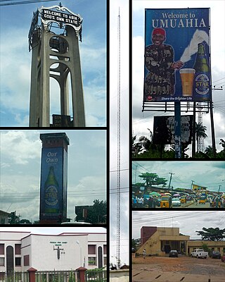
Umuahia is the capital city of Abia State in southeastern Nigeria. Umuahia is located along the rail road that lies between Port Harcourt to its south,and Enugu city to its north. Umuahia has a population of 359,230 according to the 2006 Nigerian census. Umuahia is indigenously Igbo.

Rivers State, also known as Rivers, is a state in the Niger Delta region of southern Nigeria. Formed in 1967, when it was split from the former Eastern Region, Rivers State borders include Imo and Anambra to the north, Abia and Akwa Ibom to the east, and Bayelsa and Delta to the west.The State capital, Port Harcourt, is a metropolis that is considered to be the commercial center of the Nigerian oil industry.
Zamfara is a state in northwestern Nigeria. The capital of Zamfara state is Gusau and its current governor is Dauda Lawal. Until 1996, the area was part of Sokoto State.
Elele is one of the big towns in Ikwerre Local Government Area of Rivers State, Nigeria. Madonna University is located in Elele in Ikwerre local government area. Elele, one of the major cities in Rivers State, is a medium-sized town in the Niger Delta Region. It has a population of about 20,620. The distance between Elele and Port Harcourt, the capital of Rivers, is roughly 42 kilometers distant. It takes 445 kilometers to get from Elele to Abuja, the capital of Nigeria.
Ohafia is an Igbo town in the Ohafia local government area (LGA) in Abia State, Nigeria. It is an Igbo speaking region. The ancestral capital of Ohafia town is the centrally located village of Elu. Ohafia Local Government Area, is an administrative jurisdiction assigned by the Nigeria Government, which covers the entire Ohafia villages and other towns such as Abiriba and Nkporo, with its Administrative Headquarters at Ebem Ohafia.

The Ikwerre are an indigenous Igbo tribe in Rivers State, Nigeria. The Ikwerre ethnic group in Rivers State, spans over four Local Government Areas; Port Harcourt, Obio Akpor, Ikwerre, and Emohua.. Pockets of the Ikwerre are found in nearby Ohaji-Egbema LGA of Imo State.
The Ogba people are one of the Igbo subgroups in Rivers state. The Ogba people speak Ogba, a dialect of Igbo language. The Ogbas reside in a local government called Ogba-Egbema-Ndoni in Rivers state Nigeria. The Ogba language has three dialects namely; Usomini, Igburu, Egi dialect. The Ogba kingdom is made up of three clans which includes; Egi, Igburu, Usomini clans, and its largest urban town is Omoku. Ogba people speak two dialects of the Ogba languages, the Egi and Igburu. Eligbo and Ukporomini are two Ogba communities in Ahaoda East Local Government Area, while Itu II in Emohua LGA also speaks Ogba language.

Obio-Akpor is a Local Government Area in the metropolis of Port Harcourt in Rivers State, Nigeria. It is one of the major centres of economic activities in Nigeria, and one of the major cities of the Niger Delta region, with industries and companies like Pabod Breweries, Coca-Cola Company, Indomie Company and Port Harcourt Electricity Distribution Company.
Numan, also known as Nomweh, is a town and a Local Government Area in Adamawa State, Nigeria. It is a port town that lies on the confluence of Benue River and Gongola River.

Kaltungo is one among the 11 Local Governments Area of Gombe State, Nigeria. Its headquarters is in the town of Kaltungo in the western part of the Local Government Area on the A345 highway at 9°48′51″N11°18′32″E.

Andoni is a Local Government Area in Rivers State, Nigeria. Its headquarters is located in Ngo-Town. It has an area of over 233 km2 and a population of over 311,500 at the last census. The postal code of the area is 504. The current Executive Chairman of Andoni Local Government Area is Hon. Barr. Erastus Awortu. Andoni shares boundaries with Khana to the North, Opobo Nkoro to the east, Bonny to the west and the Atlantic Ocean to the south.
Ikwerre is a Local Government Area in Rivers State, Nigeria. Its headquarters is in the town of Isiokpo 'known as the ancient Kingdom of Ikwerre land'. It is the first Iwuhuohna local government and later Emohua, Obio/Akpor and Port Harcourt LGAs were created, also the Ikwerre tribe occupies the upland region of Rivers State. It shares boundaries with Imo State to the north, Emohua to the west, Etche to the east, and Obio-Akpor to the south.
Gokana kingdom is among the six kingdoms of the Ogoni people in Ogoni in the Niger Delta region of Nigeria. Gokana kingdom has geographic, historic and ethno-linguistic elements with some 130,000 Gokana language speakers located in the Gokana Local Government Area in Rivers State. Gokana contains a tremendous number of villages, including Lewe, B.Dere (Barayowa-Dere), K. Dere (Kegbara-Dere), Nwe-biara Kpor, Mogho, Bomu, Bodo, Gio-koo, Nwe-ol, Bera, Biara, Deeyor, Gbe, Goi, Barako, Deken, and Yeghe.
The Urhobos are people located in southern Nigeria, near the northwestern Niger Delta.
Igwuruta is one of the big towns in Ikwerre Local Government Area of Rivers State, Nigeria. It is made up of 9 villages; Igwuruta-Ali, Omuodukwu, Omunobo, Omuchi, Omuohia, Omueke, Agboga, Omumah and Omuwie. It is located near Omagwa, a community hosting the Port Harcourt International Airport. Its geographic coordinates are: 4°57′15″N7°0′45″E. with a population of 50,000 people. Schools found in Igwuruta area include: Brookstone School Secondary, Charles Dale Memorial International School, Springflowers International Schools, Queens International High School, Ozulems International Montessori School, Beryl Education Centre and Evidence Bloom School. Igwuruta is roughly 20 km/12 miles from Port Harcourt.
Andrew Igbonule Uchendu is a Nigerian politician. He is currently a member of the Senate of Nigeria representing the Rivers East senatorial district. He had always been a member of the People's Democratic Party until 2014 when he switched allegiance to the All Progressives Congress party. Between 2003 and 2015, he represented the Ikwerre–Emohua constituency in the Federal House of Representatives.
References
- ↑ Wande, S.-Davies (2018-06-21). "Atiku visits Rivers, lauds Wike on projects delivery". Tribune Online. Retrieved 2023-05-13.
- ↑ Nwoke, Chidi (2023-01-04). "Isiokpo Bicycle Festival Holds In Nigeria". Voice of Nigeria. Retrieved 2023-05-13.
- ↑ Naija, Click (2023-01-06). "Rivers State holds 'Isiokpo' Bicycle carnival, to mark end of year – Photos". Click Naija. Retrieved 2023-05-13.
- ↑ "Home | Isiokpo Cultural Carnival". isiokpoculturalcarnival.com. Retrieved 2023-05-13.