
Russia is the largest country in the world, covering over 17,125,192 km2, and encompassing more than one-eighth of Earth's inhabited land area. Russia extends across eleven time zones, and has the most borders of any country in the world, with sixteen sovereign nations.

The Beskids or Beskid Mountains are a series of mountain ranges in the Carpathians, stretching from the Czech Republic in the west along the border of Poland with Slovakia up to Ukraine in the east.

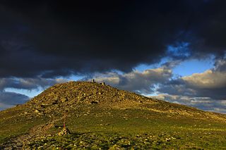
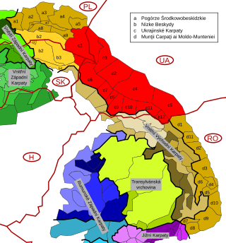
Divisions of the Carpathians are a categorization of the Carpathian mountains system.

The High Tatras or High Tatra Mountains, are a mountain range along the border of northern Slovakia in the Prešov Region, and southern Poland in the Lesser Poland Voivodeship. They are a range of the Tatra Mountains chain.

Chornohora is the highest mountain range in Western Ukraine. It is within the Polonynian Beskids, a subgroup of the mountain group of Eastern Beskids, which in turn is part of the Outer Eastern Carpathians.
Babia Góra National Park is one of the 23 national parks in Poland, located in the southern part of the country, in Lesser Poland Voivodeship, on the border with Slovakia. The park has its headquarters in the village of Zawoja.
Roztocze is a range of hills in east-central Poland and western Ukraine which rises from the Lublin Upland and extends southeastward through Solska Forest and across the border into Ukrainian Podolia. Low and rolling, the range is approximately 180 km long and 14 km wide. Its highest peak within Poland is Wielki Dział at 390 meters, while in Ukraine it is Vysokyi Zamok at 409 m. In Poland Roztocze lies in the Lublin and Podkarpackie voivodships, while the portion in Ukraine extends all the way to the outskirts of Lviv. In 2011 UNESCO established the Roztochya Biosphere Reserve. The Polish portion of the range makes up the Roztocze National Park.

Silesian Beskids is one of the Beskids mountain ranges in Outer Western Carpathians in southern Silesian Voivodeship, Poland and the eastern Moravian-Silesian Region, Czech Republic.
Bochnia Commune is a gmina within Lesser Poland Voivodeship in the south of Poland. It is situated on the borderline between two geographical regions: the Sandomierz Basin in the northern part of the commune's territory, and the Wieliczka Piedmont in the southern part.

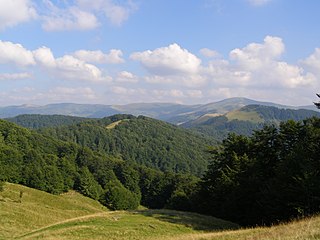
The Western Beskids are a set of mountain ranges spanning the Czech Republic, Slovakia, and Poland. Geologically the Western Beskids are part of the Outer Western Carpathians.
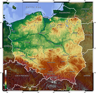
Poland is a country that extends across the North European Plain from the Sudetes and Carpathian Mountains in the south to the sandy beaches of the Baltic Sea in the north. Poland is the fifth-most populous country of the European Union and the ninth-largest country in Europe by area. The territory of Poland covers approximately 312,696 km2 (120,733 sq mi), of which 98.52% is land and 1.48% is water. The Polish coastline was estimated at 770 km (478 mi) in length. Poland's highest point is Mount Rysy, at 2,501 m (8,205 ft).
The Svydovets is a mountain range in western Ukraine, one of the ranges of Eastern Beskids, itself belonging to the Outer Eastern Carpathians. It is a biodiversity hotspot in the Ukrainian Carpathians. The territories of the Svydovets mountain range belong to the state. The highest peak of the range is Blysnyzi mountain. The Black Tisza, the source of Tisza, is one of the more fullflowing rivers of the region, it flows out from the Svydovets.

The Orava Magura is a mountain range in the Žilina Region of northern central Slovakia. The range is part of the Central Beskids, which are themselves part of the Outer Western Carpathians.

The Kysucké Beskydy is a set of mountain ranges in the Kysuce region of northern Slovakia. Slovaks consider the mountains to belong to the Central Beskids, of the Outer Western Carpathians, while Poles classify them as part of the Western Beskids.

The Skole Beskids is a mountain range in western Ukraine, belonging to the set of ranges called the Eastern Beskids, within the Outer Eastern Carpathians.
Čergov is a mountain range in the central part of the Prešov Region of Slovakia. Geologically the range is part of the Outer Western Carpathians.

The Gorce Mountains are part of the Western Beskids mountain range spreading across southernmost Poland. They are situated in Małopolska Province, at the western tip of the long Carpathian range extending east beyond the Dunajec River for some 1,500 kilometres (930 mi). The Gorce are characterized by numerous ridges reaching in all directions for up to 40 kilometres (25 mi) east–west with a series of higher elevations cut by deep river valleys.

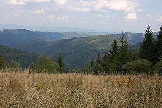
Beskid Sądecki is a mountain range in the eastern section of the Western Beskids, within the Outer Western Carpathians. It is located in the border region between Poland and Slovakia. On the Polish side, it stretches along an area of 670 km², between the Dunajec river in the west and the valleys of the Kamienica Nawojowska river, Mochnaczka, Muszynka, Przełęcz Tylicka in the east. The highest peak of the mountain range is Radziejowa at 1262 metres. The mountains are built from flysch rocks.
The Eastern Beskids or Eastern Beskyds are a geological group of mountain ranges of the Beskids, within the Outer Eastern Carpathians. As a continuation of the Central Beskids, this mountain range includes the far southeastern corner of Poland, the far eastern corner of Slovakia, and stretches southward through western parts of Ukraine, up to the border of Romania.

The Carpathian montane conifer forests, also known as Carpathian montane forests, is a temperate coniferous forests ecoregion in the Carpathian Mountains of the Czech Republic, Poland, Slovakia, Ukraine, and Romania.

