
The British Isles are a group of islands in the North Atlantic Ocean off the north-western coast of continental Europe, consisting of the islands of Great Britain, Ireland, the Isle of Man, the Inner and Outer Hebrides, the Northern Isles, and over six thousand smaller islands. They have a total area of 315,159 km2 (121,684 sq mi) and a combined population of almost 72 million, and include two sovereign states, the Republic of Ireland, and the United Kingdom of Great Britain and Northern Ireland. The Channel Islands, off the north coast of France, are normally taken to be part of the British Isles, even though geographically they do not form part of the archipelago. Under the UK Interpretation Act 1978, the Channel Islands are clarified as forming part of the British Islands, not to be confused with the British Isles.

The Isle of Man or Mann, is a self-governing British Crown Dependency in the Irish Sea, between Great Britain and Ireland. It is recognized as one of the Celtic nations, and is the homeland of the Manx people, a Celtic ethnic group. As head of state, Charles III holds the title Lord of Mann and is represented by a Lieutenant Governor. The government of the United Kingdom is responsible for the isle's military defence and represents it abroad.

Onondaga County is a county in the U.S. state of New York. As of the 2020 census, the population was 476,516. The county seat is Syracuse. The county is part of the Central New York region of the state.

Geddes is a town in Onondaga County, New York, United States. As of the 2020 Census, the population was 17,088.

Liverpool is a lakeside village in Onondaga County, New York, United States. As of the 2020 census, the population was 2,242. The name was adopted from the city of Liverpool in the United Kingdom. The village is on Onondaga Lake, in the western part of the town of Salina and is northwest of Syracuse, of which it is a suburb.

Onondaga is a town in Onondaga County, New York, United States, encompassing 65 square miles. As of the 2020 Census, the population was 22,937. The town is named after the native Onondaga tribe, part of the Iroquois Confederacy. Onondaga was incorporated April 2, 1798, and is located southwest of the city of Syracuse, which it borders. The villages and hamlets which make up the town are: Cedarvale, Howlett Hill, Navarino, Nedrow, Onondaga Hill, Sentinel Heights, South Onondaga, Southwood, Split Rock, and Taunton.

Onondaga Reservation is a Native American reservation in Onondaga County, New York, United States. It is the territory of the Onondaga Nation. It lies just south of the city of Syracuse. The population was 2,244 at the 2010 census.

Camillus is a town in Onondaga County, New York, United States. As of the 2020 Census, the population was 25,346.
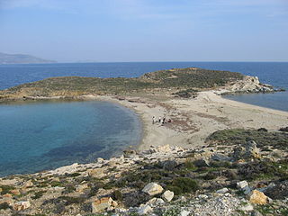
A tombolo is a sandy or shingle isthmus. A tombolo, from the Italian tombolo, meaning 'pillow' or 'cushion', and sometimes translated incorrectly as ayre, is a deposition landform by which an island becomes attached to the mainland by a narrow piece of land such as a spit or bar. Once attached, the island is then known as a tied island.
The Crown Dependencies are three offshore island territories in the British Islands that are self-governing possessions of the British Crown: the Bailiwick of Guernsey and the Bailiwick of Jersey, both located in the English Channel and together known as the Channel Islands, and the Isle of Man in the Irish Sea between Great Britain and Ireland.

The Onondaga people are one of the five original nations of the Haudenosaunee (Iroquois) Confederacy in the Northeastern Woodlands. Their historical homelands are in and around present-day Onondaga County, New York, south of Lake Ontario.

Onondaga Lake is located in Central New York, immediately northwest of and adjacent to Syracuse, New York. The southeastern end of the lake and the southwestern shore abut industrial areas and expressways; the northeastern shore and northwestern end border a series of parks and museums.
The International Island Games Association (IIGA) is the organising body for the Island Games, a friendly biennial multi-sport competition between teams from several European islands and other small territories. The IIGA liaises with the member island associations and with sponsors of the games. It investigates whether islands wanting to join fit the membership criteria.

The Battle of the Thousand Islands was an engagement fought on 16–24 August 1760, in the upper St. Lawrence River, among the Thousand Islands, along the present day Canada–United States border, by British and French forces during the closing phases of the Seven Years' War, as it is called in Canada and Europe, or the French and Indian War as it is referred to in the United States.
New York's 35th congressional district was a congressional district for the United States House of Representatives in New York. It was created in 1903 as a result of the 1900 census. It was eliminated as a result of the redistricting cycle after the 1980 census. It was last represented by Barber B. Conable, Jr. who was redistricted into the 30th district.

Reuben Humphrey was a United States representative from New York.

Michael Edward Driscoll was an American lawyer and politician from New York.

USRC Onondaga was an Algonquin-class cutter built for the U.S. Revenue Cutter Service for service on the Great Lakes. Because of the Spanish–American War, she was cut in half shortly before completion and transported to Ogdensburg, New York for service on the Atlantic coast although the war ended before she could be put into service. After the formation of the United States Coast Guard in 1915 she became USCGC Onondaga. She served as a patrol vessel at various Atlantic coast ports before World War I and unlike most Coast Guard cutters during World War I, she remained under the control of the Commandant of the Coast Guard. After the war she patrolled for a brief time based at New London, Connecticut before being decommissioned in 1923.
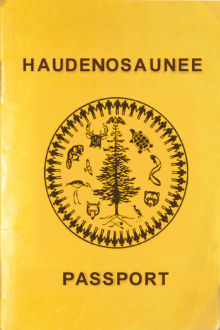
The Iroquois or Haudenosaunee passport is an important form of identification, cultural agency and an "expression of sovereignty" used by the nationals of the Six Nations.
