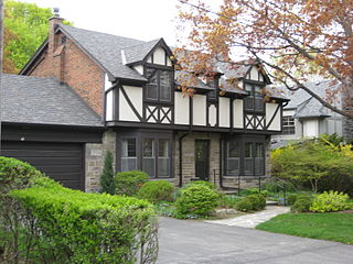
The Kingsway is an affluent residential neighbourhood in Toronto, Ontario, Canada. It is located in the former City of Etobicoke, an area that became the west end of Toronto upon amalgamation in 1998. It is bounded by Bloor Street to the south, Dundas Street to the north, the Mimico Creek to the west and the Humber River to the east. While the area was first known as "Kingsway Park", popular usage drifted to "The Kingsway", that being the name of the main road which winds through the heart of the area. "The Kingsway" is also the name of the Business Improvement Association business district along Bloor Street. Along with The Bridle Path and Forest Hill, Toronto, The Kingsway is one of the most affluent areas in Toronto and homes are characterized by large stone mansions of English style. The 2012 average price of a detached house was $2,931,065. The mandatory 2006 long form Census found that 535 homes are owned and the 2011 voluntary National Household Survey returned similar results as it was determined 520 homes are owned within the tract. The number of homes that are owned drastically outnumbers the number of homes being rented. In 2006 it was found that eighty-five homes were being rented in Census tract 0227.00. 2011 saw a small rise in this number and the National Household Survey determined that ninety-five homes were being rented.

New Toronto is a neighbourhood and former municipality in Toronto, Ontario, Canada. It is located in the south-west area of Toronto, along Lake Ontario. The Town of New Toronto was established in 1890, and was designed and planned as an industrial centre by a group of industrialists from Toronto who had visited Rochester, New York. New Toronto was originally a part of the Township of Etobicoke. It was an independent municipality from 1913 to 1967, being one of the former 'Lakeshore Municipalities' amalgamated into the Borough of Etobicoke, and eventually amalgamated into Toronto. The neighbourhood has retained the name.

Thistletown is a culturally diverse neighbourhood in Toronto, Ontario, Canada. It consists of the area surrounding the intersection of Albion Road and Islington Avenue in the former City of Etobicoke.

Etobicoke Collegiate Institute is a high school at the former centre of Etobicoke in the Islington neighbourhood of Toronto, Ontario, Canada, and is overseen by the former Etobicoke Board of Education, which is part of the merged Toronto District School Board.

Richview is a neighbourhood in the city of Toronto, Ontario, Canada. It is located in the area of Etobicoke. It is bounded on the west by Highway 401 and on the north by the highway and by Dixon Road, Royal York Road on the east, and Eglinton Avenue West along the south. It encompasses the former post office of "Richview" which was merged into the then-borough of Etobicoke.

The Etobicoke School of the Arts (ESA) is a specialized public arts-academic high school located in the Etobicoke area of Toronto, Ontario, Canada housed in the Royal York Collegiate Institute facility since 1983. Founded on September 8, 1981, the Etobicoke School of the Arts has the distinction of being the oldest, free standing, arts-focused high school in Canada.

Kingsview Village is a neighbourhood in the city of Toronto, Ontario, Canada. It is located in the north end of the former city of Etobicoke, and is bounded on the north by Highway 401, on the east by the Humber River and St. Phillips Road, on the south by Dixon Road. It is relatively close to Toronto Pearson International Airport in Mississauga, and TTC bus routes connect it to the rest of the city.

Humber Valley Village is a neighbourhood located in Toronto, Ontario, Canada. It is within the former City of Etobicoke and is a relatively affluent community. The boundaries are from Dundas Street on the south to Islington Avenue to the west, Eglinton Avenue to the north, and the Humber River in the east. The neighbourhood is in the political riding of Etobicoke Centre.

Silverthorn, often misspelled as Silverthorne, is a neighbourhood in Toronto, Ontario, Canada. It was part of the former City of York before the amalgamation of Toronto in 1998. The approximate boundaries are the GO Transit Barrie line railway tracks to the east, Black Creek Drive and the CP railway line to the west and the former boundaries of the City of York to the north and south. The neighbourhood west of Black Creek Drive is known as Keelesdale. For demographic purposes, the city breaks the area down into two neighbourhoods Keelesdale-Eglinton West, south of Eglinton, and Beechborough-Greenbrook north of Eglinton.

The Queensway – Humber Bay, known officially as Stonegate-Queensway, is a neighbourhood in the south-west of Toronto, Ontario, Canada. It is located in the south-east of the former City of Etobicoke.

Scarlett Heights Entrepreneurial Academy (SHEA), formerly known as Scarlett Heights Collegiate Institute (SHCI) is a Toronto District School Board facility that was operated as a secondary school opened in 1963 whose curriculum was broadened through a Student Leadership Development Program. This program extends the base curriculum. Although the TDSB closed the school in June 2018 due to low enrollment, the building remains under board possession awaiting its future.

Princess Gardens is a neighbourhood in Toronto, Ontario, Canada. It is located in the western area of Toronto that was formerly the City of Etobicoke. Its boundaries are Eglinton Avenue to the north, Martin Grove to the west, Islington to the east, and Rathburn Road to the south. The southeastern part of this area is the separate neighbourhood of Thorncrest Village. The neighbourhood is divided into two areas. The portion east of Kipling Road is known as Princess Anne Manor while the portion west of Kipling is Princess Margaret Gardens. They are named after The Princess Anne and The Princess Margaret, members of the British Royal family. The southwestern part of the neighbourhood is also sometimes known as Glen Agar.

Our Lady of Sorrows is a Roman Catholic church in Toronto, Ontario, Canada, is located in the neighbourhood of The Kingsway in the former city of Etobicoke. The parish includes the central section of Etobicoke where two much earlier Catholic missions once served as the first Roman Catholic places of worship in Etobicoke.

Burnhamthorpe Collegiate Institute and Adult Learning Centre is an adult and alternative high school that is part of the Toronto District School Board in Etobicoke, Ontario, Canada, originally part of the Etobicoke Board of Education since 1956. The motto for Burnhamthorpe is Quisque Praestet Officium which translates to "No matter whose attention offers".

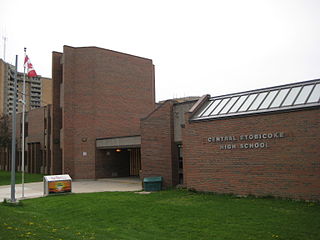
Central Etobicoke High School is a secondary school located at 10 Denfield Street, bordered by Widdicombe Hill Blvd to the South and Clement Rd to the North in the Richview neighbourhood of Etobicoke in Toronto, Ontario, Canada. There are four course levels offered: Essential, Workplace, Open and K. It is also governed by the Etobicoke Board of Education that was transferred over to the Toronto District School Board after 1997.

The Etobicoke Board of Education is the former public-secular school board administering the schools of Etobicoke, Ontario, headquartered in the Etobicoke Civic Centre. In 1998, it was merged into the Toronto District School Board. The former EBE offices remain in use today by the TDSB as the West Education Office.


