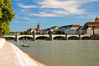
The Rhine is one of the major European rivers. The river begins in the Swiss canton of Graubünden in the southeastern Swiss Alps. It forms the Swiss-Liechtenstein border and partly the Swiss-Austrian and Swiss-German borders. After that the Rhine defines much of the Franco-German border, after which it flows in a mostly northerly direction through the German Rhineland. Finally in Germany, the Rhine turns into a predominantly westerly direction and flows into the Netherlands where it eventually empties into the North Sea. It drains an area of 9,973 km2.

The river Ticino is the most important perennial left-bank tributary of the Po. It has given its name to the Swiss canton through which its upper portion flows.

The Engadin or Engadine is a long high Alpine valley region in the eastern Swiss Alps in the canton of Graubünden in southeasternmost Switzerland with about 25,000 inhabitants. It follows the route of the Inn from its headwaters at Maloja Pass in the southwest running roughly northeast until the Inn flows into Austria, little less than one hundred kilometers downstream. The En/Inn subsequently flows at Passau into the Danube, making it the only Swiss river to drain into the Black Sea. The Engadine is protected by high mountain ranges on all sides and is famous for its sunny climate, beautiful landscapes and outdoor activities.

The Adige is the second-longest river in Italy, after the Po. It rises near the Reschen Pass in the Vinschgau in the province of South Tyrol, near the Italian border with Austria and Switzerland, and flows 410 kilometres (250 mi) through most of northeastern Italy to the Adriatic Sea.

The Ossola is an area of Italy situated to the north of Lago Maggiore. It lies within the Province of Verbano-Cusio-Ossola. Its principal river is the Toce, and its most important town Domodossola.

Onsernone is a municipality in the Swiss canton of Ticino, near the city of Locarno. The river Isorno, known as the Onsernone River in Italy, runs through the valley with which Onsernone shares its name.

Intragna is a village and locality in the municipality of Centovalli in the district of Locarno of the canton of Ticino in Switzerland.

Gresso is a former municipality in the district of Locarno in the canton of Ticino in Switzerland. The municipality was formed in 1882 by splitting from Vergeletto. On 10 April 2016 the former municipalities of Vergeletto, Gresso, Mosogno and Isorno merged into the municipality of Onsernone.

Isorno is a former municipality in the district of Locarno in the canton of Ticino in Switzerland. On 10 April 2016 the former municipalities of Vergeletto, Gresso, Mosogno and Isorno merged into the municipality of Onsernone.
Loco is a village and former municipality in the canton of Ticino, Switzerland.

Comologno is a village and former municipality in the district of Locarno in the canton of Ticino, Switzerland.

The Hinterrhein, or Posterior Rhine, is the right of the two initial tributaries of the Rhine. It is located in the canton of Grisons, Switzerland. One of its upper tributaries is Reno di Lei, which is the outflow of Lago di Lei located in Lombardy, Italy.
Pizzo di Madéi is a mountain of the Lepontine Alps, located on the border between Switzerland and Italy. It lies between the valleys of Vergeletto (Ticino), Isorno and Onsernone (Piedmont).

The Melezzo Occidentale is a 13 km Alpine torrent which runs through the western part of the Val Vigezzo, a side valley of the Ossola in the Province of Verbano Cusio Ossola, northern Italy. Belonging to the Po basin, it is a left tributary of the Toce which in its turn flows into Lago Maggiore.

The Melezza, in Italy the Melezzo Orientale, is a 42 km Alpine torrent which runs through the eastern part of the Val Vigezzo, in the Province of Verbano Cusio Ossola, northern Italy; and through the Centovalli of Canton Ticino, Switzerland. Belonging to the Po basin, it is a tributary of the Maggia which in its turn flows into Lago Maggiore.

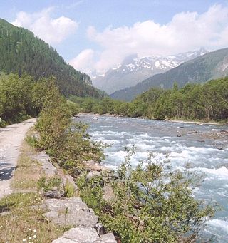
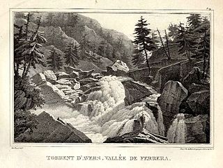
The Avers Rhine is a tributary of the Hinterrhein/Rein Posteriur in the Swiss canton of Graubünden.

Bagni di Craveggia is a frazione of the municipality of Craveggia, in Piedmont, northern Italy. It is located in the Onsernone Valley at 986 m (3,235 ft), on the border of Switzerland. Road access is through Spruga, a village in the municipality of Onsernone, which lies across the Isorno river. It owes its name to a source of thermal water at 28 °C (82 °F).

Spruga is a village in the Swiss municipality of Onsernone, in the district of Locarno, in the canton of Ticino. It lies on the sunny, south-facing slopes above the Isorno river on the border of Italy. The first recorded mention of Spruga goes back to the year 1285. Spruga is the last village on the sole road through the Onsernone Valley as well as the nearest settlement to the old thermal baths at Bagni di Craveggia where a 6-story hotel, now in ruins but open to the public, was built in 1819. In the 19th century, visitors to the baths had to take an 8-hour carriage ride from Locarno to Comologno and then walk the last three to four kilometers on a dirt trail through Spruga with their luggage on mules or carried by locals. Mail service was brought into and from the Onsernone Valley on foot to Loco, where mail was then distributed and collected.


