
The Pastaza River also known as the Patate, flowing in Ecuador and Peru is a large tributary to the Marañón River in the northwestern Amazon Basin of South America.

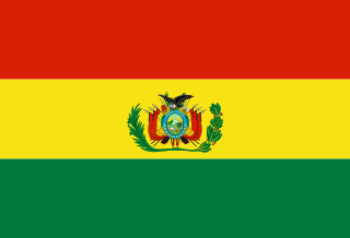
The demographic characteristics of the population of Bolivia are known from censuses, with the first census undertaken in 1826 and the most recent in 2024. The National Institute of Statistics of Bolivia (INE) has performed this task since 1950. The population of Bolivia in 2024 reached 11 million for the first time in history. The population density is 11.36 inhabitants per square kilometer, and the overall life expectancy in Bolivia at birth is 68.2 years. The population has steadily risen from the late 1800s to the present time. The natural growth rate of the population is positive, which has been a continuing trend since the 1950s; in 2012, Bolivia's birth rate continued to be higher than the death rate. Bolivia is in the third stage of demographic transition. In terms of age structure, the population is dominated by the 15–64 segment. The median age of the population is 23.1, and the gender ratio of the total population is 0.99 males per female.
The Bolivian Armed Forces are the military of Bolivia. The Armed Forces of Bolivia are responsible for the defence, both of external and internal, of Bolivia and they are constituted by Bolivian Army, the Bolivian Air Force and the Bolivian Navy. All these institutions depend on the Ministry of Defence of this country.

Beni, sometimes El Beni, is a northeastern department of Bolivia, in the lowlands region of the country. It is the second-largest department in the country, covering 213,564 square kilometers, and it was created by supreme decree on November 18, 1842, during the administration of General José Ballivián. Its capital is Trinidad.

Santa Cruz is the largest of the nine constituent departments of Bolivia, occupying about one-third (33.74%) of the country's territory. With an area of 370,621 km2 (143,098 sq mi), it is slightly smaller than Japan or the US state of Montana. It is located in the eastern part of the country, sharing borders in the north and east with Brazil and with Paraguay in the south.
The Confederation of Indigenous Peoples of Bolivia is a national representative organization of the Bolivian indigenous movement. It was founded in October 1982 in Santa Cruz de la Sierra as the Confederation of Indigenous Peoples of the Bolivian East, with the participation of representatives of four indigenous peoples of the Bolivian East: Guarani-Izoceños, Chiquitanos, Ayoreos and Guarayos.

José Ballivián is a province of the Beni Department in northern Bolivia. It is named for José Ballivián, a general and former president of Bolivia who lived from 1805 until 1852. The province has a north-south extent. To the west the province is bounded by the Beni River, to the east it borders on the Yacuma Province of the Beni Department.
The Machupo River is a river in Beni Department, Bolivia, a tributary of the Amazon. It rises in the foothills of the Andes and flows east and northeast into the Guaporé River just to the east of Forte Principe da Beira.

San Borja is a city in the Beni Department in northern Bolivia, It is the most populous city in the province of General José Ballivián.

Ñuflo de Chávez is one of the fifteen provinces of the Bolivian Santa Cruz Department and is situated in the northern and central parts of the department. The name of the province honors the conquistador Ñuflo de Chaves (1518–1556) who founded the city of Santa Cruz de la Sierra. Its capital is Concepción. The province was created by law of September 16, 1915, during the presidency of Ismael Montes. Originally it was part of the Chiquitos Province.
Santa Cruz, Pucaraju,Pukaraju or Pico de Huaylas is a mountain in the Cordillera Blanca in the Andes of Peru; within Santa Cruz District, Huaylas Province, Ancash. It has a height of 6,259 metres (20,535 ft), although other maps cite a height of 6,241 metres (20,476 ft).

The Parapetí River is a river in Bolivia that has its source on the eastern side the Andes, flows through the Gran Chaco of Bolivia and ends in the marshes of the Bañados de Izozog depression. The drainage basin is 25,300 km2, and with the inclusion of the Bañados of Izozog is 61,903 km2.

Bolivians are people identified with the country of Bolivia. This connection may be residential, legal, historical or cultural. For most Bolivians, several of these connections exist and are collectively the source of their being Bolivian.
The Jach'a Jawira is a river in the La Paz Department of Bolivia, south of Wiñaymarka, the southern branch of Lake Titicaca. It is a tributary of the Desaguadero River.
Los CedrosCreek is a stream in Peru located in Huaylas Province, Ancash. It is a right tributary of the Santa River which flows to the Pacific Ocean.
Malla Jawira is a river in the La Paz Department in Bolivia. It is a right tributary of the Luribay River whose waters flow to the La Paz River.
Cunuyo is a mountain in the north of the Apolobamba mountain range on the border of Bolivia and Peru. It is about 5,100 metres (16,732 ft) high. On the Bolivian side it is located in the La Paz Department, Franz Tamayo Province, Pelechuco Municipality, and on the Peruvian side it lies in the Puno Region, Putina Province, Sina District. Cunuyo is situated southwest of the mountain Locopauchenta and east of Losojocha.
Qachini or Tara Paka is a mountain in the north of the Apolobamba mountain range in the Andes of Peru, about 5,200 metres (17,060 ft) high. It is located in the Puno Region, Putina Province, Ananea District, northwest of La Rinconada. Qachini lies southwest of the mountain named Wilaquta, northeast of Qala K'umu and southeast of Qurwari.
Chuqi Warani is a 5,388-metre-high (17,677 ft) mountain in Bolivia. It is located in the Potosí Department, Antonio Quijarro Province, Tomave Municipality. It lies southwest of the Jatun Mundo Quri Warani volcano. In the map of the Bolivian Instituto Geográfico Militar the term Chaupi Mundo is added under Cerro Choquehuarani. This may be an alternate name or a supplement.
The Ch'alla Jawira which upstream successively is named Chilla Jawira, Pichini Jawira, Janq'u Quta and Siwinqa is a river in the La Paz Department in Bolivia. It is a left tributary of the Desaguadero River.

