Rendsburg-Eckernförde is a district in Schleswig-Holstein, Germany. It is bounded by the city of Kiel, the district of Plön, the city of Neumünster, the districts of Segeberg, Steinburg, Dithmarschen and Schleswig-Flensburg, and the Baltic Sea.

Steinburg is a district in Schleswig-Holstein, Germany, administered from Itzehoe. It is bounded by the districts of Dithmarschen, Rendsburg-Eckernförde, Segeberg and Pinneberg, and by the Elbe River.
Pinneberg is a district in Schleswig-Holstein, Germany. It is bounded by the districts of Steinburg and Segeberg, the city of Hamburg and the state of Lower Saxony. The island of Heligoland is also part of the district.
Stade is a district (Landkreis) in Lower Saxony, Germany. It has its seat in Stade and is part of the Hamburg Metropolitan Region.
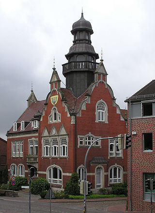
Kellinghusen is a town in the district of Steinburg in the Bundesland of Schleswig-Holstein.
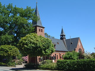
Aukrug is a municipality in the district of Rendsburg-Eckernförde, in Schleswig-Holstein, Germany. It is situated approximately 13 km west of Neumünster, and 35 km southwest of Kiel.
Itzehoe-Land is an Amt in the district of Steinburg, in Schleswig-Holstein, Germany. It is situated around Itzehoe, which is the seat of the Amt, but not part of it.

Wasbek is a municipality, immediately west of Neumünster, in the district of Rendsburg-Eckernförde, in Schleswig-Holstein, Germany.
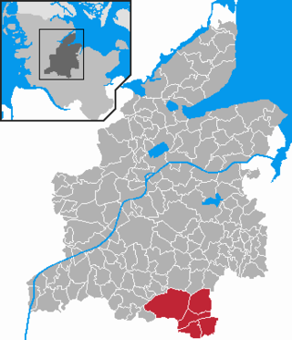
Aukrug is a former Amt in the district of Rendsburg-Eckernförde, in Schleswig-Holstein, Germany. The seat of the Amt is in Aukrug. It was disbanded on 1 January 2012 along with the Hanerau-Hademarschen, the Amt Hohenwestedt-Land and Hohenwestedt to become Mittelholstein.
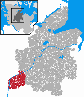
Hanerau-Hademarschen is a former Amt in the district of Rendsburg-Eckernförde, in Schleswig-Holstein, Germany. The seat of the Amt was in Hanerau-Hademarschen. It was disbanded in January 2012 together with the Amt Aukrug, Amt Hohenwestedt-Land and Hohenwestedt to become Mittelholstein.

Rade is a municipality in the district of Steinburg in Schleswig-Holstein, Germany.

Rosdorf is a municipality in the district of Steinburg, in Schleswig-Holstein, Germany. It is located around 3 kilometres north of Kellinghusen and east of the Stör River. Rosdorf is situated in the Aukrug Nature Park. The federal highway Bundesstraße 206 from Lübeck to Itzehoe is about 4 kilometres south of Rosdorf.

Wiedenborstel is a municipality in the district of Steinburg, in Schleswig-Holstein, Germany.
Breitenburg is an Amt in the district of Steinburg, in Schleswig-Holstein, Germany. The seat of the Amt is in Breitenburg.
Schenefeld is an Amt in the district of Steinburg, in Schleswig-Holstein, Germany. The seat of the Amt is in Schenefeld.
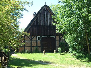
Dat ole Hus is a privately run local history museum in the village of Bünzen in the municipality of Aukrug in Schleswig-Holstein. Its interior rooms portray the living quarters of a farmer from this region from the 18th to the early 20th century.
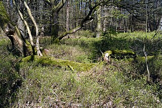
The Tönsheide Forest is a nature reserve near the village of Aukrug east of Neumünster in the north German state of Schleswig-Holstein.

The Aukrug Nature Park is a nature park in north Germany with an area of 380 square kilometres (150 sq mi). It lies in the centre of the state of Schleswig-Holstein in the region of Holstein. It is sponsored by an association formed by the 2 districts.

Mittelholstein is an Amt in the district of Rendsburg-Eckernförde, in Schleswig-Holstein, Germany. It was formed on 1 January 2012 from the three former Ämter Aukrug, Hanerau-Hademarschen and Hohenwestedt-Land and the municipality Hohenwestedt. The seat of the Amt is in Hohenwestedt.


