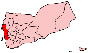
Al Hudaydah is a governorate of Yemen. Its capital is Al Hudaydah. The governorate is also sometimes referred to as the Western Coast. With an estimated population of nearly 4 million, it is the third-most populous governorate in Yemen, behind Ibb and Taiz.

Raymah is a governorate of Yemen. Its capital is Al Jabin. The governorate was established in January 2004 from parts of Sanaa Governorate. Its name derives from Wadi Rima, which crosses through the governorate.
As Sawd District (Arabic: مديرية السود) is a district of the 'Amran Governorate, Yemen. As of 2003, the district had a population of 25,892 inhabitants.
As Sudah District is a district of the 'Amran Governorate, Yemen. As of 2003, the district had a population of 32,169 inhabitants.
Jabal Iyal Yazid District (Arabic: مديرية جبل عيال يزيد) is a district of the 'Amran Governorate, Yemen. As of 2003, the district had a population of 84,393 inhabitants.
Maswar District (Arabic: مديرية مسور) is a district of the 'Amran Governorate, Yemen. As of 2003, the district had a population of 38,432 inhabitants. In the early 20th century, the mountain village was visited by German explorer and photographer, Hermann Burchardt.

Shaharah District is a district of the 'Amran Governorate, Yemen. As of 2003, the district had a population of 43,738 inhabitants. Its capital lies at Shaharah.
Suwayr District is a district of the 'Amran Governorate, Yemen. As of 2003, the district had a population of 20,854 inhabitants.
Ad Durayhimi District is a district of the Al Hudaydah Governorate, Yemen. As of 2003, the district had a population of 55,013 inhabitants.
Al Mansuriyah District is a district of the Al Hudaydah Governorate, Yemen. As of 2003, the district had a population of 44,744 inhabitants.
As Sukhnah District is a district of the Al Hudaydah Governorate, Yemen. As of 2003, the district had a population of 59,652 inhabitants.
At Tuhayta District is a district of the Al Hudaydah Governorate, Yemen. As of 2003, the district had a population of 67,660 people.
Bayt al-Faqih District is a district of the Al Hudaydah Governorate, Yemen. As of 2003, the district had a population of 241,300 inhabitants.
Bura District is a district of the Al Hudaydah Governorate, Yemen. As of 2003, the district had a population of 45,116 inhabitants.
Jabal Ra's District is a district of the Al Hudaydah Governorate, Yemen. As of 2003, the district had a population of 44,674 inhabitants.
Zabid District is a district of the Al Hudaydah Governorate in western Yemen.
Al Mudhaffar District is a district of the Taiz Governorate, Yemen. As of 2003, the district had a population of 146,259 inhabitants.

Manakhah District is a district of the Sana'a Governorate, Yemen. As of 2003, the district had a population of 78,932 inhabitants.

al-Marawi'a (المراوعة) is a city in Al Marawi'ah District in Al Hudaydah Governorate of Yemen.
Maheshbati is a village in Raina I CD block in Bardhaman Sadar South subdivision of Purba Bardhaman district in the Indian state of West Bengal.


