
Palmer is a city in and the borough seat of the Matanuska-Susitna Borough, Alaska, located 42 miles northeast of Anchorage on the Glenn Highway in the Matanuska Valley. It is the ninth-largest city in Alaska, and forms part of the Anchorage Metropolitan Statistical Area. As of the 2020 census, the population of the city is 5,888, down from 5,937 in 2010.

The Alaska Range is a relatively narrow, 400-mile-long (650 km) mountain range in the southcentral region of the U.S. state of Alaska, from Lake Clark at its southwest end to the White River in Canada's Yukon Territory in the southeast. The highest mountain in North America, Denali, is in the Alaska Range. It is part of the American Cordillera.

Denali National Park and Preserve, formerly known as Mount McKinley National Park, is an American national park and preserve located in Interior Alaska, centered on Denali, the highest mountain in North America. The park and contiguous preserve encompass 6,045,153 acres which is larger than the state of New Hampshire. On December 2, 1980, 2,146,580-acre Denali Wilderness was established within the park. Denali's landscape is a mix of forest at the lowest elevations, including deciduous taiga, with tundra at middle elevations, and glaciers, snow, and bare rock at the highest elevations. The longest glacier is the Kahiltna Glacier. Wintertime activities include dog sledding, cross-country skiing, and snowmobiling. The park received 594,660 recreational visitors in 2018.

The Stewart–Cassiar Highway, also known as the Dease Lake Highway and the Stikine Highway as well as the Terrace–Kitimat Highway from Kitimat to Terrace, is the northwesternmost highway in the Canadian province of British Columbia. A scenic route through some of the province's most isolated areas, the highway first gained designation as British Columbia Highway 37 in the year 1975. At that time, its southern terminus was at the community of New Hazelton on the BC Highway 16. In 1975, with the completion of a new bridge over the Kitimat River, the highway's Yellowhead junction was relocated to a point on Highway 16 just south of the site of Kitwanga. Highway 37 was then extended south to Kitimat in 1986 superseding what was then designated Highway 25. At the north end, the highway briefly stretches into the Yukon, becoming Yukon Highway 37.

Lake Clark National Park and Preserve is an American national park in southwest Alaska, about 100 miles (160 km) southwest of Anchorage. The park was first proclaimed a national monument in 1978, then established as a national park and preserve in 1980 by the Alaska National Interest Lands Conservation Act. The park includes many streams and lakes vital to the Bristol Bay salmon fishery, including its namesake Lake Clark. A wide variety of recreational activities may be pursued in the park and preserve year-round. The park protects rainforests along the coastline of Cook Inlet, alpine tundra, glaciers, glacial lakes, major salmon-bearing rivers, and two volcanoes, Mount Redoubt and Mount Iliamna. Mount Redoubt is active, erupting in 1989 and 2009. The wide variety of ecosystems in the park mean that virtually all major Alaskan animals, terrestrial and marine, may be seen in and around the park. Salmon, particularly sockeye salmon, play a major role in the ecosystem and the local economy. Large populations of brown bears are attracted to feed on the spawning salmon in the Kijik River and at Silver Salmon Creek. Bear watching is a common activity in the park.

Watson Lake is a town in Yukon, Canada, located at mile 635 on the Alaska Highway close to the British Columbia border. It has a population of 790 in 2016. The town is named for Frank Watson, an American-born trapper and prospector, who settled in the area at the end of the 19th century.

Absaroka–Beartooth Wilderness was created from existing National Forest lands in 1978 and is located in Montana and Wyoming, United States. The wilderness is partly in Gallatin, Custer and Shoshone National Forests and is composed of 944,000 acres (3,820 km2). The wilderness encompasses two distinct mountain ranges, namely the Beartooth and Absaroka ranges. These ranges are completely distinct geologically speaking with the Absarokas composed primarily of volcanic and metamorphic rock, while the Beartooths are made up almost entirely of granitic rocks. The Absarokas are noted for their dark and craggy appearance, lush and heavily forested valleys and abundant wildlife. The highest peak in the range, located in Wyoming, is Francs Peak at 13,153 feet (4,009 m). The Beartooths are more alpine with huge treeless plateaus and the highest peak in the state of Montana. The wilderness contains 30 peaks over 12,000 feet (3,700 m). The wilderness is an integral part of the 20-million-acre (81,000 km2) Greater Yellowstone Ecosystem and borders Yellowstone National Park.

Chugach State Park covers 495,204 acres immediately east of the Anchorage Bowl in south-central Alaska. Though primarily in the Municipality of Anchorage, a small portion of the park north of the Eklutna Lake area in the vicinity of Pioneer Peak lies within the Matanuska-Susitna Borough. Established by legislation signed into law on August 6, 1970, by Alaska Governor Keith Miller, this state park was created to provide recreational opportunities, protect the scenic value of the Chugach Mountains and other geographic features, and ensure the safety of the water supply for Anchorage. The park, managed by Alaska State Parks, is the third-largest state park in the United States, and consists of geographically disparate areas each with different attractions and facilities. Only Anza-Borrego Desert State Park in California and Wood-Tikchik State Park in western Alaska are larger. Hunting and fishing are permitted in the Chugach under regulations established by the Alaska Department of Fish and Game for game management unit 14c. Target practice is not allowed within the park boundaries.

Denali State Park is a 325,240-acre (131,620 ha) state park in the U.S. state of Alaska. It is located in the Matanuska-Susitna Borough adjacent to the east side of Denali National Park and Preserve, along the Parks Highway.

Northern Rocky Mountains Provincial Park is a provincial park in British Columbia, Canada. It is located in the north-eastern part of the province, 90 km south-west from Fort Nelson and it is bordered to the north by the Alaska Highway. Access is mostly done by boat, aircraft, on horseback or by hiking.

Coldstream is a district municipality in British Columbia, Canada, located at the northern end of Kalamalka Lake in the Okanagan Valley. Incorporated on December 21, 1906, Coldstream celebrated its centennial in 2006. The municipality is directly southeast of Vernon and is considered part of Greater Vernon. It is a member municipality of, and also the location of the head offices, of the Regional District of North Okanagan.

Mount Silverthrone, officially named Silverthrone Mountain, is a mountain in the Pacific Ranges of the Coast Mountains of British Columbia, Canada, located over 320 km (200 mi) northwest of the city of Vancouver and about 50 km (30 mi) west of Mount Waddington, British Columbia, Canada. It is the highest peak in the Ha-Iltzuk Icefield, which is the largest icefield in the Coast Mountains south of the Alaska Panhandle.

A long-distance trail is a longer recreational trail mainly through rural areas used for hiking, backpacking, cycling, horse riding or cross-country skiing. They exist on all continents except Antarctica.
Narrow Hills Provincial Park is a northern boreal forest provincial recreational park along the in the Canadian province of Saskatchewan. It contains a series of recreational facilities and over 25 lakes within its boundaries. Some of these include the Gem Lakes, Lower Fishing Lake, Upper Fishing Lake and others.
Bashful Peak is a mountain in the U.S. state of Alaska, located in Chugach State Park. At 8,005 feet (2,440 m), Bashful is the highest peak in Chugach State Park, and the highest peak in the Municipality of Anchorage. The peak carries snow year-round and several small glaciers hang from its steep western face.
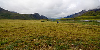
The Brooks–British Range tundra is an ecoregion spanning North America and Canada, and is one of the WWF Global 200 ecoregions.
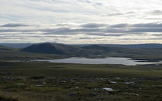
Toolik Lake is an Arctic lake located within the North Slope Borough, Alaska. It is in a remote wilderness area managed by the Bureau of Land Management accessed by the Dalton Highway. It is 130 mi (210 km) south of Prudhoe Bay in the northern foothills of the Brooks Range. The name is derived from the Iñupiat word tutlik, meaning yellow-billed loon.

Alaska Lake is a freshwater lake located on the western skirt of Alaska Mountain at the border between King County and Kittitas County, Washington. The lake is a popular area for hiking, swimming, and fishing. Other Alpine lakes are in the vicinity, including the Rampart Lakes a short distance south, at the base of Mount Margaret. To the east is Hibox Mountain.
Joe Lake is a freshwater lake located on the eastern skirt of Alaska Mountain at the border between King County and Kittitas County, Washington. The lake is a popular area for hiking, swimming, and fishing rainbow trout and cutthroat trout. Frequently hicked Huckleberry Mountain is just north of the lake on the opposite side of the Pacific Crest Trail. Other Alpine lakes are in the vicinity, including the Rampart Lakes a short distance south, at the base of Mount Margaret. To the east is Hibox Mountain.
