Jagatpura Ahir | |
---|---|
Village | |
Coordinates: 26°13′48″N79°22′34″E / 26.23°N 79.376°E Coordinates: 26°13′48″N79°22′34″E / 26.23°N 79.376°E | |
Country | |
State | Uttar Pradesh |
District | Jalaun |
Founded by | Raja Jagat Singh |
Government | |
• Body | Gram Sabha |
Elevation | 147 m (482 ft) |
Population (2011) | |
• Total | 1,850 |
Languages | |
• Official | Hindi |
Time zone | UTC+5:30 (IST) |
Jagatpura Ahir is a village in Jalaun Tehsil of Jalaun District of Uttar Pradesh in India.
Uttar Pradesh is a state in northern India. With over 200 million inhabitants, it is the most populous state in India as well as the most populous country subdivision in the world. It was created on 1 April 1937 as the United Provinces of Agra and Oudh during British rule, and was renamed Uttar Pradesh in 1950. The state is divided into 18 divisions and 75 districts with the capital being Lucknow. The main ethnic group is the Hindavi people, forming the demographic plurality. On 9 November 2000, a new state, Uttarakhand, was carved out from the state's Himalayan hill region. The two major rivers of the state, the Ganga and Yamuna, join at Allahabad (Prayagraj) and then flow as the Ganga further east. Hindi is the most widely spoken language and is also the official language of the state.
India, also known as the Republic of India, is a country in South Asia. It is the seventh largest country by area and with more than 1.3 billion people, it is the second most populous country as well as the most populous democracy in the world. Bounded by the Indian Ocean on the south, the Arabian Sea on the southwest, and the Bay of Bengal on the southeast, it shares land borders with Pakistan to the west; China, Nepal, and Bhutan to the northeast; and Bangladesh and Myanmar to the east. In the Indian Ocean, India is in the vicinity of Sri Lanka and the Maldives, while its Andaman and Nicobar Islands share a maritime border with Thailand and Indonesia.
As of 2011 [update] India census, [1] Jagatpura Ahir follows the same statistics as of Jalaun [Nearest Town having 2011 census statistics]. Jagatpura Ahir had a population of 1850. The Male population is 952 and female population is 898.
A census is the procedure of systematically acquiring and recording information about the members of a given population. The term is used mostly in connection with national population and housing censuses; other common censuses include agriculture, business, and traffic censuses. The United Nations defines the essential features of population and housing censuses as "individual enumeration, universality within a defined territory, simultaneity and defined periodicity", and recommends that population censuses be taken at least every 10 years. United Nations recommendations also cover census topics to be collected, official definitions, classifications and other useful information to co-ordinate international practice.
It is around 19 km from Jalaun City and around 28 km from Auraiya district on the state highway 21. The nearest busstop is at Hadrukh and the village is situated at a distance of 3 km in east side from Hadrukh. It was founded in early 17th century by Raja Jagat Singh of dynasty Rinya. He was ruler of 18 village (Kuri) at that time.
Jagatpur Ahir is well known for its history in warfare during British times. In early 20th Century, during the Battle of Peking, Subedar Major Thakur Adhar Sing Kushwah was the eminent member of 7th D. C. Q Rajputs British Infantry. Due to his courageous performance and contribution, Adhar Sing Kushwah was promoted as Honorary Captain and given the title of Sardar Bahadur, one of the titles in from Order of British India. [2] Jagatpura Ahir is also famous for an ancient temple called Barahi Devi and a 3 days fair has been organised every year during winter season. A Panch Mukhi Shiva idol has also been situated in the temple of "Matan".
The Battle of Peking, or historically the Relief of Peking, was the battle on 14–15 August 1900, in which a multi-national force, led by Britain, relieved the siege of foreign legations in Peking during the Boxer Rebellion. From 20 June 1900, Boxer forces and Imperial Chinese troops had besieged foreign diplomats, citizens and soldiers within the legations of Austria-Hungary, Belgium, Britain, France, Italy, Germany, Japan, Netherlands, Russia, Spain and the United States within the city of Peking.
In recent 2002-05, Thakur Awdhesh Pratap singh Kushwah was elected as the Gram Pradhan. During this time, several initiatives were taken for the development of Village. Some of them were installation of Water Tank, Check dam on Malanga River, reconstruction of the Village pond and connecting roads of the Village.
Datia is the district headquarters of the Datia District in north central Madhya Pradesh, a state of Central India. It is an ancient town, mentioned in the Mahabharata ruled by King 'Dantavakra'. The town is 69 km from Gwalior, 325 km south of New Delhi and 320 km north of Bhopal. About 15 km from Datia is Sonagiri, a sacred Jain hill. Datia is also about 34 km from Jhansi, Uttar Pradesh and 52 km from Orchha. The nearest airport is at Gwalior. It was formerly the seat of the eponymous princely state in the British Raj. Datia is situated near Gwalior and on the border with Uttar Pradesh (U.P.).
Mainpuri is a city in Mainpuri district in the Indian state of Uttar Pradesh. It is the administrative headquarters of the Mainpuri district and is situated to the north-east of Agra and is 270 km from New Delhi. Mainpuri forms part of ancient legendary region of Lord Krishna's land called Braj.
Hastinapur is a city in Meerut district in the Indian state of Uttar Pradesh. It is described in Hindu texts as the capital of the Kuru Kingdom and is also mentioned in ancient Jain texts.
Jalaun is a city and a municipal board in Jalaun district in the Indian state of Uttar Pradesh.
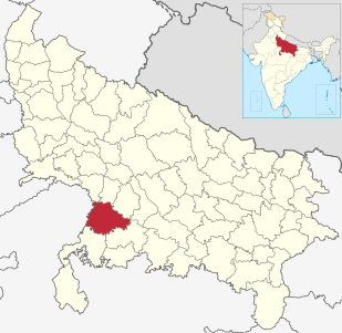
Jalaun district is a district of Uttar Pradesh state of India.
Bhind District is a district of Madhya Pradesh state in central India of Chambal division. The town of Bhind is the district headquarters. Bhind District is situated in Chambal region in the northwest of the state. The geographical coordinates of the district are Latitude 26°36' N and Longitude 78°46' E. It is bounded by Agra, Etawah, Jalaun and Jhansi districts of Uttar Pradesh state to the north and the east, and the Madhya Pradesh districts of Datia to the south, Gwalior to the southwest, and Morena to the west. The geography of the district is characterized by uneven ravines, plain fertile fields and scanty forests. The total area of the district is 4,459 km².
Budhana is a town, block, tehsil, Nagar Panchayat, and one of the constituencies of the Uttar Pradesh Legislative Assembly in Muzaffarnagar district in the state of Uttar Pradesh, India.
Gosainganj is a town and a nagar panchayat, in Lucknow district in the Indian state of Uttar Pradesh,.
Jhinjhak is a town and a Nagar Palika Parishad in Kanpur Dehat District in the Indian state of Uttar Pradesh. The town is situated on the banks of the Lower Ram Ganga canal.
Shikohabad is a town and a municipal board in the Firozabad district of the Indian state of Uttar Pradesh.
Singahi Bhedaura is a town and a nagar panchayat in Lakhimpur Kheri district in the state of Uttar Pradesh, India.
Tundla is a town and a municipal board in Firozabad district in the Indian state of Uttar Pradesh. It is located 24 km away from Agra city.
Rampura is a town and a nagar panchayat in Jalaun district in the Indian state of Uttar Pradesh.
Itaura is a village in Jalaun district in the Indian state of Uttar Pradesh. This is a twin village and it includes Akbarpur(Guru ka itora) and Itora.
Rudhmuli is a Village in Bah Tehsil of Agra District of Uttar Pradesh in India.
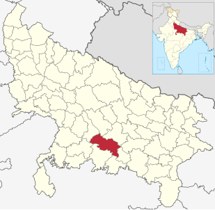
Fatehpur District is one of the 75 districts of Uttar Pradesh state in northern India. The district covers an area of 4,152 km². The district has a population of 2,632,733. Fatehpur city is the administrative headquarters of the district. Located on the banks of the sacred rivers Ganges and Yamuna, Fatehpur was mentioned in the puranic literature. The ghats of Bhitaura and Asani were described as sacred in the puranas. Bhitaura, the site of the sage Bhrigu, was an important source of learning. Fatehpur district is a part of Allahabad division.
The Phatak is one of the clans of Ghosi Ahir Yadavs who were agriculturalists, soldiers and small Kings. One of the Ahir Phatak Rana a very brave soldier was married to the daughter of a Ghosi Ahir King Digpal of Mahaban.
Injuwarampur is a village in Kanpur Dehat district in the state of Uttar Pradesh, India.
Kamariya is a sub-caste of Ahir Community.
Saifai is a large village in the Etawah district and Mainpuri Parliamentary constituency of Indian state Uttar Pradesh. It is also a sub-division (Tehsil) and Block of the Etawah district. It is the birthplace of Mulayam Singh Yadav, founding president of Samajwadi Party, former Minister of Defence and former Chief Minister of Uttar Pradesh. According to newspaper The Hindu, Saifai is in a process to establish itself as a sports and education hub in the state.