Buldhana district is located in the Amravati division of Maharashtra, India. It is situated at the western border of Vidarbha region and is 500 km away from the state capital, Mumbai. The district has towns and cities like deulghat, dhad, mehakar, Shegaon, Malkapur, Khamgaon, Lonar and Chikhli. It is surrounded by Madhya Pradesh in the north, Akola, Washim, and Amravati districts on the east, Jalna district on the south, and Jalgaon and Aurangabad districts on the west. Khamgaon is the largest city in the district.

Lonar is a town, just 79 km from Buldhana city and municipal council in Buldhana district of Vidarbha region of the Indian state of Maharashtra. The town is the headquarter of Lonar taluka and is located near Mehkar.

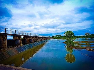
The Purna River is a river of Central and Western India. It is one of the chief tributaries of the Tapti river and empties into it at Changdev in Jalgaon, Maharashtra.
Buldhana is a City and a Municipal Council in the Indian state of Maharashtra. Established on 17 February 1893. It is the Administrative headquarters of the Buldhana District of Amravati division. It is the Second largest City in the district after Khamgaon and a popular place as a hill station because the city is surrounded by the mountainous area in the Ajanta range. Buldhana is around 552 km away from the state capital Mumbai. Buldhana has many religious, historical and tourist places around it like Balaji Temple in rajur ghat a replica of popular Balaji Temple of South India, is a famous religious and tourist place within city limits, Shri Gajanan Maharaj Temple in Shegaon around 75 km away, the World Famous Lonar Crater a National Geo-heritage monument created by meteorite impact is almost 100 km from city of Buldhana, Rajmata Jijau birthplace Sindkhed Raja is 90 km, Sailani Baba Dargah a major attraction of Buldhana just 25 km away from the city, The World Heritage Site Ajanta Caves is just 55 km away from the City and Dnyanganga Wildlife Sanctuary in Botha Forest is also just 20 km away from the city and many more tourist places are there around Buldhana City.
Pusad is a city in the Yavatmal district located in Vidarbha region of Maharashtra state of India. It is named after the Pus river. Its ancient name was 'Pushpawanti'. Pusad is second largest city of Yavatmal district. For last 20 years Pusad is being tried to be promoted to the stature of district but due to lack of administration of governing bodies it is only a dream of the people.
Chikhli is a city and a municipal council in Buldana district in Vidarbha Region of Maharashtra state, India. It is located on the Pune-Nagpur highway. It is situated at the westernmost border of Vidarbha region of Maharashtra and is 500 km from the state capital, Mumbai. Chikhli is situated on the border of the Marathwada Region and Vidarbha Regions of Maharashtra.
Nandura (नांदुरा) is a city in Buldhana district in Maharashtra state. Nandura is the headquarters of Nandura taluka. Nandura is situated on the National Highway No. 6 and the Mumbai-Howrah railway line. The municipality of Nandura was established during the British Raj in 1931. The place is major supplier of milk products to all nearby area.
Shirur is an administrative subdivision of the Pune district in the Indian state of Maharashtra. It is located on the eastern boundary of the district, on the banks of the Ghod River. The town is also called Ghodnadi to distinguish it from other locations that have the same name. Ghodnadi in Marathi Language means Ghod River.
Sangrampur is a Nagar Panchayat, a tehsil of Buldhana district, Maharashtra State, India.
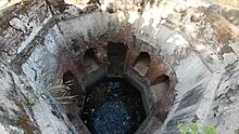
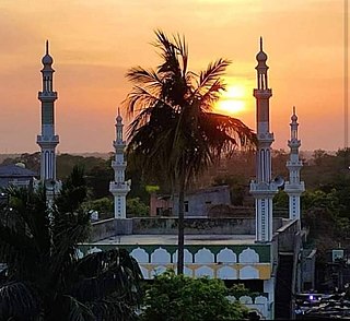
Motala is a township, or tehsil, in the Buldhana district in the Indian state of Maharashtra. One of its villages, Thal, is said to be the birthplace of Gajanan Maharaj. Motala market is a centre of economic activity, partially due to the good communication links between the villages. Villages in Motala taluka include Jaipur, Buldhana Korhala, kharbadi, Kothali, Dhamangaon Badhe, Rohinkhed, Shelapur, Takarkhed and Rajur.
Vairag is a town in Barshi Taluka of Solapur district in Maharashtra, India. The village is located centrally between Solapur and Barshi.
Warwat Bakal is a Gram Panchayat, in Sangrampur tehsil of Buldhana district, includes in Vidarbha region in the state of Maharashtra, India.
Advihir is a village in Motala taluka of Buldhana district, Amravati division, Maharashtra, India, and is 5 km east of Motala on Nandura–Motala road.
Anjani Khurd is a village in Lonar taluka, Buldhana district, Maharashtra, India.
{{Infobox settlement | name = Pimpalgaon Raja | native_name = | native_name_lang = | other_name = | nickname = P.Raja | settlement_type = Village | image_skyline = | image_alt = | image_caption = | pushpin_map = India Maharashtra | pushpin_label_position = right | pushpin_map_alt = | pushpin_map_caption = Location in Maharashtra, India | coordinates = 20°43′00″N76°26′00″E | subdivision_type = Country | subdivision_name = India | subdivision_type1 = State | subdivision_name1 = Maharashtra | subdivision_type2 = District | subdivision_name2 = Buldana | established_title = | established_date = | founder = | named_for = | government_type = Grampanchiyat | governing_body = Grampanchiyat Members | unit_pref = Metric | area_footnotes = | area_rank = 1 | area_total_km2 = | elevation_footnotes = | elevation_m = | population_total = 15234 | population_as_of = | population_rank = | population_density_km2 = auto | population_demonym = | population_footnotes = | demographics_type1 = Marathi, Hindi, English, Urdu | demographics1_title1 = Official | demographics1_info1 = [[language [marathi, hindi]] | timezone1 = IST | utc_offset1 = +5:30 | postal_code_type = | postal_code = 444306 | registration_plate = MH-28 | website = | footnotes = }}

The Nagpur–Bhusawal section is part of the Howrah–Nagpur–Mumbai line and connects Nagpur and Bhusawal both in the Indian state of Maharashtra. This section also has a number of branch lines. Part of one of the major trunk lines in the country, Nagpur–Bhusawal section passes through a section of the Deccan Plateau. The main line crosses Nagpur, Wardha, Amravati, Akola, and Buldhana districts of Vidarbha region and Jalgaon district of Khandesh region.

Makner is a village in Malkapur tehsil of Buldhana district in Maharashtra, India. This is regarded as a holy place, with three major temples dedicated to Hindu saints. Nearby towns are Malkapur on west, Nandura on East.
Chinchpur is a village located in the Taluka of Motala, in Buldhana district, Maharashtra, India, with a total population of 1292.
Chandol is a village located in Buldhana Tehsil of Buldhana district in Maharashtra, India.
Dhad is a gram panchayat village in Buldana Taluka in Buldhana District of Maharashtra State, India. It belongs to Vidarbha region. It belongs to Amravati Division. It is located 29 km towards west from District headquarters Buldhana. 17 km from Buldana. 424 km from State capital Mumbai.