Jalapa, Nepal

Last updated
Jalapa, Nepal

जाल्पा
Nepal adm location map.svg
Red pog.svg
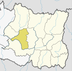
Jalapa, Nepal
Location in Nepal
Coordinates: 27°19′N86°47′E / 27.31°N 86.78°E / 27.31; 86.78 Coordinates: 27°19′N86°47′E / 27.31°N 86.78°E / 27.31; 86.78
CountryFlag of Nepal.svg    Nepal
Zone Sagarmatha Zone
District Khotang District
Population
 (1991)
  Total2,351
Time zone UTC+5:45 (Nepal Time)

Jalapa is a village and also the Village Development Committee of Khotang District in the Sagarmatha Zone of eastern Nepal is located here. At the time of the 1991 Nepal census, it had a population of 2,351 persons living in 448 individual households. [1]

Village Small clustered human settlement smaller than a town

A village is a clustered human settlement or community, larger than a hamlet but smaller than a town, with a population ranging from a few hundred to a few thousand. Though villages are often located in rural areas, the term urban village is also applied to certain urban neighborhoods. Villages are normally permanent, with fixed dwellings; however, transient villages can occur. Further, the dwellings of a village are fairly close to one another, not scattered broadly over the landscape, as a dispersed settlement.

Khotang District District in Province No. 1, Nepal

Khotang District is one of 14 districts of Province No. 1 of eastern Nepal. The district, with Diktel as its district headquarters, covers an area of 1,591 km² and has a population (2011) of 206,312. Khotang is part of the area traditionally called Majh Kirat, home to indigenous ethnic Kirat Rai people. Apart from Rais, other ethnic groups and hill castes live in Khotang. The main languages are Kirat Rai Chamling language or Kirat Rai languages and Khas Nepali.

Sagarmatha Zone Zone in Nepal

Sagarmāthā was one of the fourteen zones of Nepal until the restructuring of zones into provinces. Sagarmāthā is a Nepali word derived from सगर (sagar) meaning "sky" and माथा (māthā) meaning "head".

Jalapa consists of other villages such as Kharbari, Purano Gau and Ghale Gau. Most maps of Nepali does not indicate these villages.

Related Research Articles

Badka Dipali is a village and Village Development Committee in Khotang District in the Sagarmatha Zone of eastern Nepal. At the time of the 1991 Nepal census it had a population of 2,632 persons living in 508 individual households.

Bahunidanda Village Development Committee in Sagarmatha Zone, Nepal

Bahunidanda is a town and Village Development Committee in Khotang District in the Sagarmatha Zone of eastern Nepal. At the time of the 1991 Nepal census it had a population of 2,365 persons living in 401 individual households.

Chhorambu Village Development Committee in Sagarmatha Zone, Nepal

Chhorambu is a village and Village Development Committee in Khotang District in the Sagarmatha Zone of eastern Nepal. At the time of the 1991 Nepal census it had a population of 2,376 persons living in 428 individual households.

Chhitapokhari Village Development Committee in Sagarmatha Zone, Nepal

Chhitapokhari is a village and Village Development Committee in Khotang District in the Sagarmatha Zone of eastern Nepal. At the time of the 1991 Nepal census it had a population of 2,314 persons living in 406 individual households.

Dandagaun is a village and Village Development Committee in Khotang District in the Sagarmatha Zone of eastern Nepal. At the time of the 1991 Nepal census it had a population of 2,903 persons living in 528 individual households.

Dikuwa Village Development Committee in Sagarmatha Zone, Nepal

Dikuwa is a village and Village Development Committee in Khotang District in the Sagarmatha Zone of eastern Nepal. At the time of the 1991 Nepal census it had a population of 2,022 persons living in 342 individual households.

Diplung Village Development Committee in Sagarmatha Zone, Nepal

Diplung is a village and Village Development Committee in Khotang District in the Sagarmatha Zone of eastern Nepal. At the time of the 1991 Nepal census it had a population of 2,063 persons living in 399 individual households.

Kaule is a village and Village Development Committee in Khotang District in the Sagarmatha Zone of eastern Nepal. At the time of the 1991 Nepal census it had a population of 2,035 persons living in 373 individual households.

Kharpa Village Development Committee in Sagarmatha Zone, Nepal

Kharpa is a village and Village Development Committee in Khotang District in the Sagarmatha Zone of eastern Nepal. At the time of the 1991 Nepal census it had a population of 2,096 living in 393 individual households.

Khidima Village Development Committee in Sagarmatha Zone, Nepal

Khidima is a village and Village Development Committee in Khotang District in the Sagarmatha Zone of eastern Nepal. At the time of the 1991 Nepal census it had a population of 2,349 people living in 415 individual households.

Khotang Bazar is a village and Village Development Committee in Khotang District in Province No. 1 in eastern Nepal. At the time of the 1991 Nepal census, it had a population of 2,433 persons living in 458 individual households.....

Kubhinde, Khotang Village Development Committee in Sagarmatha Zone, Nepal

Kubhinde is a village and Village Development Committee in Khotang District in the Sagarmatha Zone of eastern Nepal. At the time of the 1991 Nepal census it had a population of 2,189 persons living in 406 individual households.

Linkuwa Pokhari is a village and Village Development Committee in Khotang District in the Sagarmatha Zone of eastern Nepal. At the time of the 1991 Nepal census it had a population of 2,655 persons living in 516 individual households.

Mangaltar, Khotang Village Development Committee in Sagarmatha Zone, Nepal

Mangaltar, Sagarmatha is a village and Village Development Committee in Khotang District in the Sagarmatha Zone of eastern Nepal. At the time of the 1991 Nepal census it had a population of 2,140 persons living in 376 individual households.

Sapteshwar Village Development Committee in Sagarmatha Zone, Nepal

Sapteshwar is a village and Village Development Committee in Khotang District in the Sagarmatha Zone of eastern Nepal. At the time of the 1991 Nepal census it had a population of 2,457 persons living in 480 individual households.

Saunechaur Village Development Committee in Sagarmatha Zone, Nepal

Saunechaur is a village and Village Development Committee in Khotang District in the Sagarmatha Zone of eastern Nepal. At the time of the 1991 Nepal census it had a population of 2,255 persons living in 406 individual households.

Simpani, Khotang Village Development Committee in Sagarmatha Zone, Nepal

Simpani is a town and Village Development Committee in Khotang District in the Sagarmatha Zone of eastern Nepal. At the time of the 1991 Nepal census it had a population of 3,597 persons living in 676 individual households. According to Simpani VDC record in 2008, its total population is 5713.

Sungdel Village Development Committee in Sagarmatha Zone, Nepal

Sungdel is a village and Village Development Committee in Khotang District in the Sagarmatha Zone of eastern Nepal. At the time of the 1991 Nepal census it had a population of 2,846 persons living in 585 individual households.Its situated at northern east belt of khotang district. Currently, there is a high school, Shree surya Ma. Vi, and four other primary schools as means of education. Peoples running their own hydropower.Mojority of people are Koyee Rai. It is the only one place where Koyee people speaks their mothertone language Koyee. This language is also known as sungdele bhasa. Most of people depends on farming.The highest hill in khotang district Loure is situated in Sungdel. Sungdel is famous for wild bee honey.

Woplukha Village Development Committee in Sagarmatha Zone, Nepal

Waplukha is a Village Development Committee in Khotang District in the Sagarmatha Zone of eastern Nepal. At the time of the 1991 Nepal census it had a population of 2,571 persons living in 484 individual households.

Wopung Village Development Committee in Sagarmatha Zone, Nepal

Wopung is a village and Village Development Committee in Khotang District in the Sagarmatha Zone of eastern Nepal. At the time of the 1991 Nepal census it had a population of 2,854 persons living in 508 individual households.

References

  1. "Nepal Census 2001". Nepal's Village Development Committees. Digital Himalaya. Archived from the original on 12 October 2008. Retrieved 30 September 2008.

2. Administrative area of Jalapa (Nepal)

Kharmi Village Development Committee in Sagarmatha Zone, Nepal

Kharmi is a town and Village Development Committee in Khotang District in the Sagarmatha Zone of eastern Nepal. At the time of the 1991 Nepal census it had a population of 3,807 persons living in 723 individual households.

Dumi is a Kiranti language spoken in the area around the Tap and Rava rivers and their confluence in northern Khotang district, Nepal. It is spoken in the villages such as Makpa, Kharbari, Baksila, Sapteshwor, and Kharmi (Ethnologue).