Jamam was a refugee camp in Maban County, Upper Nile state, South Sudan. [1]
A refugee camp is a temporary settlement built to receive refugees and people in refugee-like situations. Refugee camps usually accommodate displaced persons who have fled their home country, but there are also camps for internally displaced persons. Usually refugees seek asylum after they've escaped war in their home countries, but some camps also house environmental- and economic migrants. Camps with over a hundred thousand people are common, but as of 2012, the average-sized camp housed around 11,400. They are usually built and run by a government, the United Nations, international organizations, or NGOs. There are also unofficial refugee camps, like Idomeni in Greece or the Calais jungle in France, where refugees are largely left without support of governments or international organizations.
Greater Maban is a county located in the Upper Nile State of South Sudan. The county capital is the town of Bunj. In 2017, the South Sudan government divided the county into two: North East and South West.
Upper Nile was one of the ten states of South Sudan. The only governor of Upper Nile since the independence of South Sudan was Simon Kun Puoch The White Nile flowed through the state, giving it its name. The state also shared a similar name with the region of Greater Upper Nile, of which it was part along with the states of Unity and Jonglei. It had an area of 77,823 square kilometres (30,048 sq mi). Malakal was the capital of the state. The town of Kodok, the location of the Fashoda Incident that ended the "Scramble for Africa", was located in the state. Upper Nile seceded from Sudan as part of the Republic of South Sudan on 9 July 2011.
The inhabitants were moved a few dozen kilometres to the south-east in May 2013 because of the flooding experienced in the Jamam area. The new camp is based around a quarry with better drainage, and is also much closer to the neighbouring camp of Batil, at which Médecins Sans Frontières has built a substantial hospital. The replacement for Jamam is called Kaya — not to be confused with the South Sudanese town of Kaya in the far south of the country.
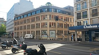
Médecins sans frontières, also known in English as Doctors Without Borders, is an international humanitarian medical non-governmental organisation (NGO) of French origin best known for its projects in conflict zones and in countries affected by endemic diseases. In 2015, over 30,000 personnel—mostly local doctors, nurses and other medical professionals, logistical experts, water and sanitation engineers and administrators—provided medical aid in over 70 countries. The vast majority of staff are volunteers. Private donors provide about 90% of the organisation's funding, while corporate donations provide the rest, giving MSF an annual budget of approximately US$1.63 billion.
Kaya is a city in Yei River State, South Sudan.
Le Monde is a French daily afternoon newspaper founded by Hubert Beuve-Méry at the request of Charles de Gaulle on 19 December 1944, shortly after the Liberation of Paris, and published continuously since its first edition. It is one of the most important and widely respected newspapers in the world.
The regions of Burkina Faso are divided into 45 administrative provinces. These 45 provinces are currently sub-divided into 351 departments or communes.
Horace is an unincorporated community in Clay Township, Decatur County, Indiana.
Brony is a village which is in the administrative district of Gmina Krzyżanów, within Kutno County, Łódź Voivodeship, in central Poland. It lies approximately 12 kilometres (7 mi) south of Kutno and 40 km (25 mi) north of the regional capital Łódź.
Czyżowice is a village in the administrative district of Gmina Bejsce, within Kazimierza County, Świętokrzyskie Voivodeship, in south-central Poland. It lies approximately 2 kilometres (1 mi) north of Bejsce, 10 km (6 mi) east of Kazimierza Wielka, and 69 km (43 mi) south of the regional capital Kielce.
Czaplinek is a village in the administrative district of Gmina Góra Kalwaria, within Piaseczno County, Masovian Voivodeship, in east-central Poland. It lies approximately 6 kilometres (4 mi) south-west of Góra Kalwaria, 16 km (10 mi) south-east of Piaseczno, and 32 km (20 mi) south of Warsaw.
Buckberg Mountain is a hill above the Hudson River that played a role in American Revolutionary War strategy concerning the Hudson Highlands. Its slopes rise directly from the riverbank to an elevation of about 793 feet (242 m) above Tomkins Cove, a section of Stony Point, New York, in Rockland County. It is flanked on the north and south by Camp Addisone Boyce of the Girl Scouts of the USA and Camp Bullowa of the Boy Scouts of America. In recent years its forests have been largely subdivided and developed for upscale housing. Buckberg lies about two miles (3 km) south and slightly west of Dunderberg Mountain.
Siadougou is a commune in the Cercle of San in the Ségou Region of Mali. The principal town lies at Siella. In 1998 the commune had a population of 10,294.
Przybród is a village in the administrative district of Gmina Kartuzy, within Kartuzy County, Pomeranian Voivodeship, in northern Poland. It lies approximately 7 kilometres (4 mi) south-west of Kartuzy and 34 km (21 mi) west of the regional capital Gdańsk.
Olszówka is a village in the administrative district of Gmina Stary Targ, within Sztum County, Pomeranian Voivodeship, in northern Poland. It lies approximately 8 kilometres (5 mi) south-east of Stary Targ, 16 km (10 mi) east of Sztum, and 67 km (42 mi) south-east of the regional capital Gdańsk.
Struga is a village in the administrative district of Gmina Nowogard, within Goleniów County, West Pomeranian Voivodeship, in north-western Poland. It lies approximately 12 kilometres (7 mi) north of Nowogard, 33 km (21 mi) north-east of Goleniów, and 54 km (34 mi) north-east of the regional capital Szczecin.
Yantan District is a district of the city of Zigong, Sichuan Province, China.
Zaouia El Abidia is a town and commune in Touggourt District, Ouargla Province, Algeria. According to the 2008 census it has a population of 19,993, up from 15,381 in 1998, and has an annual population growth rate of 2.7%. It forms the northern part of the urban area of Touggourt.
Legislative elections took place on 10 and 17 June 2012 to select the members of the 14th National Assembly of the French Fifth Republic – a little over a month after the French presidential election run-off held on 6 May.
Yida is a settlement and refugee camp in Unity state, South Sudan. In 2011 it had 20,000 people. As of June 2012, it has over 50,000. Yida is located in wetland, 12 km from border with Sudan. In the rainy season it is "virtually an island".
Mayombe is a geographic area on the western coast of Africa occupied by low mountains extending from the mouth of the Congo River in the south to the Kouilou-Niari River to the north. The area includes parts of the Democratic Republic of the Congo, Angola, the Republic of the Congo and Gabon. In the Democratic Republic of the Congo, Mayombe is part of the north-western province of Kongo Central on the right bank of the River Congo, and contains the cities and towns of Lukula, Seke Banza, Kangu and Tshela.
LaBelle Valley is a valley, 1 nautical mile (1.9 km) long, between Peterson Terrace and Price Terrace in the Cruzen Range of Victoria Land. The valley opens south to Barwick Valley. Named by the Advisory Committee on Antarctic Names in 2005 after James W. LaBelle, Department of Physics and Astronomy, Dartmouth College; United States Antarctic Program principal investigator for the study of low, middle, and high frequency auroral radio noise observed at the Amundsen-Scott South Pole Station and at other observatories from 1991 to 2004.
The Sardegna Arena is a temporary football stadium in Cagliari, Sardinia, Italy. Built in 2017, it hosts Cagliari Calcio football matches from 2017–18, since Stadio Sant'Elia was closed and partially demolished in order to build a new stadium. It is intended to serve as the home stadium for Cagliari until 2021, when the construction of its planned replacement is completed.
Coordinates: 10°08′15″N033°15′45″E / 10.13750°N 33.26250°E
A geographic coordinate system is a coordinate system that enables every location on Earth to be specified by a set of numbers, letters or symbols. The coordinates are often chosen such that one of the numbers represents a vertical position and two or three of the numbers represent a horizontal position; alternatively, a geographic position may be expressed in a combined three-dimensional Cartesian vector. A common choice of coordinates is latitude, longitude and elevation. To specify a location on a plane requires a map projection.
This South Sudan location article is a stub. You can help Wikipedia by expanding it. |