West Sussex is a county in South East England on the English Channel coast. The ceremonial county comprises the districts of Adur, Arun, Chichester, Horsham, and Mid Sussex, and the boroughs of Crawley and Worthing. Covering an area of 1,991 square kilometres, West Sussex borders Hampshire to the west, Surrey to the north, and East Sussex to the east. The county town and only city in West Sussex is Chichester, located in the south-west of the county. In the 2011 census, West Sussex recorded a population of 806,900.

Sulgrave is a village and civil parish in West Northamptonshire, England, about 5 miles (8 km) north of Brackley. The village is just south of a stream that rises in the parish and flows east to join the River Tove, a tributary of the Great Ouse.

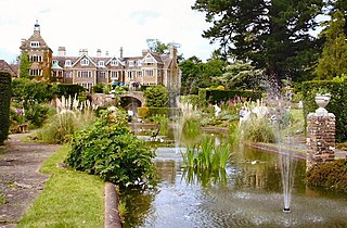
Mannings Heath is a village in the civil parish of Nuthurst and the Horsham District of West Sussex, England. The village is on the A281 road, 2 miles (3 km) south-east from the town of Horsham. Mannings Heath is the largest settlement in Nuthurst, and largely a dormitory for Horsham.

Hockley Heath is a large village and civil parish in the Arden area mostly within the Metropolitan Borough of Solihull, West Midlands, England, incorporating the hamlet of Nuthurst, with a history dating back to the year 705 AD as a wood owned by Worcester Cathedral. The parish, known as Nuthurst cum Hockley Heath, is to the south of the West Midlands conurbation, 12 miles (19 km) southeast of Birmingham 5.5 miles (8.9 km) from Solihull town centre and 12.5 miles (20.1 km) north of Stratford-upon-Avon. The village forms part of the border with Warwickshire and the District of Stratford-on-Avon to the south, with some parts of the village on either side of the border. According to the 2001 census, the parish had a population of 6,771, being measured at the 2011 Census as 2,038.

Buckland is a village and large civil parish about 4 miles (6.4 km) northeast of Faringdon in the Vale of White Horse District. Buckland was part of Berkshire until the 1974 boundary changes transferred it to Oxfordshire. The 2011 Census recorded the parish's population as 588. Outside the village the civil parish includes the small settlements of Carswell and Barcote to the west, Buckland Marsh to the north, and the modern development of Gainfield on the southern boundary.

Dinton is a village, civil parish and former manor in Wiltshire, England, in the Nadder valley on the B3089 road about 8 miles (13 km) west of Salisbury. The parish population was 696 at the 2011 census, estimated at 733 in 2019. The civil parish includes the village of Baverstock, about 1 mile (1.6 km) east of Dinton village.

Nuthurst is a village and civil parish in the Horsham district of West Sussex, England. The north of the parish borders Horsham town, with Nuthurst village 3 miles (5 km) south from the border. Within the parish is the estate and largely 19th-century country house of Sedgwick Park.

Bramshott is a village and parish with mediaeval origins in the East Hampshire district of Hampshire, England. It lies 0.9 miles (1.4 km) north of Liphook, and with Liphook forms the civil parish of Bramshott and Liphook.

Botolphs, formerly known as Annington, is a tiny village in the Horsham District of West Sussex, England. It is in the Adur Valley 1.5 miles (2.4 km) southeast of Steyning on the road between Steyning and Coombes. Botolphs lies on the South Downs Way long-distance footpath. At the 2011 Census the population of the village is included in the civil parish of Bramber.

Broadwater is a neighbourhood of Worthing, in the borough of Worthing in West Sussex, England. Situated between the South Downs and the English Channel, Broadwater was once a parish in its own right and included Worthing when the latter was a small fishing hamlet. Before its incorporation into the Borough of Worthing in 1902 Broadwater also included the manor of Offington to the north. It borders Tarring to the west, Sompting to the east, and East Worthing to the south-east.

Durrington is a neighbourhood of Worthing and former civil parish, now in the borough of Worthing in West Sussex, England. Historically in Sussex, in the rape of Bramber, it is situated near the A27 road, 2.3 miles (3.7 km) northwest of the town centre. Since 1992 it has been home to the community-led Durrington Festival.

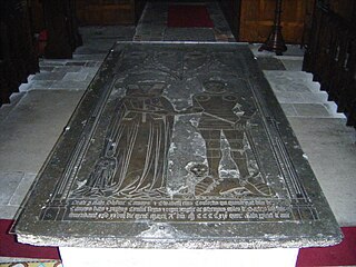
Thomas de Camoys, 1st Baron Camoys, KG, of Trotton in Sussex, was an English peer who commanded the left wing of the English army at the Battle of Agincourt in 1415.

St. Mary's Church, Broadwater, is a Church of England parish church in the Worthing Deanery of the Diocese of Chichester. It serves the ecclesiastical parish of Broadwater, West Sussex and is named after St. Mary. St Mary's is one of several sites in this benefice along with Queen Street and St. Stephen's.

Winsley is a large village and civil parish about 2 miles (3 km) west of Bradford on Avon in Wiltshire, England.

The Hundred of North Petherton is one of the 40 historical Hundreds in the ceremonial county of Somerset, England, dating from before the Norman conquest. Although the Hundreds have never been formally abolished, their functions ended with the establishment of county courts in 1867 and the introduction of districts by the Local Government Act 1894. The name of the hundred derives from the name of the large royal estate that covered much of the area in 1086, recorded variously as Nortpetret in the Domesday Book, Nortpedret in Liber Exoniensis and Nort Peretu in the associated tax returns. This, in turn, was derived from the area's location to the northern end of the River Parrett.

Chesworth House is a former Tudor manor house, located a mile south of Horsham, West Sussex, England.
George Kirwan Carr, who changed his surname to Carr Lloyd in 1855, was an English army officer and Sussex landowner.

The Worthing Downland Estate, Worthing Downs or Worthing Downland, is an area of land in the South Downs National Park in West Sussex, England, close to the town of Worthing. It was bought by the public, following threats to the beauty spot of Cissbury Ring and the surrounding farmland, which led to a public campaign purchases in the 1930s. It is currently owned and managed, on behalf of the public, by Worthing Borough Council.
Sir Arthur Hopton of Cockfield Hall in Yoxford, Suffolk was an English knight, landowner, magistrate, and Member of Parliament.
Sir William Gostwick, 4th Baronet was an English Whig politician who served as MP for Bedfordshire from 1698 to 1713.


