
Lipinki is a village in the administrative district of Gmina Biskupiec, within Nowe Miasto County, Warmian-Masurian Voivodeship, in northern Poland. It lies approximately 5 kilometres (3 mi) south-west of Biskupiec, 19 km (12 mi) west of Nowe Miasto Lubawskie, and 86 km (53 mi) south-west of the regional capital Olsztyn.

Piotrowice is a village in the administrative district of Gmina Biskupiec, within Nowe Miasto County, Warmian-Masurian Voivodeship, in northern Poland. It lies approximately 4 kilometres (2 mi) north of Biskupiec, 21 km (13 mi) north-west of Nowe Miasto Lubawskie, and 81 km (50 mi) west of the regional capital Olsztyn.
Podlasek is a village in the administrative district of Gmina Biskupiec, within Nowe Miasto County, Warmian-Masurian Voivodeship, in northern Poland. It lies approximately 6 kilometres (4 mi) west of Biskupiec, 24 km (15 mi) north-west of Nowe Miasto Lubawskie, and 87 km (54 mi) west of the regional capital Olsztyn.

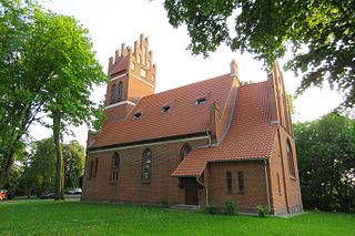
Zawada is a village in the administrative district of Gmina Biskupiec, within Nowe Miasto County, Warmian-Masurian Voivodeship, in northern Poland. It lies approximately 6 kilometres (4 mi) east of Biskupiec, 15 km (9 mi) north-west of Nowe Miasto Lubawskie, and 77 km (48 mi) south-west of the regional capital Olsztyn.
Montowo is a village in the administrative district of Gmina Grodziczno, within Nowe Miasto County, Warmian-Masurian Voivodeship, in northern Poland. It lies approximately 5 kilometres (3 mi) north of Grodziczno, 13 km (8 mi) east of Nowe Miasto Lubawskie, and 61 km (38 mi) south-west of the regional capital Olsztyn.
Zajączkowo is a village in the administrative district of Gmina Grodziczno, within Nowe Miasto County, Warmian-Masurian Voivodeship, in northern Poland. It lies approximately 7 kilometres (4 mi) north-west of Grodziczno, 8 km (5 mi) north-east of Nowe Miasto Lubawskie, and 66 km (41 mi) south-west of the regional capital Olsztyn.
Kamionka is a village in the administrative district of Gmina Kurzętnik, within Nowe Miasto County, Warmian-Masurian Voivodeship, in northern Poland. It lies approximately 5 kilometres (3 mi) north-west of Kurzętnik, 5 km (3 mi) west of Nowe Miasto Lubawskie, and 77 km (48 mi) south-west of the regional capital Olsztyn.

Krzemieniewo is a village in the administrative district of Gmina Kurzętnik, within Nowe Miasto County, Warmian-Masurian Voivodeship, in northern Poland. It lies approximately 5 kilometres (3 mi) north-east of Kurzętnik, 4 km (2 mi) east of Nowe Miasto Lubawskie, and 71 km (44 mi) south-west of the regional capital Olsztyn.
Marzęcice is a village in the administrative district of Gmina Kurzętnik, within Nowe Miasto County, Warmian-Masurian Voivodeship, in northern Poland. It lies approximately 5 kilometres (3 mi) north-west of Kurzętnik, 3 km (2 mi) north-west of Nowe Miasto Lubawskie, and 74 km (46 mi) south-west of the regional capital Olsztyn.

Mikołajki is a village in the administrative district of Gmina Kurzętnik, within Nowe Miasto County, Warmian-Masurian Voivodeship, in northern Poland. It lies approximately 7 kilometres (4 mi) north-west of Kurzętnik, 6 km (4 mi) north-west of Nowe Miasto Lubawskie, and 75 km (47 mi) south-west of the regional capital Olsztyn.
Nielbark is a village in the administrative district of Gmina Kurzętnik, within Nowe Miasto County, Warmian-Masurian Voivodeship, in northern Poland. It lies approximately 3 kilometres (2 mi) north of Kurzętnik, 2 km (1 mi) west of Nowe Miasto Lubawskie, and 74 km (46 mi) south-west of the regional capital Olsztyn.

Wawrowice is a village in the administrative district of Gmina Kurzętnik, within Nowe Miasto County, Warmian-Masurian Voivodeship, in northern Poland. It lies approximately 10 kilometres (6 mi) north-west of Kurzętnik, 9 km (6 mi) north-west of Nowe Miasto Lubawskie, and 78 km (48 mi) south-west of the regional capital Olsztyn.

Chrośle is a village in the administrative district of Gmina Nowe Miasto Lubawskie, within Nowe Miasto County, Warmian-Masurian Voivodeship, in northern Poland. It lies approximately 6 kilometres (4 mi) north of Nowe Miasto Lubawskie and 71 km (44 mi) south-west of the regional capital Olsztyn.
Gryźliny is a village in the administrative district of Gmina Nowe Miasto Lubawskie, within Nowe Miasto County, Warmian-Masurian Voivodeship, in northern Poland. It lies approximately 9 kilometres (6 mi) north-west of Mszanowo, 10 km (6 mi) north of Nowe Miasto Lubawskie, and 72 km (45 mi) south-west of the regional capital Olsztyn.
Lekarty is a village in the administrative district of Gmina Nowe Miasto Lubawskie, within Nowe Miasto County, Warmian-Masurian Voivodeship, in northern Poland. It lies approximately 9 kilometres (6 mi) north-west of Mszanowo, 10 km (6 mi) north-west of Nowe Miasto Lubawskie, and 74 km (46 mi) south-west of the regional capital Olsztyn.

Nawra is a village in the administrative district of Gmina Nowe Miasto Lubawskie, within Nowe Miasto County, Warmian-Masurian Voivodeship, in northern Poland. It lies approximately 3 kilometres (2 mi) north-west of Mszanowo, 4 km (2 mi) north of Nowe Miasto Lubawskie, and 72 km (45 mi) south-west of the regional capital Olsztyn.
Radomno is a village in the administrative district of Gmina Nowe Miasto Lubawskie, within Nowe Miasto County, Warmian-Masurian Voivodeship, in northern Poland. It lies approximately 12 kilometres (7 mi) north of Nowe Miasto Lubawskie and 69 km (43 mi) south-west of the regional capital Olsztyn.
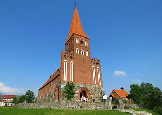
Skarlin is a village in the administrative district of Gmina Nowe Miasto Lubawskie, within Nowe Miasto County, Warmian-Masurian Voivodeship, in northern Poland. It lies approximately 10 kilometres (6 mi) north-west of Nowe Miasto Lubawskie and 77 km (48 mi) south-west of the regional capital Olsztyn.
Tylice is a village in the administrative district of Gmina Nowe Miasto Lubawskie, within Nowe Miasto County, Warmian-Masurian Voivodeship, in northern Poland. It lies approximately 5 kilometres (3 mi) east of Mszanowo, 6 km (4 mi) east of Nowe Miasto Lubawskie, and 68 km (42 mi) south-west of the regional capital Olsztyn.


