Szczyrzyc is a village in Poland, located in the Lesser Poland Voivodeship, Limanowa County, Jodłownik Commune. Geographically it is located in the Beskid Wyspowy, in the Stradomka river valley. It lies approximately 4 kilometres (2 mi) west of Jodłownik, 20 km (12 mi) north-west of Limanowa, and 36 km (22 mi) south-east of the regional capital Kraków.
Gmina Dobra is a rural gmina in Limanowa County, Lesser Poland Voivodeship, in southern Poland. Its seat is the village of Dobra, which lies approximately 13 kilometres (8 mi) west of Limanowa and 45 km (28 mi) south-east of the regional capital Kraków.
Gmina Tymbark is a rural gmina in Limanowa County, Lesser Poland Voivodeship, in southern Poland. Its seat is the village of Tymbark, which lies approximately 8 kilometres (5 mi) north-west of Limanowa and 47 km (29 mi) south-east of the regional capital Kraków.

Wielki Potok is a village in the administrative district of Gmina Biecz, within Gorlice County, Lesser Poland Voivodeship, in southern Poland. It lies approximately 6 kilometres (4 mi) north-west of Biecz, 14 km (9 mi) north of Gorlice, and 98 km (61 mi) east of the regional capital Kraków.

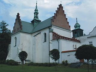
Góra Świętego Jana is a village in the administrative district of Gmina Jodłownik, within Limanowa County, Lesser Poland Voivodeship, in southern Poland.
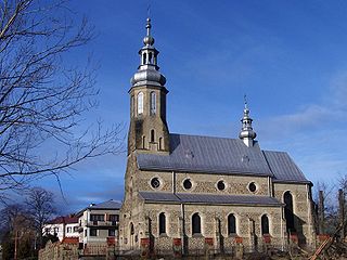
Jodłownik is a village in Limanowa County, Lesser Poland Voivodeship, in southern Poland. It is the seat of the gmina called Gmina Jodłownik. It lies approximately 17 kilometres (11 mi) north-west of Limanowa and 39 km (24 mi) south-east of the regional capital Kraków.
Kostrza is a village in the administrative district of Gmina Jodłownik, within Limanowa County, Lesser Poland Voivodeship, in southern Poland. It lies approximately 3 kilometres (2 mi) east of Jodłownik, 14 km (9 mi) north-west of Limanowa, and 40 km (25 mi) south-east of the regional capital Kraków.
Krasne-Lasocice is a village in the administrative district of Gmina Jodłownik, within Limanowa County, Lesser Poland Voivodeship, in southern Poland. It lies approximately 5 kilometres (3 mi) north of Jodłownik, 19 km (12 mi) north-west of Limanowa, and 35 km (22 mi) south-east of the regional capital Kraków.
Mstów is a village in the administrative district of Gmina Jodłownik, within Limanowa County, Lesser Poland Voivodeship, in southern Poland. It lies approximately 3 kilometres (2 mi) north of Jodłownik, 17 km (11 mi) north-west of Limanowa, and 37 km (23 mi) south-east of the regional capital Kraków.
Pogorzany is a village in the administrative district of Gmina Jodłownik, within Limanowa County, Lesser Poland Voivodeship, in southern Poland. It lies approximately 5 kilometres (3 mi) west of Jodłownik, 21 km (13 mi) north-west of Limanowa, and 36 km (22 mi) south-east of the regional capital Kraków.
Sadek is a village in the administrative district of Gmina Jodłownik, within Limanowa County, Lesser Poland Voivodeship, in southern Poland. It lies approximately 4 kilometres (2 mi) north-east of Jodłownik, 16 km (10 mi) north-west of Limanowa, and 38 km (24 mi) south-east of the regional capital Kraków.
Słupia is a village in the administrative district of Gmina Jodłownik, within Limanowa County, Lesser Poland Voivodeship, in southern Poland. It lies approximately 5 kilometres (3 mi) north-east of Jodłownik, 18 km (11 mi) north-west of Limanowa, and 36 km (22 mi) south-east of the regional capital Kraków.

Szyk is a village in the administrative district of Gmina Jodłownik, within Limanowa County, Lesser Poland Voivodeship, in southern Poland. It lies approximately 7 kilometres (4 mi) north-east of Jodłownik, 14 km (9 mi) north-west of Limanowa, and 40 km (25 mi) south-east of the regional capital Kraków.
Wilkowisko, Limanowa is a village in the administrative district of Gmina Jodłownik, within Limanowa County, Lesser Poland Voivodeship, in southern Poland. It lies approximately 3 kilometres (2 mi) south-east of Jodłownik, 14 km (9 mi) north-west of Limanowa, and 41 km (25 mi) south-east of the regional capital Kraków.
Bałażówka is a village in the administrative district of Gmina Limanowa, within Limanowa County, Lesser Poland Voivodeship, in southern Poland. It lies approximately 8 kilometres (5 mi) north-west of Limanowa and 46 km (29 mi) south-east of the regional capital Kraków.
Kisielówka is a village in the administrative district of Gmina Limanowa, within Limanowa County, Lesser Poland Voivodeship, in southern Poland. It lies approximately 9 kilometres (6 mi) north-west of Limanowa and 45 km (28 mi) south-east of the regional capital Kraków.
Koszary is a village in the administrative district of Gmina Limanowa, within Limanowa County, Lesser Poland Voivodeship, in southern Poland. It lies approximately 7 kilometres (4 mi) north-west of Limanowa and 48 km (30 mi) south-east of the regional capital Kraków.
Rupniów is a village in the administrative district of Gmina Limanowa, within Limanowa County, Lesser Poland Voivodeship, in southern Poland. It lies approximately 13 kilometres (8 mi) north-west of Limanowa and 42 km (26 mi) south-east of the regional capital Kraków.
Walowa Góra is a village in the administrative district of Gmina Limanowa, within Limanowa County, Lesser Poland Voivodeship, in southern Poland. It lies approximately 7 kilometres (4 mi) north-west of Limanowa and 47 km (29 mi) south-east of the regional capital Kraków.


