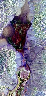
Remote sensing is the acquisition of information about an object or phenomenon without making physical contact with the object and thus in contrast to on-site observation, especially the Earth. Remote sensing is used in numerous fields, including geography, land surveying and most Earth science disciplines ; it also has military, intelligence, commercial, economic, planning, and humanitarian applications.

Photogrammetry is the science and technology of obtaining reliable information about physical objects and the environment through the process of recording, measuring and interpreting photographic images and patterns of electromagnetic radiant imagery and other phenomena.
Geoinformatics is the science and the technology which develops and uses information science infrastructure to address the problems of geography, cartography, geosciences and related branches of science and engineering.

Willem "Wim" Schermerhorn was a Dutch politician of the defunct Free-thinking Democratic League (VDB) and later co-founder of the Labour Party (PvdA). He served as Prime Minister of the Netherlands from 25 June 1945 until 3 July 1946. According to Harry W. Laidler, the government under Schermerhorn's premiership "achieved important results in the fields of labor, finance, housing, old age pensions, and the social services."
The Indian Institute of Remote Sensing is a premier institute for research, higher education and training in the field of Remote Sensing, Geoinformatics and GPS Technology for Natural Resources, Environmental and Disaster Management under the Indian Department of Space, which was established in the year 1966. It is located in the city of Dehradun, Uttarakhand.
The American Society for Photogrammetry and Remote Sensing (ASPRS) is an American learned society devoted to photogrammetry and remote sensing. It is the United States' member organization of the International Society for Photogrammetry and Remote Sensing. Founded in 1934 as American Society of Photogrammetry and renamed in 1985, the ASPRS is a scientific association serving over 7,000 professional members around the world. As a professional body with oversight of specialists in the arts of imagery exploitation and photographic cartography. Its official journal is Photogrammetric Engineering & Remote Sensing (PE&RS), known as Photogrammetric Engineering between 1937 and 1975.
Integrated Land and Water Information System (ILWIS) is a geographic information system (GIS) and remote sensing software for both vector and raster processing. Its features include digitizing, editing, analysis and display of data, and production of quality maps. ILWIS was initially developed and distributed by ITC Enschede in the Netherlands for use by its researchers and students. Since 1 July 2007, it has been released as free software under the terms of the GNU General Public License. Having been used by many students, teachers and researchers for more than two decades, ILWIS is one of the most user-friendly integrated vector and raster software programmes currently available. ILWIS has some very powerful raster analysis modules, a high-precision and flexible vector and point digitizing module, a variety of very practical tools, as well as a great variety of user guides and training modules all available for downloading. The current version is ILWIS 3.8.6. Similar to the GRASS GIS in many respects, ILWIS is currently available natively only on Microsoft Windows. However, a Linux Wine manual has been released.
The International Society for Photogrammetry and Remote Sensing (ISPRS) is an international non-governmental organization that enhances international cooperation between the worldwide organizations with interests in the photogrammetry, remote sensing and spatial information sciences. Originally named International Society for Photogrammetry (ISP), it was established in 1910, and is the oldest international umbrella organization in its field, which may be summarized as addressing “information from imagery”.
Maged N. Kamel Boulos is a British health informatician, scientist and Professor of Digital Health Systems currently based at Sun Yat-sen University, Guangzhou, China, having worked before that at the Alexander Graham Bell Centre of Digital Health, University of the Highlands and Islands, at the University of Plymouth, at the University of Bath and at City University London. He is particularly known for his research into Geographic Information Systems (GIS) applications in health and healthcare, which received wide news media coverage. He is credited with coining the phrases 'online consumer geoinformatics services' and 'wikification of GIS by the masses' in 2005, when neogeography and virtual globes were still very new.

George Joseph is an Indian space scientist, best known for his contributions to the development of remote sensing technology in India, especially in the field of earth observation sensors. He is a former chairman of the Lunar Mission Study Task Force of the Indian Space Research Organization and an elected fellow of the National Academy of Sciences, India, Indian Academy of Sciences and Indian National Academy of Engineering. The Government of India awarded him the Padma Bhushan, the third highest civilian award, in 1999.
Prof. em. Dr. Armin Gruen is, since 1984, professor and head of the Chair of photogrammetry at the Institute of Geodesy and Photogrammetry (IGP), Federal Institute of Technology (ETH) Zurich, Switzerland. Since 1 August 2009, he is retired and is now with the Chair of Information Architecture, ETH Zurich Faculty of Architecture. He is currently acting as a principal investigator on the Simulation Platform of the SEC-FCL in Singapore.

The Institute of Geomatics (IG) was a public consortium made up of the Autonomous Government of Catalonia and the Polytechnic University of Catalonia, created by Decree Law 256/1997 of the Autonomous Government of Catalonia, on September 30, 1997. It was a founding member of the Associació Catalana d'Entitats de Recerca (ACER).
The ISPRS Journal of Photogrammetry and Remote Sensing is the official journal of International Society for Photogrammetry and Remote Sensing (ISPRS), publishes scientific and technical articles and reviews in photogrammetry, remote sensing, and related fields. It is published by Elsevier and is edited by Derek Lichti and Qihao Weng. The journal was originally established as Internationales Archiv für Photogrammetrie in 1908, changing its name to Photogrammetria in 1938, and taking its current name in 1989.
The United Nations Committee of Experts on Global Geospatial Information Management (UN-GGIM) is an initiative of the United Nations to foster the global development geospatial information.

Pix4D is a Swiss company which started in 2011 as a spinoff of the École Polytechnique Fédérale de Lausanne (EPFL) Computer Vision Lab in Switzerland. It develops a suite of software products that use photogrammetry and computer vision algorithms to transform DSLR, fisheye, RGB, thermal and multispectral images into 3D maps and 3D modeling.
The International Journal of Remote Sensing is a semimonthly peer-reviewed scientific journal covering research on remote sensing. It was established in 1980 and is published by Taylor & Francis on behalf of the Remote Sensing and Photogrammetry Society, of which it is the official journal. The journal Remote Sensing Reviews, which was established in 1983, was incorporated into the International Journal of Remote Sensing in 2001. The editors-in-chief are Timothy A. Warner and Arthur P. Cracknell. According to the Journal Citation Reports, the journal has a 2019 impact factor of 2.976.
The LAS (LASer) format is a file format designed for the interchange and archiving of lidar point cloud data. It is an open, binary format specified by the American Society for Photogrammetry and Remote Sensing (ASPRS). The format is widely used and regarded as an industry standard for lidar data.
The Remote Sensing and Photogrammetry Society (RSPSoc) is a British learned society devoted to photogrammetry and remote sensing. It is the UK's adhering body of the International Society for Photogrammetry and Remote Sensing.
The Journal of Photogrammetry, Remote Sensing and Geoinformation Science is an academic journal published by Springer on behalf of the Deutsche Gesellschaft für Photogrammetrie, Fernerkundung und Geoinformation about photogrammetry, remote sensing, and geoinformation science. Its editor-in-chief is Wolfgang Kresse; its 2018 impact factor is 1.259.
The Indian Society of Remote Sensing (ISRS) is an Indian learned society devoted to remote sensing; it was created in 1969 and has more than 5000 members. It is a national member of the International Society for Photogrammetry and Remote Sensing. ISRS publishes the Journal of the Indian Society of Remote Sensing.