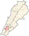
Ain Ebel is a Lebanese village in the Nabatieh/Nabatiye Governorate, about 90 kilometers south of Beirut. Its inhabitants are predominantly Christian.

Southern Lebanon is the area of Lebanon comprising the South Governorate and the Nabatiye Governorate. The two entities were divided from the same province in the early 1990s. The Rashaya and Western Beqaa districts, the southernmost districts of the Beqaa Governorate.
Ain al-Hilweh, also spelled as Ayn al-Hilweh and Ein al-Hilweh, is the largest Palestinian refugee camp in Lebanon. It had a population of over 70,000 Palestinian refugees but swelled to nearly 120,000, as a result of influx of refugees from Syria since 2011. The camp is located west of the village Miye ou Miye and the Mieh Mieh refugee camp, southeast of the port city of Sidon and north of Darb Es Sim.
Arnoun is a majority Lebanese Shia village 7 kilometres (4.3 mi) south-east of Nabatiyeh, in Nabatiyeh Governorate, southern Lebanon. The village is located approximately 8 kilometres (5.0 mi) from the Israeli border. The village is approximately 550 metres above sea level, and approximately one kilometre from the Beaufort Castle.
Yaroun is a Lebanese village located in the Caza of Bint Jbeil in the Nabatieh Governorate in Lebanon.

The Nabatieh District is a district in the Nabatieh Governorate of Lebanon. The capital of the district is Nabatieh.
Kfar Fila, is a town in the Nabatieh Governorate, al-Nabatiya, or Nabatiye southern Lebanon. It is one of the 243 towns of Nabatieh Governorate, situated at the northern region of this district, at the other side of Al-Kateh(The cutter); a shallow but wide valley, separating a group of 32 towns from the Sidon District.

Jbaa, is a town in Lebanon located about 22 km from Sidon and 64 km from Beirut. It is part of the Nabatieh Governorate. Jbaa is situated on the great Safi Mountain, and rises over 770 metres (2,530 ft) from the sea level and then begins to rise to 900 metres (3,000 ft) in the district of "Ein-Elsataoun". The village covers over 3,000 acres (12 km2). Surrounding the village is gorgeous greenery including diverse trees, especially walnut trees that spread around most of the town houses.
Ansar is a village in the Nabatieh Governorate region of southern Lebanon located between Nabatieh and Tyre, Lebanon, next to the village of Doueir. It has a population of 31,970.
Al-Wazzani, is a small Lebanese village in the Marjeyoun District of the Nabatieh Governorate, on the banks of the Hasbani River. The village is located about 1 km from the Wazzani Spring, a major source of the Hasbani, which is a tributary of the Jordan River. The village has about 200 residents.
Kfar Dunin is a village in Lebanon, 102 km from the capital Beirut and 580 m from sea coast remote. Adjacent villages: Deir Kifa, Alkaline, Khirbat Silm, Der Ntar. It is considered first of villages in Bent Jbeil district of Nabatieh Governorate. Its population is 6000 people.
Kfar Tebnit or Kfar Tibnit is a village located approximately 4 kilometres (2.5 mi) south southeast of Nabatieh, 37 kilometres (23 mi) southeast of Sidon in Lebanon.
Jebchit is a village in the Nabatieh Governorate region of southern Lebanon located north of the Litani River.
Charkiyeh is a village in the Nabatieh Governorate region of southern Lebanon, located just north of Doueir.

Nabatieh, or Nabatîyé, is the city of the Nabatieh Governorate, in southern Lebanon. The population is not accurately known as by as no census has been taken in Lebanon since the 1930s; estimates range from 15,000 to 120,000. A 2006 population estimate by the now-closed German population site called World Gazetteer put the population at 100,541, which would make it the fifth largest city in Lebanon, according to the 2006 population estimates of Lebanese cities, but after an update in either 2007 or 2008 and calculations for the following years the 2013 population estimate turned out to be much lower at 36,593 and making the city the 11th largest in Lebanon behind Tyre, Bint Jbeil, Zahlé, Sidon, Baalbek, Jounieh, Tripoli and Beirut according to those 2013 estimates. It is the main city in the Jabal Amel area and the chief center for both the mohafazat, or governorate, and the kaza, or canton both also called Nabatieh. Nabatieh is an important town both economically and culturally.

Baraachit, also spelt Brashit, is a rural town located in the Nabatiye Governorate, in the Bint Jbeil District of southern Lebanon, ca. 3.5 kilometres (2.2 mi) southeast of Tibnine and about 80 kilometres (50 mi) from Beirut. The village sits on an elevation of 832 metres (2,730 ft) above sea level. The town has a mixed population of Shi'a and Christians.
Mayfadoun is a village in Nabatieh District in southern Lebanon.
Kfar Remen is a city in the Nabatieh Governorate region of southern Lebanon; located north east of Nabatieh.
Sir el Gharbieh is a village just north of the Litani River, in the Nabatieh District in southern Lebanon.
Nabatieh Fawka, also known as Upper Nabatieh is a Lebanese village in the Nabatieh Governorate.


