Nabatieh | |
|---|---|
District | |
 Nabatieh District | |
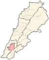
 Location in Lebanon | |
| Country | |
| Governorate | Nabatieh Governorate |
| Capital | Nabatieh |
| Area | |
• Total | 117 sq mi (304 km2) |
| Population | |
• Estimate (31 December 2017) | 155,233 |
| Time zone | UTC+2 (EET) |
| • Summer (DST) | UTC+3 (EEST) |
The Nabatieh District is a district in the Nabatieh Governorate of Lebanon. The capital of the district is Nabatieh.