Marjayoun District | |
---|---|
District | |
Coordinates: 33°21′43″N35°35′23″E / 33.36194°N 35.58972°E | |
Country | Lebanon |
Governorate | Nabatiyeh Governorate |
Capital | Marjayoun |
Area | |
• Total | 102.4 sq mi (265.3 km2) |
Elevation | 2,820 ft (860 m) |
Population | |
• Estimate (31 December 2017) | 85,960 |
Time zone | UTC+2 (EET) |
• Summer (DST) | UTC+3 (EEST) |
The Marjayoun District is a district in the Nabatieh Governorate of Lebanon. The capital of the district is Marjayoun.
Marjayoun stands at a hill facing Mount Hermon to the East, with Beaufort Castle. The Litani River and Mount Amel are to the West, The Rihan, Niha and the Lebanon Mountain Range to the North and the fertile plains of Sahil Marjayoun that extends into Northern Israel between the Galilee finger and plains immediately underneath the Golan Heights.
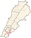
The following 32 municipalities are all located in the Marjayoun District:
According to registered voters in 2014:
Year | Christians | Muslims | Druze | |||||||
---|---|---|---|---|---|---|---|---|---|---|
Total | Greek Orthodox | Maronites | Greek Catholics | Other Christians | Total | Shias | Sunnis | Alawites | Druze | |
2014 [2] |
The nine governorates of Lebanon are subdivided into 25 districts. Beirut Governorate is not subdivided into districts, and Akkar Governorate comprises a single district.
Blat or BLAT may refer to:
Deir al-Qamar is a city south-east of Beirut in south-central Lebanon. It is located five kilometres outside of Beit ed-Dine in the Chouf District of the Mount Lebanon Governorate at 800 m of average altitude.
Beit ed-Dine, also known as Btaddine is a small town and the administrative capital of the Chouf District in the Mount Lebanon Governorate in Lebanon. The town is located 45 kilometers southeast of Beirut, and near the town of Deir el-Qamar from which it is separated by a steep valley. It had 1,613 registered voters in 2010 and its inhabitants are predominantly Christians from the Maronite, Melkite and Greek Orthodox denominations. Beit ed-Dine's total land area consists of 244 hectares and its average elevation is 860 meters above sea level.
Southern Lebanon is the area of Lebanon comprising the South Governorate and the Nabatiye Governorate. The two entities were divided from the same province in the early 1990s. The Rashaya and Western Beqaa districts, the southernmost districts of the Beqaa Governorate.
Nabatieh Governorate is one of the nine governorates of Lebanon. The area of this governorate is 1,058 km2. The capital is Nabatieh.
Ras el-Matn or or is a Lebanese town and municipality in the Baabda District of Mount Lebanon Governorate stretching over 1300 hectares. The town has a population of nearly 11,000 inhabitants who are Druze.
Marjayoun or Jdeidet Marjayoun, also Marj 'Ayoun, Marjuyun or Marjeyoun which reflects the area's lush landscape and abundant water resources and Jdeideh / Jdeida / Jdeidet Marjeyoun, is a Lebanese town and an administrative district, the Marjeyoun District, in the Nabatieh Governorate in Southern Lebanon.
Kfarshima, also spelled Kfarchima, is a town in the Baabda District of the Mount Lebanon Governorate, southeast of Beirut and is part of Greater Beirut. The town is populated by Lebanese Christians: mainly Melkite Greek Catholic and Maronites, with smaller communities of Greek Orthodox and Protestant Evangelical Christians. Kfarshima was subject to heavy bombing during the Lebanese civil war since it was a primary fault line.
Deir El Ahmar is a Lebanese town, located 100km from Beirut and 22km northwest of Baalbek in the Bekaa Valley in Lebanon.
Deir Mimas is a town 88 km south of Beirut in Lebanon. Named in honor of Saint Mamas, the town overlooks the Litani River and the medieval Beaufort Castle to the west and the snow-capped summits of Mount Hermon to the east. It has a population of around 4,600 people.
The 1860 civil conflict in Mount Lebanon and Damascus, also known as the 1860 Syrian Civil War and the 1860 Christian–Druze war, was a civil conflict in Mount Lebanon during Ottoman rule in 1860–1861 fought mainly between the local Druze and Christians. Following decisive Druze victories and massacres against the Christians, the conflict spilled over into other parts of Ottoman Syria, particularly Damascus, where thousands of Christian residents were killed by Druze militiamen. The fighting precipitated a French-led international military intervention.
Karak is a village in the municipality of Zahlé in the Zahle District of the Beqaa Governorate in eastern Lebanon. It is located on the Baalbek road close to Zahle. Karak contains a sarcophagus claimed by the locals to be the tomb of Noah. The inhabitants of Karak are Melkites, Maronites and Shia Muslims.
Lebanese Greek Orthodox Christians refers to Lebanese people who are adherents of the Greek Orthodox Church of Antioch in Lebanon, which is an autocephalous Greek Orthodox Church within the wider communion of Eastern Orthodox Christianity, and is the second-largest Christian denomination in Lebanon after the Maronite Christians.
House of Stone: A Memoir of Home, Family, and a Lost Middle East is a 2012 book by Anthony Shadid, a former New York Times journalist.
Bakka, Bekka or Beka is a village and municipality situated 85 kilometres (53 mi) east of Beirut in the Rashaya District of the Beqaa Governorate in Lebanon. The population of the village is Sunni.
Tartej is a village in the Byblos District of the Keserwan-Jbeil Governorate, Lebanon. Its average elevation is 1,100 meters. Qornet Ain el-Deb is the highest peak in the mountain (1,859 meters), peak Ain al-Marbout (1,774 meters), Jouret al-Maktoul (1,715 meters), Jouret al-Touti (1,480 meters) and al-Wata (1,088 meters).
Jdeideh may refer to the following places:
Deir Siryan or Deir Seryan is a village in the Marjayoun District in Southern Lebanon.