Related Research Articles

Magnetic Island is an island 8 kilometres (5 mi) offshore from the city of Townsville, Queensland, Australia. This 52 km2 (20.1 sq mi) mountainous island in Cleveland Bay has effectively become a suburb of Townsville, with 2,335 permanent residents. The island is accessible from Townsville Breakwater to Nelly Bay Harbour by ferry. There is a large 39.5 km2 (15.3 sq mi) National Park and bird sanctuary and walking tracks can be taken between the populated bays and to a number of tourist destinations such as the World War II forts.

Coolangatta is a coastal suburb in the City of Gold Coast, Queensland, Australia. It is the Gold Coast's southernmost suburb and it borders New South Wales. In the 2016 census, Coolangatta had a population of 5,948 people.
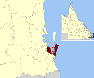
Redland City, better known as the Redlands and formerly known as Redland Shire, is a local government area and a part of the Brisbane metropolitan area in South East Queensland, Australia. With a population of 159,222 in June 2021, the city is spread along the southern coast of Moreton Bay, covering 537.2 square kilometres (207.4 sq mi). Its mainland borders the City of Brisbane to the west and north-west, and Logan City to the south-west and south, while its islands are situated north of the City of Gold Coast.

Broadbeach is a suburb in the City of Gold Coast, Queensland, Australia. In the 2021 census, Broadbeach had a population of 6,786 people.

Burleigh Heads is a suburb in the City of Gold Coast, Queensland, Australia. In the 2016 census, Burleigh Heads had a population of 10,077 people.

Mudgeeraba is a town and suburb in the City of Gold Coast, Queensland, Australia. In the 2021 census, the suburb of Mudgeeraba had a population of 14,578 people. Mudgeeraba's essential character remains one of a nineteenth-century village.

Nerang is a town and suburb in the City of Gold Coast, Queensland, Australia. In the 2016 census, Nerang had a population of 16,864 people.

Moorooka is a southern suburb in the City of Brisbane, Queensland, Australia. In the 2021 census, Moorooka had a population of 10,783 people.

Musgrave Park is a park in South Brisbane, Queensland, Australia. The park is bordered by Edmonstone, Russell, and Cordelia Streets, and Brisbane State High School, and has an area of 63,225 square metres (680,550 sq ft). The park is of cultural significance to Aboriginal Australians.
Miami is a coastal suburb in the City of Gold Coast, Queensland, Australia. At the 2021 census, Miami had a population of 7,445 people.

Gold Coast Hospital, located at 98–136 Nerang Street, Southport was, from 1960 to 2013 a major teaching and referral hospital and the third largest in Queensland. The Gold Coast Hospital had one of the busiest emergency departments in the state. The Hospital admitted over 60,000 patients annually. It was replaced by the Gold Coast University Hospital.

The history of the Gold Coast in Queensland, Australia began in prehistoric times with archaeological evidence revealing occupation of the district by indigenous Australians for at least 23,000 years. The first early European colonizers began arriving in the late 1700s, settlement soon followed throughout the 19th century, and by 1959 the town was proclaimed a city. Today, the Gold Coast is one of the fastest-growing cities in Australia.

Woodford is a rural town and locality in the City of Moreton Bay, Queensland, Australia. In the 2016 census, the locality of Woodford had a population of 3,458 people.

Beerburrum is a small town and coastal locality in the Sunshine Coast Region, Queensland, Australia. In the 2016 census, Beerburrum had a population of 763 people.

Tallebudgera is a suburb in the City of Gold Coast, Queensland, Australia. In the 2021 census, Tallebudgera had a population of 3,826 people.
Alberton is a rural locality in the City of Gold Coast, Queensland, Australia. In the 2021 census, Alberton had a population of 547 people.

The Yugambeh ( YOO-gum-BERR, also known as the Minyangbal ( MI-nyung-BUHL, or Nganduwal ( NGAHN-doo-WUL. are an Aboriginal Australian people of south-east Queensland and the Northern Rivers of New South Wales, their territory lies between the Logan and Tweed rivers. A term for an Aboriginal of the Yugambeh tribe is Mibunn, which is derived from the word for the Wedge-tailed Eagle. Historically, some anthropologists have erroneously referred to them as the Chepara, the term for a first-degree initiate. Archaeological evidence indicates Aboriginal people have occupied the area for tens of thousands of years. By the time European colonisation began, the Yugambeh had a complex network of groups, and kinship. The Yugambeh territory is subdivided among clan groups with each occupying a designated locality, each clan having certain rights and responsibilities in relation to their respective areas.

Shaun Davies is an Aboriginal Australian language activist, linguist, radio personality, and actor. He is known for his advocacy work with the Yugambeh language and culture, as well as appearances in various media.

Patricia O'Connor is an Australian Aboriginal elder of the Yugambeh people. She is known for her work in reviving the Yugambeh language and opening the Yugambeh Museum. In 2014 she received the NAIDOC Award for Female Elder of the Year, and in 2019 she was named a Queensland Great.

William Robert Black (1859-1930) was an Australia mine-owner and philanthropist. He donated to establish many Presbyterian churches and supported schools, orphanages and other charitable institutions in Queensland.
References
- ↑ Google (26 March 2024). "Jebribillum Bora Park" (Map). Google Maps . Google. Retrieved 26 March 2024.
- ↑ "Aboriginal Bora Grounds". First People Then and Now. Retrieved 2 July 2017.
- ↑ Hundloe, Tor; McDougall, Bridgette; Page, Craig (2015). The Gold Coast Transformed: From Wilderness to Urban Ecosystem. CSIRO.
- ↑ "Bora Memorial Rock" (PDF). Gold Coast Local Heritage Register. City of Gold Coast. Retrieved 2 July 2017.
- ↑ Ysola Best, 'An Uneasy coexistence: An Aboriginal perspective of contact history in southeast Queensland,' Aboriginal History - Volume 18, Issues 1-2, pp.87-94 pp-93-94.
- ↑ "AN OLD BORA GROUND". The Brisbane Courier . No. 17, 366. Queensland, Australia. 10 September 1913. p. 9. Retrieved 3 July 2017– via National Library of Australia.
- ↑ "A Bora Ground". The Brisbane Courier . No. 17, 494. Queensland, Australia. 7 February 1914. p. 16. Retrieved 3 July 2017– via National Library of Australia.
- ↑ "Bora Ground near Burleigh Heads". The Brisbane Courier . No. 17, 397. Queensland, Australia. 16 October 1913. p. 6. Retrieved 3 July 2017– via National Library of Australia.
- ↑ "Burleigh Heads Heritage and Character Study November 2010" (PDF). City of Gold Coast. Archived from the original (PDF) on 5 March 2016. Retrieved 2 July 2017.
- ↑ "BURLEIGH HEWS". South Coast Bulletin . No. 1625. Queensland, Australia. 14 April 1954. p. 3. Retrieved 3 July 2017– via National Library of Australia.
- ↑ "BURLEIGH BORA GROUND". South Coast Bulletin . No. 1642. Queensland, Australia. 11 August 1954. p. 1. Retrieved 3 July 2017– via National Library of Australia.
- ↑ "BURLEIGH BORA GROUND". South Coast Bulletin . No. 1629. Queensland, Australia. 12 May 1954. p. 19. Retrieved 3 July 2017– via National Library of Australia.
- ↑ "BURLEIGH BORA RING". South Coast Bulletin . No. 1639. Queensland, Australia. 21 July 1954. p. 25. Retrieved 3 July 2017– via National Library of Australia.
- ↑ "From cities and towns". The Courier-mail . Queensland, Australia. 11 September 1954. p. 10. Retrieved 3 July 2017– via National Library of Australia.
- ↑ "Bora Rings on Gold Coast and Tweed Preserved for All Time" (PDF). Dawn: A magazine for the Aboriginal People of N.S.W. 11 (8): 10. August 1962. Retrieved 3 July 2017.
- ↑ "Bora Memorial Rock" (PDF). Gold Coast Local Heritage Register. City of Gold Coast. Retrieved 2 July 2017.
- ↑ Marshall, Candice. "Stone memorial for Indigenous 'diggers'". Australian Broadcasting Commission. Retrieved 2 July 2017.
- ↑ "Burleigh Heads Aboriginal War Memorial". Queensland War Memorials. Retrieved 2 July 2017.
- ↑ "List of Public Funded Aboriginal and Torres Strait Islander Memorials". AIATSIS. Archived from the original on 5 February 2017. Retrieved 2 July 2017.