Jericho, Washington

Last updated

Jericho is an extinct town in Grant County, in the U.S. state of Washington. The GNIS classifies it as a populated place. [1]

Grant County, Washington County in the United States

Grant County is a county located in the U.S. state of Washington. As of the 2010 census, the population was 89,120. The county seat is Ephrata, and the largest city is Moses Lake. The county was formed out of Douglas County in February 1909 and is named for U.S. President Ulysses S. Grant.

U.S. state constituent political entity of the United States

In the United States, a state is a constituent political entity, of which there are currently 50. Bound together in a political union, each state holds governmental jurisdiction over a separate and defined geographic territory and shares its sovereignty with the federal government. Due to this shared sovereignty, Americans are citizens both of the federal republic and of the state in which they reside. State citizenship and residency are flexible, and no government approval is required to move between states, except for persons restricted by certain types of court orders. Four states use the term commonwealth rather than state in their full official names.
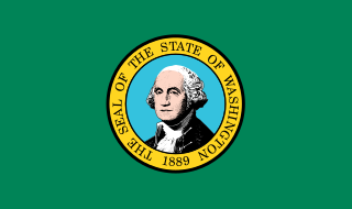
Washington (state) State of the United States of America

Washington, officially the State of Washington, is a state in the Pacific Northwest region of the United States. Named for George Washington, the first president of the United States, the state was made out of the western part of the Washington Territory, which was ceded by Britain in 1846 in accordance with the Oregon Treaty in the settlement of the Oregon boundary dispute. It was admitted to the Union as the 42nd state in 1889. Olympia is the state capital; the state's largest city is Seattle. Washington is sometimes referred to as Washington State, to distinguish it from Washington, D.C., the capital of the United States, which is often shortened to Washington.

The community was named after the ancient city of Jericho. [2]

Jericho City in Jericho

Jericho is a city in the Palestinian Territories and is located near the Jordan River in the West Bank. It is the administrative seat of the Jericho Governorate, and is governed by the Fatah faction of the Palestinian National Authority. In 2007, it had a population of 18,346. The city was occupied by Jordan from 1949 to 1967, and has been held under Israeli occupation since 1967; administrative control was handed over to the Palestinian Authority in 1994. It is believed to be one of the oldest inhabited cities in the world and the city with the oldest known protective wall in the world. It was thought to have the oldest stone tower in the world as well, but excavations at Tell Qaramel in Syria have discovered stone towers that are even older.

Related Research Articles

Mill Brook is a 10.7-mile-long (17.2 km) stream located in the White Mountains of New Hampshire in the United States. It is a tributary of the southern Swift River, part of the Bearcamp River / Ossipee Lake / Saco River watershed leading to the Atlantic Ocean.

Howard, Colorado Census-designated place in Colorado, United States

Howard is a census-designated place and a U.S. post office in Fremont County, Colorado, United States. The population as of the 2010 census was 723. The Howard Post Office has the ZIP code 81233.

Clint, California Unincorporated community in California, United States

Clint is an unincorporated community in Fresno County, California. It is located on the Atchison, Topeka and Santa Fe Railroad 5 miles (8 km) east of Riverdale, at an elevation of 236 feet.

Elm View, California Unincorporated community in California, United States

Elm View is an unincorporated community in Fresno County, California. It is located 15 miles (24 km) south of downtown Fresno, at an elevation of 256 feet.

Gordon, California Unincorporated community in California, United States

Gordon is an unincorporated community in Fresno County, California. It is located on the Southern Pacific Railroad 5.25 miles (8 km) north-northwest of Clovis, at an elevation of 394 feet.

Lerona, California Unincorporated community in California, United States

Lerona is an unincorporated community in Fresno County, California. It is located 6.5 miles (10 km) west-northwest of Shaver Lake Heights, at an elevation of 2789 feet.

Eldon Knolls is an unincorporated community in Pittsylvania County, in the U.S. state of Virginia.

Bates Island is a forested and uninhabited island located in Lake Chaubunagungamaug in Webster, Massachusetts.

Pawnee Station, Kansas Unincorporated community in Kansas, United States

Pawnee Station is an unincorporated community in Bourbon County, Kansas, United States.

The Frenchman Hills are hills in Grant County, Washington, United States of America. The high point is 1,640 feet (500 m). They are an anticlinal fold in the northeastern part of the larger Yakima Fold Belt.

Corfu is an unincorporated community in Grant County, in the U.S. state of Washington.

Newark is an unincorporated community in Marshall County, in the U.S. state of South Dakota.

Indiana Beach, Indiana Unincorporated community in Indiana, United States

Indiana Beach is an unincorporated community in Union Township, White County, in the U.S. state of Indiana.

Haven is an extinct town in Grant County, in the U.S. state of Washington.

Low Gap is an unincorporated community in Grant County, in the U.S. state of Washington.

Smyrna is an unincorporated community in Grant County, in the U.S. state of Washington.

Taunton is an extinct town in Adams County, in the U.S. state of Washington.

Harriston is an unincorporated community in Cooper County, in the U.S. state of Missouri.

Little Piney Creek is a stream in the Phelps, Texas and Dent counties of the Ozarks of southern Missouri. It is a tributary of the Gasconade River.

Stoddard is an unincorporated community in Stoddard County, in the U.S. state of Missouri.

References

Coordinates: 46°50′04″N119°47′29″W / 46.83444°N 119.79139°W / 46.83444; -119.79139

Geographic coordinate system Coordinate system

A geographic coordinate system is a coordinate system that enables every location on Earth to be specified by a set of numbers, letters or symbols. The coordinates are often chosen such that one of the numbers represents a vertical position and two or three of the numbers represent a horizontal position; alternatively, a geographic position may be expressed in a combined three-dimensional Cartesian vector. A common choice of coordinates is latitude, longitude and elevation. To specify a location on a plane requires a map projection.