Low Gap, Washington

Last updated

Low Gap is an unincorporated community in Grant County, in the U.S. state of Washington. [1]

Grant County, Washington U.S. county in Washington

Grant County is a county located in the U.S. state of Washington. As of the 2010 census, the population was 89,120. The county seat is Ephrata, and the largest city is Moses Lake. The county was formed out of Douglas County in February 1909 and is named for U.S. President Ulysses S. Grant.

U.S. state constituent political entity of the United States

In the United States, a state is a constituent political entity, of which there are currently 50. Bound together in a political union, each state holds governmental jurisdiction over a separate and defined geographic territory and shares its sovereignty with the federal government. Due to this shared sovereignty, Americans are citizens both of the federal republic and of the state in which they reside. State citizenship and residency are flexible, and no government approval is required to move between states, except for persons restricted by certain types of court orders.
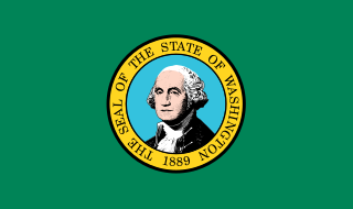
Washington (state) state of the United States of America

Washington, officially the State of Washington, is a state in the Pacific Northwest region of the United States. Named for George Washington, the first U.S. president, the state was made out of the western part of the Washington Territory, which was ceded by the British Empire in 1846, in accordance with the Oregon Treaty in the settlement of the Oregon boundary dispute. The state, which is bordered on the west by the Pacific Ocean, Oregon to the south, Idaho to the east, and the Canadian province of British Columbia to the north, was admitted to the Union as the 42nd state in 1889. Olympia is the state capital; the state's largest city is Seattle. Washington is often referred to as Washington State to distinguish it from the nation's capital, Washington, D.C..

History

A post office called Lowgap was established in 1906, and remained in operation until 1921. [2] The community took its name from a gap near the original town site. [3]

Gap (landform) landform that is a low point or opening between hills or mountains or in a ridge

A gap is a land form that is a low point or opening between hills or mountains or in a ridge or mountain range. It may be called a col, notch, pass, saddle, water gap, or wind gap, and geomorphologically are most often carved by water erosion from a freshet, stream or a river. Gaps created by freshets are often, if not normally, devoid of water through much of the year, their streams being dependent upon the meltwaters of a snow pack. Gaps sourced by small springs will generally have a small stream excepting perhaps during the most arid parts of the year.

Related Research Articles

Center is an unincorporated community in Jefferson County, Washington, United States. Center was so named because it was at one point considered to be the center of Jefferson County, although it is now significantly to the east. Center is not a town, but rather the name often applied to this residential part of the county.

North Georgetown, Ohio human settlement in Ohio, United States of America

North Georgetown is an unincorporated community in western Knox Township, Columbiana County, Ohio, United States. Although unincorporated, it has a post office, with the ZIP code of 44665. The town itself is located at the intersection of Georgetown Road and Rochester Road.

Beverly, Washington, United States, is a small unincorporated community along the banks of the Columbia River in central Washington state. The community, which consists of a few hundred residents, is a few miles downriver from Wanapum Dam and is nestled at the base of Sentinel Gap, a water gap in the Saddle Mountains that predates the Columbia River.

Colorado is an unincorporated community in Bastrop County, Texas, United States. Its elevation is 351 feet (107 m).

The Frenchman Hills are hills in Grant County, Washington, United States of America. The high point is 1,640 feet (500 m). They are an anticlinal fold in the northeastern part of the larger Yakima Fold Belt.

Corfu is an unincorporated community in Grant County, in the U.S. state of Washington.

Coal Hill is an extinct town in Muskingum County, in the U.S. state of Ohio. The GNIS classifies it as a populated place.

Franklin Square is an unincorporated community in Columbiana County, in the U.S. state of Ohio.

Speicherville, Indiana Unincorporated community in Indiana, United States

Speicherville is an unincorporated community in Lagro Township, Wabash County, in the U.S. state of Indiana.

Anglin is an unincorporated community in Okanogan County, in the U.S. state of Washington.

Burke is an unincorporated community in Grant County, in the U.S. state of Washington.

Haven is an extinct town in Grant County, in the U.S. state of Washington.

Jericho is an extinct town in Grant County, in the U.S. state of Washington. The GNIS classifies it as a populated place.

Leber is an unincorporated community in Pierce County, in the U.S. state of Washington.

Mae is an unincorporated community in Grant County, in the U.S. state of Washington.

Mottinger is an extinct town in Benton County, in the U.S. state of Washington.

Smyrna is an unincorporated community in Grant County, in the U.S. state of Washington.

Taunton is an extinct town in Adams County, in the U.S. state of Washington.

Neeper is an unincorporated community in Clark County, in the U.S. state of Missouri.

Sentinel Gap

Sentinel Gap is a water gap formed by the Columbia River in the Saddle Mountains, near Mattawa in Washington state. The gap is "a water gap where erosion by the Columbia River was able to keep pace with folding, faulting and uplifting across the Saddle Mountain anticline". During Ice Age floods in which waters from the Channeled Scablands found passage to the Pacific Ocean here and at Wallula Gap, this opening was "repeatedly reamed out, which probably widened and steepened the walls of the gap". Strandlines from the floods can be seen on the basalt walls of the gap.

References

  1. U.S. Geological Survey Geographic Names Information System: Low Gap, Washington
  2. "Post Offices". Jim Forte Postal History. Retrieved 14 August 2016.
  3. Meany, Edmond S. (1923). Origin of Washington geographic names. Seattle: University of Washington Press. p. 150.

Coordinates: 46°59′09″N119°47′30″W / 46.98583°N 119.79167°W / 46.98583; -119.79167

Geographic coordinate system Coordinate system

A geographic coordinate system is a coordinate system that enables every location on Earth to be specified by a set of numbers, letters or symbols. The coordinates are often chosen such that one of the numbers represents a vertical position and two or three of the numbers represent a horizontal position; alternatively, a geographic position may be expressed in a combined three-dimensional Cartesian vector. A common choice of coordinates is latitude, longitude and elevation. To specify a location on a plane requires a map projection.