Jerry's Pond is an artificial pond created from a clay pit circa 1870 in North Cambridge, Massachusetts. Before being disused, it was known as Jerry's Pit. [1]
Jerry's Pond is an artificial pond created from a clay pit circa 1870 in North Cambridge, Massachusetts. Before being disused, it was known as Jerry's Pit. [1]
Jerry's Pit was likely named after Jeremiah McCrehan, a North Cambridge resident and co-owner of the land until 1878 when it was lost due to foreclosure. It was later reopened by the DeRosay family. During this time, it was used as a swimming hole in the neighborhood,. [2] However, several drownings did occur. [3] In the 1940s, the Dewey & Almy Chemical Company purchased the property and spent $5,000 for the city to improve the land for swimming. Swimming remained common there until a pool was built nearby, named after McCrehan's grandson, Frank McCrehan. [1] [3]
After the McCrehan pool was built next to it in 1961, a fence was erected around it and the public was prevented from entering. When the Dewey & Almy Chemical Company, now merged with W. R. Grace and Company, owned the land, many toxic chemicals were used including PAHs, naphthalene, and asbestos as a part of a brake development program. [4] [5]
In 1995, in response to a developer's proposal, neighbors formed the Alewife Study Group (ASG), which is devoted to
In 2015, a group was formed to restore the site called Friends of Jerry’s Pond along with Mass Audubon, Alewife Study Group, and Green Cambridge. [6] [7] The group also works with young people of the area alongside the city's mayor's employment program. [4] The group hosts an annual cleanup day known as Jerry's PondFest. [8] However, due to the toxic chemicals found in the soil, concerns arose mainly regarding the asbestos. Since it was buried deep in the soil, the asbestos posed no immediate danger to the public, but if it was disturbed by those restoring the park, it could pose a threat to the safety of those around it. [4] Concerns were raised regarding environmental justice because of the high density of affordable housing in the Alewife neighborhood. [4] [9] In 2020, the site was purchased from W. R. Grace by IQHQ, a real estate developer for $125 million. [2] [9] [10] In April 2023, the company committed to opening up the land for public use. [7] [11] In March 2024, the project got approval from the Cambridge Conservation Commission, and opening was expected in summer 2025. [12]

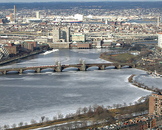
Cambridge is a city in Middlesex County, Massachusetts, United States. It is a suburb in the Greater Boston metropolitan area, located directly across the Charles River from Boston. The city's population as of the 2020 U.S. census was 118,403, making it the most populous city in the county, the fourth-largest in Massachusetts behind Boston, Worcester, and Springfield, and ninth-most populous in New England. The city was named in honor of the University of Cambridge in Cambridge, England, which was an important center of the Puritan theology that was embraced by the town's founders.

Woburn is a city in Middlesex County, Massachusetts, United States. The population was 40,876 at the 2020 census. Woburn is located 9 miles (14 km) north of Boston. Woburn uses Massachusetts' mayor-council form of government, in which an elected mayor is the executive and a partly district-based, partly at-large city council is the legislature. It was the last of Massachusetts' 351 municipalities to refer to members of its city council as "aldermen".

Libby is a city in northwestern Montana, United States and the county seat of Lincoln County. The population was 2,775 at the 2020 census.
The Charles River, sometimes called the River Charles or simply the Charles, is an 80-mile-long (129 km) river in eastern Massachusetts. It flows northeast from Hopkinton to Boston along a highly meandering route, that doubles back on itself several times and travels through 23 cities and towns before reaching the Atlantic Ocean. The indigenous Massachusett named it Quinobequin, meaning "meandering" or "meandering still water".
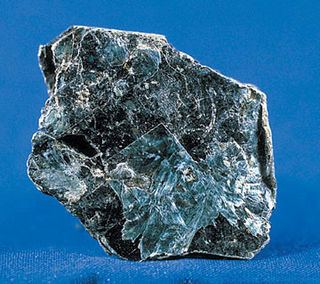
Vermiculite is a hydrous phyllosilicate mineral which undergoes significant expansion when heated. Exfoliation occurs when the mineral is heated sufficiently; commercial furnaces can routinely produce this effect. Vermiculite forms by the weathering or hydrothermal alteration of biotite or phlogopite. Large commercial vermiculite mines exist in the United States, Russia, South Africa, China, and Brazil.

Alewife station is a Massachusetts Bay Transportation Authority (MBTA) intermodal transit station in the North Cambridge neighborhood of Cambridge, Massachusetts. It is the northwest terminal of the rapid transit Red Line and a hub for several MBTA bus routes. The station is at the confluence of the Minuteman Bikeway, Alewife Linear Park, Fitchburg Cutoff Path, and Alewife Greenway off Alewife Brook Parkway adjacent to Massachusetts Route 2, with a five-story parking garage for park and ride use. The station has three bike cages. Alewife station is named after nearby Alewife Brook Parkway and Alewife Brook, themselves named after the alewife fish.

The Minuteman Bikeway, also known as the Minuteman Commuter Bikeway, is a 10-mile (16-kilometre) paved multi-use rail trail located in the Greater Boston area of Massachusetts. It runs from Bedford to Alewife station, at the northern end of the Red Line in Cambridge, passing through the towns of Lexington and Arlington along the way. Also along the route are several notable regional sites, including Alewife Brook Reservation, the Cyrus Dallin Art Museum, Spy Pond, "Arlington’s Great Meadows", the Battle Green in Lexington, and Hanscom Air Force Base.
The Rocky Mountain Arsenal National Wildlife Refuge is a 15,988-acre (24.981 sq mi) National Wildlife Refuge located adjacent to Denver and Commerce City, Colorado, in the United States. It is approximately 8 miles (13 km) northeast of downtown Denver. The refuge is on the grounds of the former Rocky Mountain Arsenal, a United States Army chemical weapons manufacturing facility. The site was designated a national wildlife refuge in 1992 by the United States Congress, and underwent a costly environmental cleanup in order to remove pollutants. The refuge is managed by the United States Fish and Wildlife Service. More than 330 species of wildlife inhabit the refuge, including raptors, deer, raccoons, coyotes, white pelicans, black-footed ferrets, black-tailed prairie dogs, and bison.

The Santa Susana Field Laboratory (SSFL), formerly known as Rocketdyne, is a complex of industrial research and development facilities located on a 2,668-acre (1,080 ha) portion of Southern California in an unincorporated area of Ventura County in the Simi Hills between Simi Valley and Los Angeles. The site is located approximately 18 miles (29 km) northwest of Hollywood and approximately 30 miles (48 km) northwest of Downtown Los Angeles. Sage Ranch Park is adjacent on part of the northern boundary and the community of Bell Canyon is along the entire southern boundary.

Alewife Brook Reservation is a Massachusetts state park and urban wild located in Cambridge, Arlington, and Somerville. The park is managed by the state Department of Conservation and Recreation and was established in 1900. It is named for Alewife Brook, which was also historically known as Menotomy River, a tributary of the Mystic River.
W. R. Grace and Co. is an American chemical business based in Columbia, Maryland. It produces specialty chemicals and specialty materials in two divisions: Grace Catalysts Technologies, which makes polyethylene and polypropylene catalysts and related products and technologies used in petrochemical, refining, and other chemical manufacturing applications, and Grace Materials and Chemicals, which makes specialty materials, including silica-based and silica-alumina-based materials, which are used in commercial products such as sunscreen and in chemical process applications.

The Bingham Canyon Mine, more commonly known as Kennecott Copper Mine among locals, is an open-pit mining operation extracting a large porphyry copper deposit southwest of Salt Lake City, Utah, in the Oquirrh Mountains. The mine is the largest human-made excavation, and deepest open-pit mine in the world, which is considered to have produced more copper than any other mine in history – more than 19,000,000 short tons. The mine is owned by Rio Tinto Group, a British-Australian multinational corporation. The copper operations at Bingham Canyon Mine are managed through Kennecott Utah Copper Corporation which operates the mine, a concentrator plant, a smelter, and a refinery. The mine has been in production since 1906, and has resulted in the creation of a pit over 0.75 miles (1,210 m) deep, 2.5 miles (4 km) wide, and covering 1,900 acres. It was designated a National Historic Landmark in 1966 under the name Bingham Canyon Open Pit Copper Mine. The mine experienced a massive landslide in April 2013 and a smaller slide in September 2013.
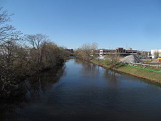
The Malden River is a 2.3-mile-long (3.7 km) river in Malden, Medford, and Everett, Massachusetts. It is roughly 675 feet (206 m) wide at its widest point and is very narrow at its smallest point. Its banks are largely occupied by industrial business, and the river is scarcely used or even mentioned. Its water quality is worse than most local waters, including the Mystic River, into which it flows. The Mystic River Watershed Association is working and creating educational programs to help the environment. The Association works on projects to improve the Mystic River and tributaries, lakes and ponds and greenways along the waterfronts. Rivergreen Park is part of the Mystic Greenways and is along the Malden River. The Friends of the Malden River organize clean-up events.

The Kingston Fossil Plant Spill was an environmental and industrial disaster that occurred on December 22, 2008, when a dike ruptured at a coal ash pond at the Tennessee Valley Authority's Kingston Fossil Plant in Roane County, Tennessee, releasing 1.1 billion US gallons of coal fly ash slurry. The coal-fired power plant, located across the Clinch River from the city of Kingston, used a series of ponds to store and dewater the fly ash, a byproduct of coal combustion. The spill released a slurry of fly ash and water which traveled across the Emory River and its Swan Pond embayment onto the opposite shore, covering up to 300 acres (1.2 km2) of the surrounding land. The spill damaged multiple homes and flowed into nearby waterways including the Emory River and Clinch River, both tributaries of the Tennessee River. It was the largest industrial spill in United States history.

Cambridge Highlands also known as "Area 12", is a neighborhood of Cambridge, Massachusetts bounded by the railroad tracks on the north and east, the Belmont town line on the west, and Fresh Pond on the south. In 2005 it had a population of 673 residents living in 281 households, and the average household income was $56,500.

Asbestos is a group of naturally occurring, toxic, carcinogenic and fibrous silicate minerals. There are six types, all of which are composed of long and thin fibrous crystals, each fibre being composed of many microscopic "fibrils" that can be released into the atmosphere by abrasion and other processes. Inhalation of asbestos fibres can lead to various dangerous lung conditions, including mesothelioma, asbestosis, and lung cancer. As a result of these health effects, asbestos is considered a serious health and safety hazard.
Donald William Molloy is a senior United States district judge of the United States District Court for the District of Montana.
Cambridge Discovery Park, formerly known as Acorn Park, is a 30 acres (12 ha) office and laboratory campus in Cambridge, Massachusetts. It is located along Massachusetts Route 2, and is connected to the Alewife Red Line subway terminus and bus station by a walking path, and to the Minuteman Bikeway.
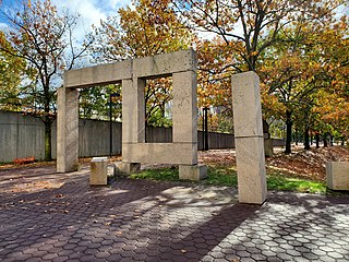
Untitled is a 1985 public art installation by American artist Richard Fleischner located in a courtyard adjacent to Alewife station on the Massachusetts Bay Transportation Authority (MBTA) Red Line in northwest Cambridge, Massachusetts. The artwork – an environmental piece consisting of granite block designs among a landscape – cost $40,000 to create as part of the Arts on the Line program.
The Atlas Asbestos Mine Superfund Site is located within the Clear Creek Management Area near Fresno County, eighteen miles northwest of Coalinga, California. The mine started operating in 1963, covering 435 acres of a large naturally occurring asbestos deposit. The mine closed in 1979 and was placed in the EPA's National Priorities List (NPL) in 1983 due to the pollution of asbestos in the surrounding soil, air and water creating potential health hazards for local populations and environment.