There are 23 national parks in Poland. These were formerly run by the Polish Board of National Parks, but in 2004 responsibility for their management was transferred to what is now the Ministry of Climate and the Environment. Most national parks are divided into strictly and partially protected zones. They currently encompass around 186000 hectares of forest, or around 2% of all the country's woodlands.

Magdeburg rights were a set of town privileges first developed by Otto I, Holy Roman Emperor (936–973) and based on the Flemish Law, which regulated the degree of internal autonomy within cities and villages granted by the local ruler. Named after the city of Magdeburg, these town charters were perhaps the most important set of medieval laws in Central Europe. They became the basis for the German town laws developed during many centuries in the Holy Roman Empire. The Magdeburg rights were adopted and adapted by numerous monarchs, including the rulers of Bohemia, Hungary, Poland, and Lithuania, a milestone in the urbanization of the region which prompted the development of thousands of villages and cities.

The Warsaw Voivodeship, between 1975 and 1990 known as the Warsaw Capital Voivodeship, was a voivodeship (province) of the Polish People's Republic from 1975 to 1989, and the Third Republic of Poland from 1989 to 1998. Its capital was Warsaw, and it was located in the central Masovia. It was established on 1 June 1975, from the part of the Warsaw Voivodeship, and a city voivodeship of Warsaw, and existed until 31 December 1998, when it was incorporated into then-established Masovian Voivodeship.

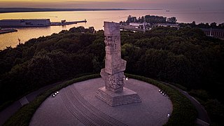
Port Island is an island located between Gdańsk Bay, Śmiała Wisła and Leniwka in northern Poland within the city limits of Gdańsk.

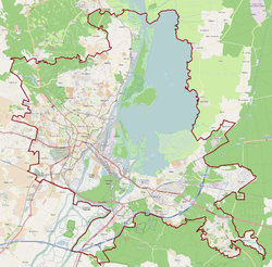
Śmierdnica is a part of Szczecin, Poland, located in the south-eastern part of the city, on the right bank of Oder river.

Wirek is a district in the centre of Ruda Śląska, Silesian Voivodeship, southern Poland. In 2006 it had an area of 5.9 km2 and was inhabited by 20,595 people. On January 12, 2006 a part of it was split off to form a new district, Czarny Las.

Niedobczyce is a district of Rybnik, Silesian Voivodeship, southern Poland. Between 1955 and 1975 it was an independent town On December 31, 2013 it had about 12,300 inhabitants.
Kijewo is a village in the administrative district of Gmina Środa Wielkopolska, within Środa Wielkopolska County, Greater Poland Voivodeship, in west-central Poland. It lies approximately 4 kilometres (2 mi) south of Środa Wielkopolska and 34 km (21 mi) south-east of the regional capital Poznań.

National road 2 is an A-class, S-class and GP-class Polish national road, being part of the European route E30 from Cork (Ireland) to Omsk (Russia). The highway traverses through the Lubusz, Greater Poland, Łódź. Masovian and Lublin voivodeships. It runs latitudinally.

Droga krajowa nr 98 was a route belonging to Polish national roads network.

Chwałowice is a district of Rybnik, Silesian Voivodeship, southern Poland. On December 31, 2013 it had 7,700 inhabitants.

Boguszowice Stare is a district of Rybnik, Silesian Voivodeship, southern Poland. In the late 2013 it had about 7,700 inhabitants.

The Koszalin Voivodeship was a voivodeship (province) of the Polish People's Republic from 1975 to 1989, and the Third Republic of Poland from 1989 to 1998. Its capital was Koszalin, and it was centered on the eastern Farther Pomerania. It was established on 1 June 1975, from the part of the Koszalin Voivodeship, and existed until 31 December 1998, when it was incorporated into then-established West Pomeranian Voivodeship.

National road 68 is a main road of accelerated traffic belonging to the Polish national road network. The length of the route is 11.4 kilometres (7.1 mi), of which 5.197 kilometres (3.229 mi) is maintained by General Directorate for National Roads and Highways. The highway connects the Kukuryki border crossing on Belarus–Poland border with national road 2 in Wólka Dobryńska. It runs entirely in Lublin Voivodeship, in Biała County. According to signage, national road 68 is a component of European highway E30.

National road 37 is a main road (Polish: droga główna, droga klasy G) route belonging to Polish national roads network, located in West Pomeranian Voivodeship. With its length of 14.6 kilometres (9.1 mi), the route connects the town of Darłowo with national road 6 near Karwice. In the future a new junction will be constructed, linking road 37 with expressway S6.

Stoczek is a village in the administrative district of Gmina Kiwity, within Lidzbark County, Warmian-Masurian Voivodeship, in northern Poland. It is located in the historic region of Warmia.

Piaski is a district of Toruń, Poland, located in the southern part of the city, within its part located in the historic region of Kuyavia.

Bohorodczany County was a former Polish county (Powiat) in the Stanisławów Voivodeship in Southeastern Poland.


