There are 23 national parks in Poland. These were formerly run by the Polish Board of National Parks, but in 2004 responsibility for them was transferred to the Ministry of the Environment. Most national parks are divided into strictly and partially protected zones. Additionally, they are usually surrounded by a protective buffer zone called otulina.

The Zielona Góra Voivodeship was a voivodeship (province) of the Polish People's Republic from 1975 to 1989, and the Third Republic of Poland from 1989 to 1998. Its capital was Zielona Góra, and it was centered on the southern Lubusz Land, in west-centre part of the county. It was established on 1 June 1975, from the part of the Zielona Góra Voivodeship, and existed until 31 December 1998, when it was incorporated into then-established Lubusz and Greater Poland Voivodeships.

Kęty is a town in Oświęcim County, Lesser Poland Voivodeship, Poland with 18,955 inhabitants (2012). The town located in Silesian Foothills dates its earliest document from 1277 when Polish prince of Opole Władysław confirmed sale of the settlement and adoption of Lviv city rights. The town's name comes from the word kąt. The greatest development of the town came under the rule of Jagiellons, when the town became royal property.

Jeżyce is a part of the city of Poznań in western Poland. It was one of the five governmental districts (dzielnicas) into which the city was divided prior to 1990, and which are retained for certain administrative purposes. For details, see Administrative division of Poznań.

The coat of arms of Poznań consists of white city walls with three towers. On the left (heraldic) tower stands Saint Peter with a key and on the heraldic right one stands Saint Paul with a sword. In the gate there are two golden crossed keys with a cross above. Over the middle tower, which contains a single window and is topped by a battlement, there is a gothic shield with a white eagle in crown. On the sides of the two saints there are golden crescents and stars. All of those elements are on a blue field. Over the shield there is golden crown. Author of modern version of coat of arms is Jerzy Bąk.

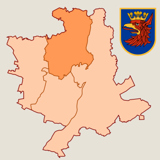
Drzetowo-Grabowo is a municipal neighborhood of Szczecin, West Pomeranian Voivodeship, Poland, part of the Śródmieście district and borders on the north on Północ district. It was formed on the basis of two, historical neighborhoods - Drzetowo and Grabowo. On 2018, the estimated population of Drzetowo-Grabowo was 22,655 residents.

Dziwnówek is a village in the administrative district of Gmina Dziwnów, within Kamień County, West Pomeranian Voivodeship, in north-western Poland. It lies approximately 4 kilometres (2 mi) north-east of Dziwnów, 8 km (5 mi) north of Kamień Pomorski, and 70 km (43 mi) north of the regional capital Szczecin.

Centrum is a municipal neighbourhood of the city of Szczecin, Poland, situated on the left bank of Oder river, in Śródmieście (Centre) District. It borders Śródmieście-Zachód to the west, Śródmieście-Północ to the north, Stare Miasto to the east, and Nowe Miasto to the south. As of January 2011 it had a population of 21,064.

Droga krajowa nr 98 was route belonging to Polish national roads network.

Chwałowice is a district of Rybnik, Silesian Voivodeship, southern Poland. On December 31, 2013 it had 7,700 inhabitants.

LGBT-free zones or LGBT ideology-free zones are municipalities and regions of Poland that have declared themselves unwelcoming of what they described as "LGBT ideology", in order to ban equality marches and other LGBT events. By June 2020, some 100 municipalities (map) and five voivodeships, encompassing a third of the country, had adopted resolutions which have been characterized as "LGBT-free zones". In September 2021, four of the voivodeships withdrew the measures, after the EU threatened to withhold funding. Poland's Human Rights Ombudsman challenged several LGBT-free zone resolutions and on 28 June 2022, a top Polish appeals court upheld lower court rulings that had annulled these resolutions, abolishing them in four municipalities. Supporters argue that the zones defend traditional family values, while opponents argue that the zones undermine the rights of LGBT people.

Henryk Dąbrowski Park is a green area covering 2,89 ha, located on the heights of Bydgoszcz, Poland. Aleja Górska is a smaller green walking path that extends to the east of the park.

The coat of arms that serves as the symbol of the city of Szczecin in West Pomeranian Voivodeship, Poland depicts the head of a red griffin with a yellow (golden) beak wearing a yellow (golden) crown, placed on the blue background.

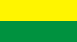
The flag is the symbol of the city of Szczecin in West Pomeranian Voivodeship, Poland.

The West Pomeranian District, also designated as the 3rd District, was a district of Poland, during the administration of the Provisional Government of the Republic of Poland in 1945, and the Provisional Government of National Unity from 1945 to 1946. It was established as one of four districts on 14 March 1945, as one of the four districts created to administer the area known as the Recovered Territories, acquired by Poland from Nazi Germany, during, and in the aftermath of World War 2. It was formed within the boundaries of former German provinces of Brandenburg, and Pomerania, and consisted of the area of the Farther Pomerania and Lubusz Land. On 25 September 1945, its southern part was incorporated into the Poznań Voivodeship. It existed until 28 June 1946, when it was abolished and incorporated into the Szczecin Voivodeship.

Nad Odrą was a district of the city of Szczecin, Poland, that functioned from 1954 to 1976.

Dąbie was a district of the city of Szczecin, Poland, that functioned from 1954 to 1976.

Śródmieście was a district of the city of Szczecin, Poland, that functioned from 1954 to 1976.

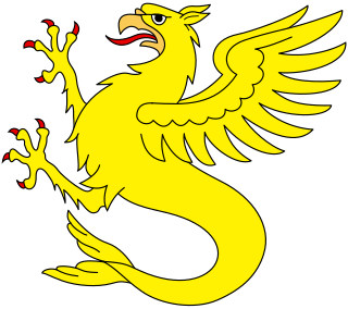
The sea-griffin is a heraldic charge, in form of a creature an upper body of a griffin, which consists of a torso of a lion, a head, claws, and wings of an eagle, ears of a horse, and a bottom botty in from of a fish tail.

National road 68 is a main road of accelerated traffic belonging to the Polish national road network. The length of the route is 11.4 kilometres (7.1 mi), of which 5.197 kilometres (3.229 mi) is maintained by General Directorate for National Roads and Highways. The highway connects the Kukuryki border crossing on Belarus–Poland border with national road 2 in Wólka Dobryńska. It runs entirely in Lublin Voivodeship, in Biała County. According to signage, national road 68 is a component of European highway E30.


