Baglung District, a part of Gandaki Province, is one of the seventy-seven districts of Nepal. The district, with Baglung as its district headquarters, covers an area of 1,784 km2 (689 sq mi) and has a population (2011) of 268,613.

A village development committee in Nepal was the lower administrative part of its Ministry of Federal Affairs and Local Development. Each district had several VDCs, similar to municipalities but with greater public-government interaction and administration. There were 3,157 village development committees in Nepal. Each village development committee was further divided into several wards depending on the population of the district, the average being nine wards.

Bode is an ancient Newar city in the east corner of the Kathmandu Valley, Nepal, about eight miles from the capital city, Kathmandu.The city is famous for Biska Jatra and tongue piercing and Nilbharahi Naach. At the time of the 2011 Nepal census it had a population of 6,364 with 1,389 houses.
Gajuri(Nepali: गजुरी ; gajuri) is a Gaupalika in Dhading District in the Bagmati Zone of central Nepal. It has a literacy rate of 64.28%. The city hosts as one of the city with highest literacy rate in the Dhading district. The local body was formed by merging three VDCs namely Gajuri, Pida, Nepal, Kiranchok.
Tokha Chandeshwari is a village and former Village Development Committee that is now part of Tokha Municipality in Kathmandu District in Province No. 3 of central Nepal. At the time of the 2011 Nepal census it had a population of 3,961. Tokha Chandeshwari now is part of Tokha municipality.
Dipsung is a village and Village Development Committee in Khotang District in the Sagarmatha Zone of eastern Nepal. At the time of the 1991 Nepal census, it had a population of 950 living in 205 individual households.
Ghyang Sukathokar is a village development committee (VDC) in Dolakha District in the Janakpur Zone of north-eastern Nepal. At the time of the 1991 Nepal census it had a population of 4,600.
'Itari prasahi 'which was once a VDC is now a ward no 3 of kalyanpur municipality of siraha district, province no 2, Nepal. It is the heart of the kalyanpur Municipality. It is the most populated ward as well as the largest in area of kalyanpur municipality. Also, It is the richest ward among all 12 ward. Most of the people depend upon agriculture and animal husbandry, fishery for their livelihood. Very few people are business men, teachers, doctors, engineers etc.
Hardiya is a village development committee in Saptari District in the Sagarmatha Zone of south-eastern Nepal. At the time of the 2011 Nepal census it had a population of 5,286 people living in 1,139 individual households.
Nargho is a village development committee in Saptari District in the Sagarmatha Zone of southeastern Nepal. At the time of the 1991 Nepal census it had a population of 4640 people living in 960 households. Different caste people like jha, yadav, mandal, sha, ram, karn, paswan, sharma, dom, shada etc., used to live in village. It consists of four subvillages. It has three small bazaars but it does not have good road facility. Most of the people are farmers and they grow paddy, wheat, pulses, vegetables, etc. Some of the people used to depend on animal husbandry and fishery to survive.

Katahariya is a municipality in Rautahat District in the Narayani Zone of south-eastern Nepal. Before September 2017, Katahariya was one of the Village Development Committees (VDC) with 8 wards. At the time of the 1991 Nepal census, it had a population of 4,619 people living in 835 individual households. Katahariya is famous for its unique moton dish. A well known moton dish named “Katiya : कटिया” is origin from Katahariya Bazar. It has a well-maintained Farmers' market (vegetable) and Cattle (domestic-animal) market. Katahariya is a fast-growing municipality, with the main occupations of local people being business and farming.
Bindyabasini is a rural municipality in Parsa District in Province No. 2 of Nepal. It was formed in 2016 occupying current 5 sections (wards) from previous 5 former VDCs. It occupies an area of 26.04 km2 with a total population of 24,468. It now consists of 5 wards of 14 small villages
Subhang, or Suvang, is a village development committee (VDC) in Panchthar district, in the Mechi Zone of eastern Nepal. It is surrounded by the Bharapa, Ekteen, Panchami, Tharpu, Chiyandada and Chattedhunga VDCs. The Suvang khola and Tambar Khola are the major rivers. Major market areas in Subhang include Jorpokhari and Chatture bazaar. Every two weeks, the Chatture local mela is organised. The main economic activity in Subhang is agriculture. Cash crops and staple crops are cultivated, with the main cash crop being cardamom; other cash crops include amlisho, ginger and vegetables. Animals such as chickens, pigs, cattle, goats, buffaloes and sheep are raised for husbandry.
Parbatipur is a part of Bharatpur Metropolitan City-21 in Chitwan District in Bagmati Province of southern Nepal. At the time of the 2011 Nepal census it had a population of 6506 people living in 1614 individual households. Though the status of the settlement has not been announced publicly, the official fees and taxes are applied by Metropolitan City standard/rate. Parbatipur Town is only 18 km far from its district capital Bharatpur. It is one of the fastest-growing towns of West Chitwan.
Sukranagar is a village development committee in Chitwan District in the Narayani Zone of southern Nepal. At the time of the 1991 Nepal census it had a population of 6,750 people living in 1,128 individual households. By 2009, the population has exceeded 30,000.

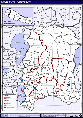
Letang, "लेटाङ " is a municipality in Morang District in the Koshi Province of Nepal. It was formed by merging the existing Village Development Committees of Letang, Jante, Warrangi and Bhogateni. This municipality is situated in Hilly Region as well as Terai Region. Previously it was called Letang Bhogateni but now it's known as Letang.
Pathari Shanishchare (पथरी-शनिश्चरे) is a Municipality in Morang District in the Koshi Zone of south-eastern Nepal. It was formed by merging three existing village development committees i.e. Hasandaha, Pathari and Sanischare in May 2014.
Tamasariya is a village development committee in Nawalparasi District in the Lumbini Zone of southern Nepal. At the time of the 1991 Nepal census it had a population of 6942 people living in 1195 individual households. It is located between Madyabindu community forest and river Girubari. The economy of the VDC is highly depended on remittance. Most of the people are engaged in animal husbandry and farming. Chormara is generally referred to as a big market area of the region that includes tamasariya village development committee (VDC) and narayani VDC. It serves as administrative headquarters for Tamsariya VDC.
Shivasatakshi is a municipality in the southeastern part of Jhapa District in the Koshi Province of eastern Nepal. The new municipality was formed by merging four existing VDCs—Shivaganj, Satasidham, Dharampur, and Panchgachhi—on 2 Dec 2014. The office of the municipality is that of the former Satasidham village development committee (VDC).

Annapurna Rural Municipality, Kaski is a Gaunpalika in Kaski District in Gandaki Province of Nepal named after the Annapurna Mountain. On 12 March 2017, the Government of Nepal implemented a new local administrative structure. With the implementation of the new local administrative structure, VDSs have been replaced with municipal and village councils. Annapurna Gaupalika is one of these 753 local units.


