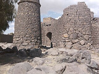
Lahij is a governorate of Yemen.
Iyal Surayh District is a district of the 'Amran Governorate, Yemen. As of 2003, the district had a population of 54,015 inhabitants.
Kharif District is a district of the 'Amran Governorate, Yemen. As of 2003, the district had a population of 45,977 inhabitants. On July 13, 2020, it is reported that the Houthi militia captured the last Jews of Yemen in the Kharif District.
Thula District (Arabic: مديرية ثلاء) is a district of the 'Amran Governorate, Yemen. As of 2003, the district had a population of 40,971 inhabitants.
An Nadirah District is a district of the Ibb Governorate, Yemen. As of 2003, the district had a population of 73,755 inhabitants.
Ar Radmah District is a district of the Ibb Governorate, Yemen. As of 2003, the district had a population of 76,576 inhabitants.
As Sabrah District is a district of the Ibb Governorate, Yemen. As of 2003, the district had a population of 69,872 inhabitants.
As Saddah District is a district of the Ibb Governorate, Yemen. As of 2003, the district had a population of 82,502 inhabitants.
As Sayyani District is a district of the Ibb Governorate, Yemen. As of 2003, the district had a population of 110,515 inhabitants.
Ash Sha'ir District is a district of the Ibb Governorate, Yemen. As of 2003, the district had a population of 39,805 inhabitants.

Arhab District is a district of the Sana'a Governorate, Yemen. As of 2003, the district had a population of 90,038 inhabitants.
Attyal District is a district of the Sana'a Governorate, Yemen. As of 2003, the district had a population of 36,253 inhabitants. Hajrat Shawkan village is in this district.
Bani Dhabyan District is a district of the Sana'a Governorate, Yemen. As of 2003, the district had a population of 16,262 inhabitants. As of 2023, it is one of the only districts controlled by tribal forces.
Bani Hushaysh District is a district in Sana'a Governorate, Yemen. As of 2003, the district had a population of 73,957 inhabitants. It's also famous for grape plantations.
Bilad Ar Rus District is a district of the Sana'a Governorate, Yemen. As of 2003, the district had a population of 31,259 inhabitants.

Hamdan District is a district of the Sana'a Governorate, Yemen. As of 2003, the district had a population of 85,370 inhabitants. It is named after the ancient Yemeni tribe of Hamdan.
Khawlan District is a district of the Sanaa Governorate, Yemen. As of 2003, the district had a population of 28,925 inhabitants.

Nihm District is a district of the Sana'a Governorate, Yemen. As of 2003, the district had a population of 41,502 inhabitants.
Sanhan and Bani Bahlul District is a district of the Sana'a Governorate, Yemen. Its seat is Sanhan. As of 2003, the district had a population of 400,399 inhabitants. The former President of Yemen Ali Abdullah Saleh comes from Beit al-Ahmar, which lies in Sanhan District.
Habab Al Hantash is a sub-district located in Khawlan District, Sana'a Governorate, Yemen. Habab Al Hantash had a population of 2526 according to the 2004 census.


