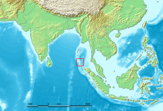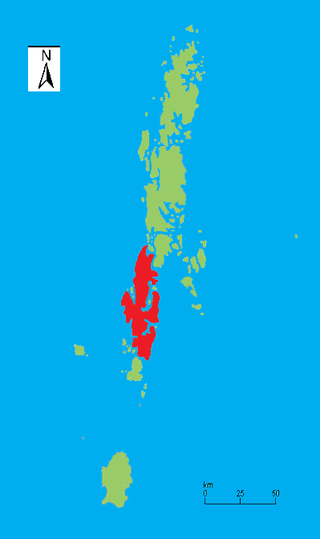
The Andaman Islands are an archipelago, made up of 200 islands, in the northeastern Indian Ocean about 130 km (81 mi) southwest off the coasts of Myanmar's Ayeyarwady Region. Together with the Nicobar Islands to their south, the Andamans serve as a maritime boundary between the Bay of Bengal to the west and the Andaman Sea to the east. Most of the islands are part of the Andaman and Nicobar Islands, a Union Territory of India, while the Coco Islands and Preparis Island are part of the Yangon Region of Myanmar.

The Andaman and Nicobar Islands is a union territory of India consisting of 571 islands, of which 37 are inhabited, at the junction of the Bay of Bengal and the Andaman Sea. The territory is about 150 km (93 mi) north of Aceh in Indonesia and separated from Thailand and Myanmar by the Andaman Sea. It comprises two island groups, the Andaman Islands (partly) and the Nicobar Islands, separated by the 150 km wide Ten Degree Channel, with the Andaman islands to the north of this latitude, and the Nicobar islands to the south. The Andaman Sea lies to the east and the Bay of Bengal to the west. The island chains are thought to be a submerged extension of the Arakan Mountains.

The Nicobar Islands are an archipelagic island chain in the eastern Indian Ocean. They are located in Southeast Asia, 150 kilometres (93 mi) northwest of Aceh on Sumatra, and separated from Thailand to the east by the Andaman Sea. Located 1,300 kilometres (810 mi) southeast of the Indian subcontinent, across the Bay of Bengal, they are part of India, as the Nicobar district within the union territory of the Andaman and Nicobar Islands.

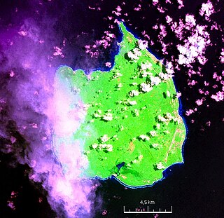
Car Nicobar is the northernmost of the Nicobar Islands. It is also one of three local administrative divisions of the Indian district of Nicobar, part of the Indian union territory of Andaman and Nicobar Islands. Annual rainfall is 2800 millimetres.

South Andaman Island is the southernmost island of the Great Andaman and is home to the majority of the population of the Andaman Islands. It belongs to the South Andaman administrative district, part of the Indian union territory of Andaman and Nicobar Islands. It is the location of Port Blair, capital of the Andaman and Nicobar Islands.
Great Nicobar is the southernmost and largest of the Nicobar Islands of India, north of Sumatra.

Middle Andaman Island is an island of the Andaman Islands. It belongs to the North and Middle Andaman administrative district, part of the Indian union territory of Andaman and Nicobar Islands.
Baratang Island is an island of the Andaman Islands. It belongs to the North and Middle Andaman administrative district, part of the Indian union territory of Andaman and Nicobar Islands. The island lies 150 km (93 mi) north of Port Blair.
Nicobar district is one of three districts in the Indian union territory of Andaman and Nicobar Islands. The district's administrative territory encompasses all of the Nicobar Islands, which are located in the Indian Ocean, between the Bay of Bengal and the Andaman Sea. The headquarters of the district is the village of Malacca, located on the island of Car Nicobar.
Rangat is a town on the Middle Andaman Island, Andaman Archipelago. It is also one of the three counties (tehsils) administrative divisions of the North and Middle Andaman district, in the Andaman and Nicobar Islands union territory of India. Its population, according to the 2001 Census of India, was 38,824 people, mainly of Bengalis and Tamils.
The Coco Islands are a small group of islands in the northeastern Bay of Bengal. They are part of the Yangon Region of Myanmar since 1937. The islands are located 414 km (257 mi) south of the city of Yangon. Coco Island group consists of five islands: four on Great Coco Reef and one on the Little Coco Reef. To the north of this island group lies Preparis Island, belonging to Myanmar. To the south lies the Landfall Island, belonging to India.
Interview Island is an island of the Andaman Islands. It belongs to the North and Middle Andaman administrative district, part of the Indian union territory of Andaman and Nicobar Islands. It lies 125 km (78 mi) north of Port Blair.
The Andaman and Nicobar Command (ANC) is the only tri-service theater command of the Indian Armed Forces, based at Port Blair in the Andaman and Nicobar Islands, a Union Territory of India. It was created in 2001 to safeguard India's strategic interests in Southeast Asia and the Strait of Malacca by increasing rapid deployment of military assets in the region. It provides logistical and administrative support to naval ships which are sent on deployment to East Asia and the Pacific Ocean.

The Andaman and Nicobar Police is the law enforcement agency for the Andaman and Nicobar Islands, India. A&N Police comes under the jurisdiction of the Ministry of Home Affairs, Government of India. The A&N Police has a sanctioned strength of 4130 posts of various ranks in Civil Police, Criminal Investigation Department, Immigration Branch, Foreigners Branch, Motor Vehicle Section, Traffic branch, Security Unit, Forensic Science Laboratory, Finger Print Unit, Dog Squad, Special Armed Police, Armed Police, Island Communication, Fire Service Units and India Reserve Battalion.
National Highway 4, or NH 4, is the major highway in the Indian union territory of Andaman and Nicobar Islands. It is 230.7 km in length. This road running from the capital city of Port Blair to Diglipur connecting all major towns of Ferrargunj, Baratang, Kadamtala, Rangat, Billy Ground, Nimbudera, Mayabunder and Diglipur. This highway is known as the Andaman Trunk Road.
Jhoola is a village in the Nicobar district of Andaman and Nicobar Islands, India. It is located in the Nancowry tehsil.
Pulomilo is an island in the Nicobar district of Andaman and Nicobar Islands, India, and home to a village of the same name. It is located just north of Little Nicobar Island.
IAF Camp is a village in the Nicobar district of Andaman and Nicobar Islands, India. It is located in the Car Nicobar tehsil. The Car Nicobar Air Force Base is located here.
Tourism in Andaman and Nicobar Islands relates to tourism in union territory of India, Andaman and Nicobar Islands. The Andamans are an archipelago of over 572 tropical islands, of which only 38 are inhabited. In 2004 Radhanagar beach at Havelock Island was bestowed with the title of "Asia’s Best Beach" and as the world's seventh most spectacular beach by Time Magazine.
Defence Island is an island of the Andaman Islands. It belongs to the South Andaman administrative district, part of the Indian union territory of Andaman and Nicobar Islands. The island is 33.5 km (21 mi) north of Port Blair.


