Joder, Nebraska

Last updated
Joder
Unincorporated community
USA Nebraska location map.svg
Red pog.svg
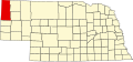
Joder
Location within the state of Nebraska
Coordinates: 42°52′58″N103°32′27″W / 42.88278°N 103.54083°W / 42.88278; -103.54083 Coordinates: 42°52′58″N103°32′27″W / 42.88278°N 103.54083°W / 42.88278; -103.54083
Country United States
State Nebraska
County Sioux
Time zone Central (CST) (UTC-6)
  Summer (DST) CDT (UTC-5)
FIPS code 24635

Joder is an unincorporated community in Sioux County, Nebraska, United States. [1] Joder is a former siding along a BNSF Railway line.

Unincorporated area Region of land not governed by own local government

In law, an unincorporated area is a region of land that is not governed by a local municipal corporation; similarly an unincorporated community is a settlement that is not governed by its own local municipal corporation, but rather is administered as part of larger administrative divisions, such as a township, parish, borough, county, city, canton, state, province or country. Occasionally, municipalities dissolve or disincorporate, which may happen if they become fiscally insolvent, and services become the responsibility of a higher administration. Widespread unincorporated communities and areas are a distinguishing feature of the United States and Canada. In most other countries of the world, there are either no unincorporated areas at all, or these are very rare; typically remote, outlying, sparsely populated or uninhabited areas.

Sioux County, Nebraska County in the United States

Sioux County is a county in the U.S. state of Nebraska. As of the 2010 United States Census, the population was 1,311. Its county seat is Harrison.

Nebraska State of the United States of America

Nebraska is a state that lies in both the Great Plains and the Midwestern United States. It is bordered by South Dakota to the north; Iowa to the east and Missouri to the southeast, both across the Missouri River; Kansas to the south; Colorado to the southwest; and Wyoming to the west. It is the only triply landlocked U.S. state.

History

Joder was formerly called Adelia. [2] A post office was established at Adelia in 1891, and remained in operation until it was discontinued in 1910. [3]

Related Research Articles

Dakota County, Nebraska County in the United States

Dakota County is a county in the U.S. state of Nebraska. As of the 2010 United States Census, the population was 21,006. Its county seat is Dakota City.

Woodbury County, Iowa County in the United States

Woodbury County is a county located in the U.S. state of Iowa. As of the 2010 census, the population was 102,172. The county seat is Sioux City.

South Sioux City, Nebraska City in Nebraska, United States

South Sioux City is a city in Dakota County, Nebraska, United States. It is located immediately across the Missouri River from Sioux City, Iowa, and is part of the Sioux City, IA-NE-SD Metropolitan Statistical Area. As of the 2010 census, the city population was 13,353, making it the 14th largest city in Nebraska.

Harrison, Nebraska Village in Nebraska, United States

Harrison is a village in Sioux County, Nebraska, United States. The population was 251 at the 2010 census. It is the county seat of Sioux County.

Sioux City, Iowa City in Iowa, United States

Sioux City is a city in Woodbury and Plymouth counties in the northwestern part of the U.S. state of Iowa. The population was 82,684 in the 2010 census, which makes it the fourth largest city in Iowa. The bulk of the city is in Woodbury County, of which it is the county seat, though a small portion is in Plymouth County. Sioux City is located at the navigational head of the Missouri River. The city is home to several cultural points of interest including the Sioux City Public Museum, Sioux City Art Center and Sergeant Floyd Monument, which is a National Historic Landmark. The city is also home to Chris Larsen Park, commonly referred to as “the Riverfront,” includes the Anderson Dance Pavilion, Sergeant Floyd Riverboat Museum and Lewis and Clark Interpretive Center. Sioux City is the primary city of the five-county Sioux City, IA–NE–SD Metropolitan Statistical Area (MSA), with a population of 168,825 in 2010 and a slight increase to an estimated 168,921 in 2012. The Sioux City–Vermillion, IA–NE–SD Combined Statistical Area had a population of 182,675 as of 2010 and has grown to an estimated population of 183,052 as of 2012.

Pine Ridge Indian Reservation Reservation in the United States

The Pine Ridge Indian Reservation, also called Pine Ridge Agency, is an Oglala Lakota Native American reservation located in the U.S. state of South Dakota. Originally included within the territory of the Great Sioux Reservation, Pine Ridge was created by the Act of March 2, 1889, 25 Stat. 888. in the southwest corner of South Dakota on the Nebraska border. Today it consists of 3,468.85 sq mi (8,984.3 km2) of land area and is the second-largest reservation in the United States, larger than Delaware and Rhode Island combined.

Siouxland

Siouxland is a vernacular region that encompasses the entire Big Sioux River drainage basin in the U.S. states of South Dakota, Minnesota, Nebraska and Iowa.

Dissected Till Plains

The Dissected Till Plains are physiographic sections of the Central Lowlands province, which in turn is part of the Interior Plains physiographic division of the United States, located in southern and western Iowa, northeastern Kansas, the southwestern corner of Minnesota, northern Missouri, eastern Nebraska, and southeastern South Dakota.

Nebraska National Forest

The Nebraska National Forest is a United States National Forest located within the U.S. state of Nebraska. The total area of the national forest is 141,864 acres, or 222 sq miles. The forest is managed by the U.S. Forest Service's Nebraska Forests and Grasslands Supervisor's Office in Chadron, Nebraska. The national forest includes two ranger districts, the Bessey Ranger District and the Pine Ridge Ranger District. In descending order of land, the forest lies in parts of Thomas, Dawes, Blaine, and Sioux counties.

The Sioux City metropolitan statistical area, otherwise known as Siouxland, as defined by the United States Census Bureau, is an area consisting of five counties in three states – Iowa, Nebraska, and South Dakota, anchored by the city of Sioux City, Iowa. As of the 2010 census, the MSA had a population of 168,825. In the future, Wayne County would be considered by some people and politicians as an additional sixth county.

Native American tribes in Nebraska

Native American tribes in the U.S. state of Nebraska have been Plains Indians, descendants of succeeding cultures of indigenous peoples who have occupied the area for thousands of years. More than 15 historic tribes have been identified as having lived in, hunted in, or otherwise occupied territory within the current state boundaries.

1996 United States presidential election in Nebraska

The 1996 United States presidential election in Nebraska took place on November 5, 1996. All 50 states and the District of Columbia, were part of the 1996 United States presidential election. Nebraska voters chose 5 electors to the Electoral College, which selected the president and vice president.

Same-sex marriage has been legally recognised in the U.S. state of Nebraska since June 26, 2015, when the U.S. Supreme Court in the case of Obergefell v. Hodges ruled the denial of marriage rights to same-sex couples unconstitutional. Following the Court's ruling, the Attorney General of Nebraska announced that the state would comply with the ruling.

Andrews, Nebraska Unincorporated Community in Nebraska, United States

Andrews is an unincorporated community in Sioux County, Nebraska, United States.

Glen is an unincorporated community in Sioux County, Nebraska, United States. It was named for the surrounding glen.

Montrose is a former village in Sioux County, Nebraska, United States. The townsite is located near the intersection of the Powder River Trail and the Cheyenne & Black Hills Stage Road and is now a part of the Oglala National Grassland. All that remains of the town is the historic Immaculate Conception Catholic Church built there in 1887.

Orella was formerly a town in Sioux County, Nebraska, United States along the BNSF Railway Butte Subdivision. It was settled by immigrants in the mid-1880s and established as a town by the railroad in 1906. It was last inhabited in the 1960s, and its former site is now private property.

Story is an unincorporated community in Sioux County, Nebraska, United States.

References

  1. U.S. Geological Survey Geographic Names Information System: Joder, Nebraska
  2. Bowie, William; Avers, Henry Godfrey (1914). Hypsometry: Fourth General Adjustment of the Precise Level Net in the United States and the Resulting Standard Elevations. U.S. Government Printing Office. p. 221.
  3. "Sioux County". Jim Forte Postal History. Retrieved 23 August 2014.