
A tornado is a violently rotating column of air that is in contact with both the surface of the Earth and a cumulonimbus cloud or, in rare cases, the base of a cumulus cloud. It is often referred to as a twister, whirlwind or cyclone, although the word cyclone is used in meteorology to name a weather system with a low-pressure area in the center around which, from an observer looking down toward the surface of the Earth, winds blow counterclockwise in the Northern Hemisphere and clockwise in the Southern. Tornadoes come in many shapes and sizes, and they are often visible in the form of a condensation funnel originating from the base of a cumulonimbus cloud, with a cloud of rotating debris and dust beneath it. Most tornadoes have wind speeds less than 180 kilometers per hour, are about 80 meters across, and travel several kilometers before dissipating. The most extreme tornadoes can attain wind speeds of more than 480 kilometers per hour (300 mph), are more than 3 kilometers (2 mi) in diameter, and stay on the ground for more than 100 km (62 mi).
A tornado warning is a public warning that is issued by weather forecasting agencies to an area in the direct path of a tornado or a thunderstorm that is capable of producing a tornado. Modern weather surveillance technology such as Doppler weather radar allow for early detection of rotation in a thunderstorm, and for subsequent warnings to be issued before a tornado actually develops. It is nevertheless still not uncommon that warnings are issued based on reported visual sighting of a tornado, funnel cloud, or wall cloud, typically from weather spotters or the public, but also law enforcement or local emergency management. In particular, a tornado can develop in a gap of radar coverage, of which there are several known in the United States.

The National Weather Service (NWS) is an agency of the United States federal government that is tasked with providing weather forecasts, warnings of hazardous weather, and other weather-related products to organizations and the public for the purposes of protection, safety, and general information. It is a part of the National Oceanic and Atmospheric Administration (NOAA) branch of the Department of Commerce, and is headquartered in Silver Spring, Maryland, within the Washington metropolitan area. The agency was known as the United States Weather Bureau from 1890 until it adopted its current name in 1970.

Storm chasing is broadly defined as the deliberate pursuit of any severe weather phenomenon, regardless of motive, but most commonly for curiosity, adventure, scientific investigation, or for news or media coverage. A person who chases storms is known as a storm chaser or simply a chaser.

Jason-1 was a satellite altimeter oceanography mission. It sought to monitor global ocean circulation, study the ties between the ocean and the atmosphere, improve global climate forecasts and predictions, and monitor events such as El Niño and ocean eddies. Jason-1 was launched in 2001 and it was followed by OSTM/Jason-2 in 2008, and Jason-3 in 2016 – the Jason satellite series. Jason-1 was launched alongside the TIMED spacecraft.
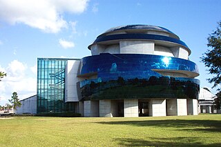
The Museum of Science & Industry (MOSI) is a non-profit science museum located in Tampa, Florida.

The Weather Prediction Center (WPC), located in College Park, Maryland, is one of nine service centers under the umbrella of the National Centers for Environmental Prediction (NCEP), a part of the National Weather Service (NWS), which in turn is part of the National Oceanic and Atmospheric Administration (NOAA) of the U.S. Government. Until March 5, 2013 the Weather Prediction Center was known as the Hydrometeorological Prediction Center (HPC). The Weather Prediction Center serves as a center for quantitative precipitation forecasting, medium range forecasting, and the interpretation of numerical weather prediction computer models.

The Byrd Polar and Climate Research Center (BPCRC) is a polar, alpine, and climate research center at The Ohio State University founded in 1960.
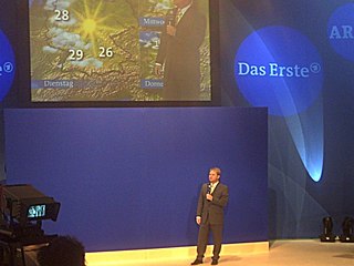
A weather presenter is a person who presents the weather forecast daily on radio, television or internet news broadcasts. Using diverse tools, such as projected weather maps, they inform the viewers of the current and future weather conditions, explain the reasons underlying this evolution, and relay to the public any weather hazards and warnings issued for their region, country or larger areas. A weather presenter is not necessarily qualified as a meteorologist. Preparation to become a weather presenter varies by country and media; it can range from an introduction to meteorology for a television host to a diploma in meteorology from a recognized university. Therefore a weather presenter is not to be confused with a meteorologist, or weather forecaster.
This is a list of meteorology topics. The terms relate to meteorology, the interdisciplinary scientific study of the atmosphere that focuses on weather processes and forecasting.
The National Severe Storms Laboratory (NSSL) is a National Oceanic and Atmospheric Administration (NOAA) weather research laboratory under the Office of Oceanic and Atmospheric Research. It is one of seven NOAA Research Laboratories (RLs).

The NASA QuikSCAT was an Earth observation satellite carrying the SeaWinds scatterometer. Its primary mission was to measure the surface wind speed and direction over the ice-free global oceans via its effect on water waves. Observations from QuikSCAT had a wide array of applications, and contributed to climatological studies, weather forecasting, meteorology, oceanographic research, marine safety, commercial fishing, tracking large icebergs, and studies of land and sea ice, among others. This SeaWinds scatterometer is referred to as the QuikSCAT scatterometer to distinguish it from the nearly identical SeaWinds scatterometer flown on the ADEOS-2 satellite.

The US National Center for Atmospheric Research is a US federally funded research and development center (FFRDC) managed by the nonprofit University Corporation for Atmospheric Research (UCAR) and funded by the National Science Foundation (NSF). NCAR has multiple facilities, including the I. M. Pei-designed Mesa Laboratory headquarters in Boulder, Colorado. Studies include meteorology, climate science, atmospheric chemistry, solar-terrestrial interactions, environmental and societal impacts.
Volumetric Imaging and Processing of Integrated Radar, known by the acronym VIPIR, is an analysis and display program for Doppler weather radar, created and sold by Baron Services. This software allows improved analysis of radar data for private users, in particular television stations, similar to the Weather Decision Support System program used by the National Weather Service.

The radius of maximum wind (RMW) is the distance between the center of a cyclone and its band of strongest winds. It is a parameter in atmospheric dynamics and tropical cyclone forecasting. The highest rainfall rates occur near the RMW of tropical cyclones. The extent of a cyclone's storm surge and its maximum potential intensity can be determined using the RMW. As maximum sustained winds increase, the RMW decreases. Recently, RMW has been used in descriptions of tornadoes. When designing buildings to prevent against failure from atmospheric pressure change, RMW can be used in the calculations.

Tropical cyclone forecasting is the science of forecasting where a tropical cyclone's center, and its effects, are expected to be at some point in the future. There are several elements to tropical cyclone forecasting: track forecasting, intensity forecasting, rainfall forecasting, storm surge, tornado, and seasonal forecasting. While skill is increasing in regard to track forecasting, intensity forecasting skill remains unchanged over the past several years. Seasonal forecasting began in the 1980s in the Atlantic basin and has spread into other basins in the years since.
Convective storm detection is the meteorological observation, and short-term prediction, of deep moist convection (DMC). DMC describes atmospheric conditions producing single or clusters of large vertical extension clouds ranging from cumulus congestus to cumulonimbus, the latter producing thunderstorms associated with lightning and thunder. Those two types of clouds can produce severe weather at the surface and aloft.

Weather reconnaissance is the acquisition of weather data used for research and planning. Typically the term reconnaissance refers to observing weather from the air, as opposed to the ground.
The following is a glossary of tornado terms. It includes scientific as well as selected informal terminology.

Hurricane Harvey was a devastating Category 4 hurricane that made landfall on Texas and Louisiana in August 2017, causing catastrophic flooding and more than 100 deaths. It is tied with 2005's Hurricane Katrina as the costliest tropical cyclone on record, inflicting $125 billion in damage, primarily from catastrophic rainfall-triggered flooding in the Houston metropolitan area and Southeast Texas; this made the storm the costliest natural disaster recorded in Texas at the time. It was the first major hurricane to make landfall in the United States since Wilma in 2005, ending a record 12-year span in which no hurricanes made landfall at the intensity of a major hurricane throughout the country. In a four-day period, many areas received more than 40 inches (1,000 mm) of rain as the system slowly meandered over eastern Texas and adjacent waters, causing unprecedented flooding. With peak accumulations of 60.58 in (1,539 mm), in Nederland, Texas, Harvey was the wettest tropical cyclone on record in the United States. The resulting floods inundated hundreds of thousands of homes, which displaced more than 30,000 people and prompted more than 17,000 rescues.


