
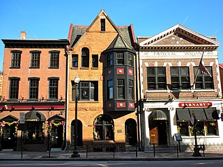
Concord is the capital city of the U.S. state of New Hampshire and the seat of Merrimack County. As of the 2020 census the population was 43,976, making it the 3rd most populous city in New Hampshire after Manchester and Nashua.

The Loop is Chicago's central business district and one of the city's 77 municipally recognized community areas. Located at the center of downtown Chicago on the shores of Lake Michigan, it is the second-largest business district in North America after Midtown Manhattan. The headquarters and regional offices of several global and national businesses, retail establishments, restaurants, hotels, and theaters–as well as many of Chicago's most famous attractions–are located in the Loop. The neighborhood also hosts Chicago's City Hall, the seat of Cook County, offices of other levels of government, and several foreign consulates. The intersection of State Street and Madison Street in the Loop is the origin point for the address system on Chicago's street grid.

Tracy is the second most populated city in San Joaquin County, California, United States. The population was 93,000 at the 2020 census. Tracy is located inside a geographic triangle formed by Interstate 205 on the north side of the city, Interstate 5 to the east, and Interstate 580 to the southwest.

Wilmington is the most populous city in the U.S. state of Delaware. The city was built on the site of Fort Christina, the first Swedish settlement in North America. It lies at the confluence of the Christina River and Brandywine Creek, near where the Christina flows into the Delaware River. It is the county seat of New Castle County and one of the major cities in the Delaware Valley metropolitan area. Wilmington was named by Proprietor Thomas Penn after his friend Spencer Compton, Earl of Wilmington, who was prime minister during the reign of George II of Great Britain.

Newport is a home rule-class city at the confluence of the Ohio and Licking rivers in Campbell County, Kentucky, United States. The population was 14,150 at the 2020 census. Historically, it was one of four county seats of Campbell County. Newport is a major urban center of Northern Kentucky and is part of the Cincinnati metropolitan area.

Nashua is a city in southern New Hampshire, United States. As of the 2020 census, it had a population of 91,322, the second-largest in northern New England after nearby Manchester. It is one of two county seats of New Hampshire's most populous county, Hillsborough; the other being Manchester.
West Chester is a borough and the county seat of Chester County, Pennsylvania, United States. Located in the Philadelphia metropolitan area, the borough had a population of 18,461 at the 2010 census. West Chester is the mailing address for most of its neighboring townships. When calculated by mailing address, the population as of the 2010 U.S. census was 108,696, which would make it the 10th-largest city by mailing address in Pennsylvania.

The Near South Side is a community area of Chicago, Illinois, United States, just south of the downtown central business district, the Loop. The Near South Side's boundaries are as follows: North—Roosevelt Road ; South—26th Street; West—Chicago River between Roosevelt and 18th Street, Clark Street between 18th Street and Cermak Road, Federal between Cermak Road and the Stevenson Expressway just south of 25th Street, and Clark Street again between the Stevenson and 26th Street; and East—Lake Michigan.
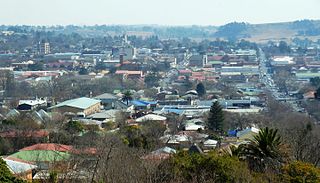
Bethlehem is a city in the eastern Free State province of South Africa that is situated on the Liebenbergs River along a fertile valley just north of the Rooiberg Mountains on the N5 road. It is the fastest growing city in the Free State province, with its target of being the third largest city after Bloemfontein and Welkom.

Interstate 205 (I-205) is an east–west auxiliary Interstate Highway in the San Joaquin Valley in Northern California. It runs from I-5 west to I-580. Along with those highways, I-205 forms the north side of a triangle around the city of Tracy. The route provides access from the San Francisco Bay Area to the northern San Joaquin Valley.
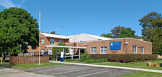
Keira High School is a government-funded co-educational comprehensive secondary day school, located in Lysaght Street, North Wollongong, in the Illawarra region of New South Wales, Australia.
Killara High School is a coeducational public secondary school, located on Koola Avenue in East Killara, Sydney. Established in 1968, Killara High School is one of the highest performing comprehensive non-selective public schools in the state. The success of the school in the Higher School Certificate (HSC) and its reputation as a school with an extensive program of curriculum enrichment make the school highly desirable. Activities such as music, art, dance, drama, debating, sport and strong participation in the Duke of Edinburgh's Award Scheme are included in the co-curricular program. Enrolment rose 21% from 2002 to a population of 1400 students in 2009. It now has 1580 students (2016). Currently, accepted catchment areas include Roseville, Lindfield, East Lindfield, West Killara, Killara, East Killara, West Gordon and East Gordon.
École Secondaire South Kamloops Secondary School (SKSS), Home of the Titans, is a grade 8-12 school in Kamloops, British Columbia, Canada. It was formed in 1904 under the name Kamloops High School, and moved to its present campus in 1952. It gained the name South Kamloops Secondary School in 2003 through the merger of John Peterson Secondary School and Kamloops Secondary School, two secondary schools located adjacently on the same block.

Center City includes the central business district and central neighborhoods of Philadelphia, Pennsylvania, United States. It comprises the area that made up the City of Philadelphia prior to the Act of Consolidation, 1854, which extended the city borders to be coterminous with Philadelphia County.

Concord High School is a public high school in Concord, New Hampshire, in the United States.
Kingston High School is a comprehensive four-year school with an enrollment of approximately 2,500 students and staff located off of Broadway, Andrew Street, and West O’Reilly Street in Kingston, New York, United States.
Kewanee High School, or KHS, is a public four-year high school located at 1211 E. Third Street in Kewanee, Illinois, a city in Kewanee Township of Henry County, Illinois, in the Midwestern United States. KHS is part of Kewanee Community Unit School District 229, which also includes Central Junior High School, Central Elementary School, Irving Elementary School, Belle Elementary School, and Lyle Preschool. The campus is 40 miles (64 km) northeast of Galesburg, Illinois, 44 miles (71 km) southeast of Moline, Illinois, and serves a mixed city and rural residential community. The school is one of two high schools in the city of Kewanee, the other being Wethersfield High School. The school is within the Davenport-Moline-Rock Island, IA-IL metropolitan statistical area.
Tracy Unified School District is a public school district in Tracy, California, United States. As of 2006-07, there were 23 schools in the district.

The Corbin Building is a historic office building at the northeast corner of John Street and Broadway in the Financial District of Manhattan in New York City. It was built in 1888–1889 as a speculative development and was designed by Francis H. Kimball in the Romanesque Revival style with French Gothic detailing. The building was named for Austin Corbin, a president of the Long Island Rail Road who also founded several banks.
Prairie Avenue is a north–south street on the South Side of Chicago, which historically extended from 16th Street in the Near South Side to the city's southern limits and beyond. The street has a rich history from its origins as a major trail for horseback riders and carriages. During the last three decades of the 19th century, a six-block section of the street served as the residence of many of Chicago's elite families and an additional four-block section was also known for grand homes. The upper six-block section includes part of the historic Prairie Avenue District, which was declared a Chicago Landmark and added to the National Register of Historic Places.
