John Wright (businessman)

Last updated

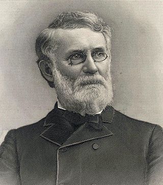
John Wright was an emigrant English pioneer, colonial period businessman who established Wright's Ferry (and eventually the town eponymously named for it). The resulting increase in settlement triggered nine years of armed conflict during the Maryland-Pennsylvania boundary dispute known as Cresap's War. The animal powered ferry was the very first means of crossing the broad unfriendly Susquehanna River in a region known as Conejohela Valley nearly halfway between what became Lancaster County, Pennsylvania, and York County, Pennsylvania.

Contents

Wright was a Quaker who first came to the area in 1724 to explore the land and preach to the local Native Americans. In 1730, he was granted a patent to operate a ferry across the river and subsequently established the ferry with Robert Barber and Samuel Blunston. He also built a ferry house and a tavern on the eastern shore of the Susquehanna, north of Locust Street, on Front Street in Wright's Ferry, as the town was then known. The two-story log tavern, operated by John Wright, Jr. until 1834, consisted of a large room on either end connected by a passageway. When John Jr. married, he moved to York County’s western shore at Wright's Ferry West (later to be named Wrightsville), and built another ferry house and tavern. The ferry itself consisted of two dugout canoes fastened together with carriage and wagon wheels. When numerous cattle were moved, the canoeist guided a lead animal with a rope so that the others would follow. If the lead animal became confused and started swimming in circles, however, the other animals followed until they tired and eventually drowned.

Extracts from Columbia, Pennsylvania

In 1724, John Wright, an English Quaker, traveled to the area (then a part of Chester County) to explore the land and proselytize to a Native American tribe, the Shawnee, who had established a settlement along a creek known as Shawnee Creek, which is still called that today. Wright built a log cabin near there on part of a tract of land first granted to George Beale by William Penn in 1699, and stayed for more than a year. The area was known as Shawanatown.

When Wright returned in 1726 with Robert Barber and Samuel Blunston, he and the others began developing the area, with Wright building a house about a hundred yards from the edge of the Susquehanna River, in the area of South Second and Union Streets. This structure eventually became home to the Wright family, including sons John Jr. and James. One of his daughters, the poet and businesswoman Susanna, born in England in 1697, arrived in the area in 1718, and later moved to the family residence to help take care of her brothers and sisters after her mother died.

Robert Barber constructed a saw mill in 1727 and years later built a home near the river, on the Washington Boro Pike, along what is now Route 441. The home still stands across from the Columbia Wastewater Treatment Plant and is the second oldest in the borough, after the Wright’s Ferry Mansion.

Samuel Blunston constructed a mansion, which he named Bellmont, atop the hill next to North Second Street, near Chestnut Street, at the location of the present-day Rotary Park Playground. Upon his death, Blunston willed the mansion to Susanna Wright, who had become a close friend. She lived there, occasionally visiting brother James, ministering to the Native Americans, and raising silkworms for the local silk industry, until her death in 1784 at the age of 87. The residence was demolished in the late 1920s to allow for construction of the Veterans’ Memorial Bridge.

In 1730, John Wright was granted a patent to operate a ferry across the Susquehanna River and subsequently established the ferry, known as Wright's Ferry, with Barber and Blunston. He also built a ferry house and a tavern on the eastern shore, north of Locust Street, on Front Street. The two-story log tavern, operated by John Wright, Jr. until 1834, consisted of a large room on either end connected by a passageway. When John Jr. married, he moved to York County’s western shore, in what became Wrightsville, and built a ferry house and tavern. The ferry itself consisted of two dugout canoes fastened together with carriage and wagon wheels. When numerous cattle were moved, the canoeist guided a lead animal with a rope so that the others would follow. If the lead animal became confused and started swimming in circles, however, the other animals followed until they tired and eventually drowned.

Traffic heading west from Lancaster, Philadelphia, and other nearby towns regularly traveled through Columbia, using the ferry to cross the Susquehanna. As traffic flow increased, the ferry grew, to the point of including canoes, rafts, flatboats, and steamboats, and was capable of handling Conestoga Wagons and other large vehicles. Due to the volume of traffic, however, wagons, freight, supplies and people often became backed up, creating a waiting period of several days to cross the river. With 150 to 200 vehicles lined up on the Columbia side, ferrymen used chalk to number the wagons. Typical fares were as follows:

Fares were reduced in 1787 due to competition from Anderson's Ferry, located further upstream, near Marietta. Wright’s Ferry was located immediately south of the Veterans Memorial Bridge along Route 462. In later years, Wright rented the ferry to others and eventually sold it.

Founding father

In 1729, after Wright had petitioned William Penn’s son to create a new county, the provincial government took land from Chester County to establish Lancaster County, the fourth county in Pennsylvania. County residents - Indians and colonists alike - regularly traveled to Wright’s home to file papers and claims, seek government assistance and redress of issues, and register land deeds. During this time, the town was called “Wright’s Ferry.”

In 1738, James Wright built the Wright’s Ferry Mansion, the oldest existing house in Columbia, for his family. The structure can still be seen at Second and Cherry Streets.

Columbia

Samuel Wright, son of James and Rhoda Wright, was born on May 12, 1754. He eventually became the town proprietor and created a public grounds company to administer the land. Through his trusteeship, the town’s first water distribution system (later The Columbia Water Company) was established and created, as well as “The Washington Institute,” the town’s first school of higher learning, and the Locust Street Park, located next to what is now Locust Street and Route 462.

In the spring of 1788 Samuel Wright had the area surveyed, and formally laid out the town into 160 building lots, which were chanced off by lottery at 15 shillings per ticket. "Adventurers" as purchasers were known, included speculators from many areas of the country. Wright and town citizens renamed the town “Columbia” in honor of Christopher Columbus in the hope of influencing the U.S. Congress to select it as the nation’s capital, a plan George Washington favored. [1] A formal proposal to do so was made in 1789. Unfortunately for the town, when Congress voted in 1790, the final tally was one vote short. Later, Columbia narrowly missed becoming the capital of Pennsylvania. Harrisburg was chosen instead, since it is closer to the state’s geographical center. The third strikeout was despite its competitive location in regards to transportation, coal, and steel, resources, Columbia narrowly lost out to Detroit during the selection process for a center for the new automotive industry.

See also

Related Research Articles

<span class="mw-page-title-main">Columbia, Pennsylvania</span> Borough in Pennsylvania, United States

Columbia, formerly Wright's Ferry, is a borough (town) in Lancaster County, Pennsylvania, United States. As of the 2020 census, it had a population of 10,222. It is 28 miles (45 km) southeast of Harrisburg, on the east (left) bank of the Susquehanna River, across from Wrightsville and York County and just south of U.S. Route 30.

<span class="mw-page-title-main">Port Deposit, Maryland</span> Historic district in Maryland, United States

Port Deposit is a town in Cecil County, Maryland, United States. It is located on the east bank of the Susquehanna River near its discharge into the Chesapeake Bay. The population was 653 at the 2010 census.

<span class="mw-page-title-main">Wrightsville, Pennsylvania</span> Borough in Pennsylvania, United States

Wrightsville is a borough that is located in York County, Pennsylvania, United States. The population was 2,257 at the time of the 2020 census.

<span class="mw-page-title-main">Susquehanna River</span> Major river in the Northeastern United States

The Susquehanna River is a major river located in the Mid-Atlantic region of the United States, overlapping between the lower Northeast. At 444 miles (715 km) long, it is the longest river on the East Coast of the United States. By watershed area, it is the 16th-largest river in the United States, and also the longest river in the early 21st-century continental United States without commercial boat traffic.

<span class="mw-page-title-main">Columbia–Wrightsville Bridge</span> Road and sidewalk overpass in Pennsylvania

The Columbia–Wrightsville Bridge, officially the Veterans Memorial Bridge, spans the Susquehanna River between Columbia and Wrightsville, Pennsylvania, and carries Pennsylvania Route 462 and BicyclePA Route S. Built originally as the Lancaster-York Intercounty Bridge, construction began in 1929, and the bridge opened September 30, 1930. On November 11, 1980, it was officially dedicated as Veterans Memorial Bridge, though it is still referenced locally as the Columbia–Wrightsville Bridge.

John Harris Sr. was an American businessman who emigrated from Britain to America late in the 17th century. Harris would later settle along the Susquehanna River and establish a ferry there. This ferry would eventually develop into Harrisburg, Pennsylvania, which was named in his honor.
<span class="mw-page-title-main">Wright's Ferry Bridge</span> Bridge over the Susquehanna River in Pennsylvania, U.S.

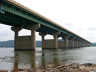
The Wright's Ferry Bridge carries U.S. Route 30 (US 30) over the Susquehanna River between Columbia and Wrightsville, Pennsylvania. The "Wright's Ferry" in its name commemorates the first ferry across the Susquehanna River.

<span class="mw-page-title-main">Pennsylvania Railroad Bridge (Columbia, Pennsylvania)</span> Bridge in the United States

The Pennsylvania Railroad Bridge once carried the York Branch of the Pennsylvania Railroad across the Susquehanna River between Columbia and Wrightsville, Pennsylvania and is therefore considered a Columbia-Wrightsville Bridge. It and its predecessors were a vital commercial and passenger linkage between Philadelphia and Baltimore for over 100 years.

<span class="mw-page-title-main">Safe Harbor Dam</span> Dam in Pennsylvania, USA

The Safe Harbor Dam is a concrete gravity dam, with an associated hydroelectric power station, on the lower Susquehanna River. It is the most northerly and last of three Great Depression-era public electrification projects' hydroelectric dams, and was constructed between April 1, 1930, and December 7, 1931. It created a long and relatively shallow lake, known as Lake Clarke, along the upper stretch of the Conejohela Valley. The creation of the lake shrank the upper Conejohela Flats in size.

<span class="mw-page-title-main">Cresap's War</span> Border conflict between the British colonies of Pennsylvania and Maryland (1730–67)

Cresap's War was a border conflict between Pennsylvania and Maryland, fought in the 1730s. Hostilities erupted in 1730 with a series of violent incidents prompted by disputes over property rights and law enforcement, and escalated through the first half of the decade, culminating in the deployment of military forces by Maryland in 1736 and by Pennsylvania in 1737. The armed phase of the conflict ended in May 1738 with the intervention of King George II, who compelled the negotiation of a cease-fire. A final settlement was not achieved until 1767 when the Mason–Dixon line was recognized as the permanent boundary between the two colonies.
<span class="mw-page-title-main">Henry H. Houston</span> American businessman

Henry H. Houston was a leading Philadelphia businessman and philanthropist. He worked in iron and transportation industries and invested in oil and precious metal concerns. He sat on boards of a number of railroad organizations and he was trustee of the University of Pennsylvania and Washington and Lee University. He developed Wissahickon Heights, an exclusive community in western Chestnut Hill.

<span class="mw-page-title-main">Chickies Ridge</span>

Chickies Ridge is a long ridge in West Hempfield Township, Lancaster County, Pennsylvania, terminating at the west end in an outcropping overlooking the Susquehanna River, known as Chickies Rock.

<span class="mw-page-title-main">Pennsylvania Route 624</span> State highway in York County, Pennsylvania, US

Pennsylvania Route 624 is a north–south state route located in southern central Pennsylvania. Its southern terminus is at PA 24 in Red Lion. The northern terminus is at PA 462 in Wrightsville near the Columbia–Wrightsville Bridge that carries PA 462 across the Susquehanna River. PA 624 is a two-lane undivided road that runs through rural areas in eastern York County. The route heads northeast from Red Lion and passes through Windsor before it comes to an intersection with PA 124 and PA 425 in Craley. PA 624 continues northeast before it turns north and follows the western bank of the Susquehanna River to Wrightsville. PA 224 was originally designated in 1928 to run from Red Lion north to U.S. Route 30 in Wrightsville. The route was extended south to PA 24/PA 74 in Red Lion by 1930. In the 1930s, PA 224 was renumbered to PA 624 to avoid confusion with US 224. The south end of PA 624 was moved to its current location in the 1960s following a rerouting of PA 24.

<span class="mw-page-title-main">Great Indian Warpath</span> Trails in eastern North America used by Native Americans

The Great Indian Warpath (GIW)—also known as the Great Indian War and Trading Path, or the Seneca Trail—was that part of the network of trails in eastern North America developed and used by Native Americans which ran through the Great Appalachian Valley. The system of footpaths extended from what is now upper New York to deep within Alabama. Various Native peoples traded and made war along the trails, including the Catawba, numerous Algonquian tribes, the Cherokee, and the Iroquois Confederacy. The British traders' name for the route was derived from combining its name among the northeastern Algonquian tribes, Mishimayagat or "Great Trail", with that of the Shawnee and Delaware, Athawominee or "Path where they go armed".

<span class="mw-page-title-main">History of Lycoming County, Pennsylvania</span>

This article details a history of Lycoming County, Pennsylvania.

<span class="mw-page-title-main">Washington Boro, Pennsylvania</span> Census-designated place in Pennsylvania, United States

Washington Boro is an unincorporated community and census-designated place (CDP) in Manor Township, Lancaster County, Pennsylvania, United States, along the Susquehanna River. The ZIP code is 17582. It is served by the Penn Manor School District and is the terminus of Pennsylvania Route 441 and Pennsylvania Route 999. As of the 2010 census, the population was 729.

Colonel Thomas Cresap (c.1702—c.1790) was an English-born settler and trader in the states of Maryland and Pennsylvania. Cresap served Lord Baltimore as an agent in the Maryland–Pennsylvania boundary dispute that became known as Cresap's War. Later, together with the Native American chief Nemacolin, Cresap improved a Native American path to the Ohio Valley, and ultimately settled and became a large landowner near Cumberland, Maryland, where he was involved in further disputes near Brownsville, Pennsylvania, including in the French and Indian War and Lord Dunmore's War.

<span class="mw-page-title-main">Wright's Ferry</span>

Wright's Ferry was a Pennsylvania Colony settlement established by John Wright in 1726, that grew up around the site of an important Inn and Pub anchoring the eastern end of a popular animal powered ferry (1730–1901) and now a historic part of Columbia, Pennsylvania. The complex was important in settling the lands west of the cranky Susquehanna, for without resorting to water craft, the ferry was the first means of crossing the wide watercourse of the relatively shallow Susquehanna River for settlers with a cargo in the southern part of Pennsylvania—which is very wide from Middletown, Dauphin County southerly past Wright's Ferry and grows steadily wider as it nears its mouth at the Chesapeake Bay, and whose banks are steep enough to prevent easy cargo handling from small boats.

The Conejohela Flats are a group of islands in the flooded Conejohela Valley, a large floodplain along the southernmost 30 miles (50 km) of the Susquehanna River in Pennsylvania and Maryland in the United States. The valley was flooded primarily during the early 1900s by the construction of the Holtwood, Conowingo, and Safe Harbor dams from 1910 to 1931.

Susanna Wright was an 18th-century colonial English American poet, pundit, botanist, business owner, and legal scholar who was influential in the political economy of the Province of Pennsylvania, one of the Thirteen Colonies that ultimately engaged in the American Revolution and founded the United States.

References

  1. Sheldon, 2006, p. 38.