Clear Creek County is a county located in the U.S. state of Colorado. As of the 2020 census, the population was 9,397. The county seat is Georgetown.
Cooper Landing is a census-designated place (CDP) in Kenai Peninsula Borough, Alaska, United States, about 100 miles (160 km) south of Anchorage, at the outlet of Kenai Lake into the Kenai River. The town was first settled in the 19th century by gold and mineral prospectors, and has become a popular summer tourist destination thanks to its scenic location and proximity to the salmon fishery of the Kenai River and Russian River. As of the 2010 census, the population in Cooper Landing was 289, down from 369 in 2000.

Crown Point is a census-designated place (CDP) in Kenai Peninsula Borough, Alaska, United States. The population was 74 at the 2010 census. Land access to this area is by either the Alaska Railroad or the Seward Highway.
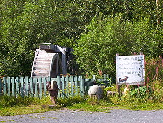
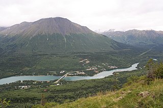
Moose Pass is a census-designated place (CDP) in Kenai Peninsula Borough, Alaska, United States. The population was 219 at the 2010 census, up from 206 in 2000.

Bragg Creek is a hamlet in southern Alberta under the jurisdiction of Rocky View County in Division No. 6.

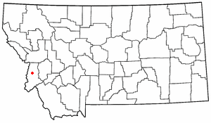
Middle Park is a high basin in the Rocky Mountains of north-central Colorado in the United States. It is located in Grand County, on the southwest slope of Rocky Mountain National Park, approximately 50 miles (80 km) west of Boulder.
Alberta Provincial Highway No. 16, commonly referred to as Highway 16, is a major east–west highway in central Alberta, Canada, connecting Jasper to Lloydminster via Edmonton. It forms a portion of the Yellowhead Highway, a major interprovincial route of the Trans-Canada Highway system that stretches from Masset, British Columbia, to Portage la Prairie, Manitoba, near Winnipeg. Highway 16 spans approximately 634 km (394 mi) from Alberta's border with British Columbia in the west to its border with Saskatchewan in the east. As of 2010, all but less than 96 km (60 mi) of the route was divided, with a minimum of two lanes in each direction. It is designated a core route in Canada's National Highway System.

Chugach State Park covers 495,204 acres covering a hilly region immediately east of Anchorage, in south-central Alaska.

The Midland Trail, also called the Roosevelt Midland Trail, was a national auto trail spanning the United States from Washington, D.C., west to Los Angeles, California and San Francisco, California. First road signed in 1913, it was one of the first, if not the first, marked transcontinental auto trails in America.

Washington Pass and Rainy Pass are two mountain passes on State Route 20 in the North Cascades mountains of Washington state. Rainy Pass is about 4 miles to the west of Washington Pass. The passes are typically closed between November and April due to heavy snowfall.
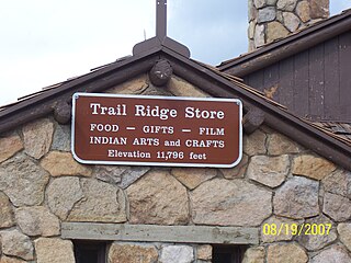
Fall River Pass is a mountain pass in northern Colorado, in the Rocky Mountains of the western United States. It is located in the Front Range, within Rocky Mountain National Park. The pass is traversed by U.S. Highway 34 on Trail Ridge Road between Granby and Estes Park. However, as at Milner Pass on the Continental Divide, the road does not descend after reaching the pass from the west, but instead continues to climb along a side ridge; thus, neither pass is the high point on Trail Ridge Road, which crests at 12,183 feet (3,713 m) elevation, east of Fall River Pass, still within Rocky Mountain National Park. On the other hand, the old, largely unpaved, and one-way-uphill Fall River Road does have its summit at Fall River Pass, where it joins the modern highway for the descent to the west.

Turnagain Pass is a mountain pass just south of the municipal limits of Anchorage, Alaska. It is located in the northeastern part of Kenai Peninsula Borough. The pass marks the highest point on the Seward Highway at approximately milepost 70. Traveling north, the Seward Highway descends into the Anchorage bowl and begins to round the Turnagain Arm.

Snoqualmie Pass is a mountain pass that carries Interstate 90 (I-90) through the Cascade Range in the U.S. state of Washington. The pass summit is at an elevation of 3,015 feet (919 m), on the county line between Kittitas County and King County.
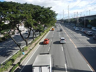
The Marikina–Infanta Highway, also known as Marilaque Highway, as well as its former name Marcos Highway, Marilaque Road or Marikina-Infanta Road, is a scenic mountain 117.5-kilometer (73.0 mi) highway that connects Metro Manila with Infanta, Quezon in the Philippines. Motorists colloquially refer to the road as Marilaque Highway.

Heckman Pass is a mountain pass in the Rainbow Range of west-central British Columbia, Canada, located west of Anahim Lake on the divide between the Chilcotin Plateau and the Bella Coola Valley. It is used by British Columbia Highway 20 and was the route used by Alexander Mackenzie on his journey to the Pacific Coast at Bella Coola via the grease trail along the West Road River from the Fraser.

Trail Creek also known as Trail River is a stream in the Chugach Mountains near Moose Pass, Alaska. It flows through the Trail Lakes and ends at Kenai Lake. There is a USFS campground near where the river empties into Kenai Lake, the river can be fished in the late summer for various species of trout.
Abo Canyon, also known as Abo Pass, is a mountain pass at the southern end of the Manzano Mountains of central New Mexico in the Southwest United States.

Indian is a community in the Municipality of Anchorage, Alaska, United States. It lies in a valley in the Chugach Mountains near the middle of the north shore of the Turnagain Arm of Cook Inlet. It is about 24 miles (39 km) southeast of downtown Anchorage and about 3 miles (4.8 km) northwest of Bird, and about 13 miles (21 km) west-northwest of Girdwood.