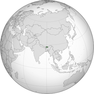
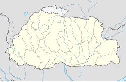
Transport in Bhutan uses about 8,000 kilometres (5,000 mi) of roads and four airports, three of which are operational and interconnected. Paro Airport is the only airport which accommodates international flights. As part of Bhutan's infrastructure modernization programs, its road system has been under development since the 1960s. There are no railways, and as Bhutan is a landlocked country with no major waterways, there are no ports.

Trashigang District is Bhutan's easternmost dzongkhag (district).

Samdrup Jongkhar District is one of the 20 dzongkhags (districts) in Bhutan. The dominant languages of the district are Tshangla (Sharchopkha) in the north and west, and Lhotsam in the east. It covers a total area of 1878 sq km. Samdrup Jongkhar Dzongkhag comprises two Dungkhags which are Jomotsangkha and Samdrupcholing, and 11 Gewogs.
The Sharchops are the populations of mixed Tibetan, Southeast Asian and South Asian descent that mostly live in the eastern districts of Bhutan.
Kokrajhar is a town in the Bodoland Territorial Region, an autonomous territory in Assam, one of the North Eastern states of India.

Jaigaon is a census town in Alipurduar subdivision under Kalchini Block of Alipurduar district in the state of West Bengal, India. It is located on the country's border with Bhutan, and Bhutan Gate separates the two countries. Phuentsholing is the Bhutan's nearest city to Jaigaon. Bhutan does not have domestic roads linking all its towns, so it uses roads passing through Jaigaon to reach destinations such as Samtse, Gomtu, Nganglam and Samdrup Jongkhar.
Immigration to Bhutan has an extensive history and has become one of the country's most contentious social, political, and legal issues. Since the twentieth century, Bhutanese immigration and citizenship laws have been promulgated as acts of the royal government, often by decree of the Druk Gyalpo on advice of the rest of government. Immigration policy and procedure are implemented by the Lhengye Zhungtshog Ministry of Home and Cultural Affairs, Department of Immigration. Bhutan's first modern laws regarding immigration and citizenship were the Bhutanese Citizenship Act 1958 and subsequent amendments in 1977. The 1958 Act was superseded by the Bhutanese Citizenship Act 1985, which was then supplemented by a further Immigration Act in 2007. The Constitution of 2008 included some changes in Bhutan's immigration laws, policy, and procedure, however prior law not inconsistent with the 2008 Constitution remained intact. Bhutan's modern citizenship laws and policies reinforce the institution of the Bhutanese monarchy, require familiarity and adherence to Ngalop social norms, and reflect the social impact of the most recent immigrant groups.
Samdrup Jongkhar (Dzongkha:བསམ་གྲུབ་ལྗོངས་མཁར་) is a town and seat of Samdrup Jongkhar District in Bhutan.
Numerous ethnic groups inhabit Bhutan, but the Ngalop people who speak the Dzongkha language constitute a majority of the Bhutanese population. The Bhutanese are of four main ethnic groups, which themselves are not necessarily exclusive – the politically and culturally dominant Ngalop of western and northern Bhutan, the Sharchop of eastern Bhutan, the Lhotshampa concentrated in southern Bhutan, and Bhutanese tribal and aboriginal peoples living in villages scattered throughout Bhutan.
Gelephu, also spelled as Gelyephug, Gelegphu, Gaylegphug, or Gaylephug, is a town or Thromde in Sarpang District in Bhutan. It is located on the Indian border, about 30 km to the east of Sarpang, the Dzongkhag (District) headquarters, and has a population of 9,858 as per the 2017 census. It is one of the road entry points into Bhutan from India; Phuntsholing to its west and Samdrup Jongkhar to its east are two other road entry points into Bhutan.

Baksa district is an administrative district in the Bodoland Territorial Region of Assam, one of the North-Eastern states of India. The administrative headquarters is at Mushalpur. Manas National Park is a part of this district.
Deothang, also known as Dewathang, is a town in south-eastern Bhutan which falls under Samdrup Jongkhar District. In 2010 it became part of Samdrup Jongkhar municipality (thromde).
Jomotsangkha is a town in south-eastern Bhutan, located in Samdrup Jongkhar District. At the 2005 census, it had a population of 957. It is connected by road with the Indian town of Bhairabkunda.

The visa policy of the Kingdom of Bhutan is strictly regulated under the policy of "High Value, Low Volume" tourism, in order to minimize the effect on the country's unique society and environment. Bhutanese policy ensures that only an acceptable number of tourists enter the country at a time, preventing the country from being overwhelmed by mass tourism and consequently changing its character, and that tourists who do arrive get the best experience and value from their visit.

Sakteng Wildlife Sanctuary is a wildlife sanctuary in Bhutan, located in Merak and Sakteng Gewogs of Trashigang District and just crossing the border into Samdrup Jongkhar District. It is one of the country's protected areas and is listed as a tentative site in Bhutan's Tentative List for UNESCO inclusion.

Operation All Clear was a military operation conducted by Royal Bhutan Army forces against Assam separatist insurgent groups in the southern regions of Bhutan between 15 December 2003 and 3 January 2004. It was the first operation ever conducted by the Royal Bhutan Army.
National Highway 715A, commonly called NH 715A is a national highway in India. It is a spur road of National Highway 15. NH-715A traverses between Jagiroad and Harishinga in the state of Assam in India.
Bhairabkunda Shiva Mandir or Daifam Shiv Mandir is one of the most important Hindu temples in Bhutan. It is the only Shakti Peetha in Bhutan. It is located in the south east corner of Bhutan near the town of Jomotsangkha (Daifam) and it shares border with the Indian states of Arunachal Pradesh to East and Assam to the South. It is located 24 km from the Indian town of Udalguri in Assam.

In 2001, about 10 per cent of the population of Bhutan's capital city Thimphu were living in squatted informal settlements; by 2019, the figure had dropped to 2 per cent since the squatters had been rehoused. There are also rudimentary settlements on the periphery of other cities such as Phuntsholing and Samdrup Jongkhar. The inhabitants work as manual labourers or in the informal economy.
Bhuragaon-Kaupati bridge is a 7.63-kilometre-long (4.74 mi) proposed concrete road bridge on National Highway-715A (NH 715A) over the Brahmaputra River in Assam. It will connect Kaupati in Darrang district on the northern bank with Bhuragaon in Morigaon District on the southern bank.


