Jordan Burn

Last updated

The Jordan Burn about to enter a culvert on its way to Blackford Jordan Burn 1.JPG
The Jordan Burn about to enter a culvert on its way to Blackford
The Jordan Burn near Canaan Lane Jordan Burn 2.JPG
The Jordan Burn near Canaan Lane

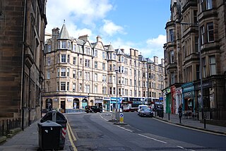
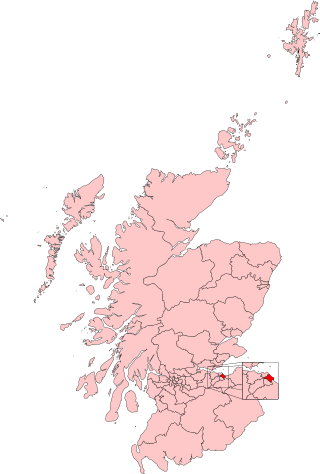
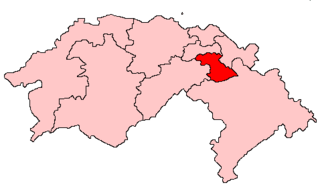
The Jordan Burn, is the name of a stream, now culverted for much of its course, that runs through the Victorian suburb of Morningside in Edinburgh, Scotland, and was until 1856 the southern boundary of the city and county. It is a tributary of the Braid Burn. Its eastern part is known as the Pow Burn.

The Jordan first appears so named on the Roy map of Edinburgh (1753) "in obvious allusion to its position between 'Egypt' and 'Canaan'" (see below). [1] It was originally called the Pow Burn when the Wester Burgh Muir, the area that became Morningside, was first feued by the Edinburgh magistrates in 1586. [2] It was also popularly known in the past as the "Braid Burn", because it marked the northern boundary of the Braid Estate, but should not be confused with its namesake above which takes a more southerly course.

The Jordan rises on Craighouse Hill, then runs eastwards under Myreside Road and along the southern edge of the Royal Edinburgh Hospital grounds, where it is fed by the Comiston Burn from South Morningside, to the end of Maxwell Street. It then flows under Morningside Road between the south side of Jordan Lane and north side of Nile Grove, continuing from there under Woodburn Terrace and through the grounds of the Astley Ainslie Hospital, where it surfaces briefly. It then continues through Blackford until it reaches Mayfield, at which point it becomes known by its old name, the Pow Burn. After leaving Newington, it joins the Braid Burn at Peffermill, where it turns in a north-easterly direction. At Duddingston Mills the name changes again, this time to the Figgate Burn which enters the Firth of Forth at Portobello, having travelled a total distance of approximately ten miles. [3] [4]

The name is one of a cluster of biblical names for lands and houses in the Morningside area. These include 'Eden', 'Paradise', 'Jordan', 'Nile', 'Salem', 'Bethel', 'Hebron', 'Goshen', and 'Zion Mount'. They seem connected in origin with a farm called 'Egypt' which stood just south of the burn where present-day Nile Grove and Woodburn Terrace meet. The farm buildings were demolished in the 1890s when the city expanded southwards on the slope of the former Burgh Muir. The farm is first mentioned in the city's Burgh Records of 1585 where it is referred to as "Littill Egypt". Since the leaders of Britain's gypsy communities often styled themselves Kings of 'Little Egypt', it has been surmised that the name indicates a gypsy presence on the muir in the 16th century when "Egyptianis" are mentioned in several official documents from the reign of James V. [5] The lands lying immediately north of the farm, beyond the Jordan Burn, are described as "Canaan", in the Burgh Records of 1661, suggesting the initial spread of names with biblical associations. These appear to have proliferated in the Victorian period, being very likely added by Bible-conscious residents of the expanding suburb of Morningside who wished to perpetuate the tradition; so much so that it contributed to the district's reputation of being the city's "Bible Belt". [6]

As late as the mid-1960s, the author of a survey of Edinburgh wrote of the community in Morningside that,

...respect is due to this disciplined if stolid army of South Edinburgh, repairing each week in satins and 'stands' of Sabbath broadcloth to its respective persuasions at 'Holy Corner', (Churchhill) and similar ecclesiastical meccas, and in the pleasant Sunday afternoons making pilgrimages to the large, airy, orderly and flowery cemeteries of Grange, Morningside and Newington. This society sent many of its sons and daughters to settle in New Zealand (among other regions) and to graft the names and cultures of home into places like Dunedin. Its influence has been truly world-wide. So, if an Empire has been lost, this cannot be laid at Morningside's door. Moreover, the influence of its missionary zeal upon the benighted heathen has probably been greater than that of any comparable area on earth. [7]

Jordan Pow and Braid Burns South Edinburgh 1854-1855.jpg

The Jordan Burn/Pow Burn (above) and the Braid Burn (below) from Ordnance Survey maps of 1854-1855, before Jordan and Pow Burns were culveted. The confluence of the Pow Burn with the Braid Burn is at top right.


Related Research Articles

<span class="mw-page-title-main">Midlothian</span> Council area of Scotland

Midlothian is a historic county, registration county, lieutenancy area and one of 32 council areas of Scotland used for local government. Midlothian lies in the east-central Lowlands, bordering the City of Edinburgh council area, East Lothian and the Scottish Borders.

<span class="mw-page-title-main">Portobello, Edinburgh</span> Coastal suburb of Edinburgh, Scotland

Portobello is a coastal suburb of Edinburgh in eastern central Scotland. It lies 3 miles (5 km) east of the city centre, facing the Firth of Forth, between the suburbs of Joppa and Craigentinny. Although historically it was a town in its own right, it is officially a residential suburb of Edinburgh. The promenade fronts onto a wide sandy beach.

<span class="mw-page-title-main">Edinburgh South (UK Parliament constituency)</span> Parliamentary constituency in the United Kingdom, 1885 onwards

Edinburgh South is a constituency of the House of Commons of the UK Parliament created in 1885. The constituency has been held by Scottish Labour since 1987, being represented by Ian Murray since 2010. Murray was the only Labour MP in Scotland to retain his seat at the 2015 and 2019 general elections and this is one of only three seats never held by the Scottish National Party (SNP).

<span class="mw-page-title-main">Bruntsfield</span> Human settlement in Scotland

Bruntsfield is a largely residential area around Bruntsfield Place in Southern Edinburgh, Scotland. In feudal times, it fell within the barony of Colinton.

<span class="mw-page-title-main">Edinburgh East (UK Parliament constituency)</span> Parliamentary constituency in the United Kingdom, 2005 onwards

Edinburgh East is a burgh constituency of the House of Commons of the Parliament of the United Kingdom. It elects one Member of Parliament (MP) by the first past the post system of election.

<span class="mw-page-title-main">Edinburgh South (Scottish Parliament constituency)</span> Scottish Parliament constituency

Edinburgh South was a constituency of the Scottish Parliament (Holyrood). It elected one Member of the Scottish Parliament (MSP) by the plurality method of election. Also, however, it was one of nine constituencies in the Lothians electoral region, which elected seven additional members, in addition to nine constituency MSPs, to produce a form of proportional representation for the region as a whole.

<span class="mw-page-title-main">Newington, Edinburgh</span> Human settlement in Scotland

Newington is a neighbourhood of southern Edinburgh, Scotland. Developed from the early 19th century, it is an affluent, predominantly residential area.

<span class="mw-page-title-main">Morningside, Edinburgh</span> District of Edinburgh, Scotland

Morningside is a district and former village in the south of Edinburgh, Scotland. It lies alongside the main arterial Morningside Road, part of an ancient route from Edinburgh to the south west of Scotland. The original village served several farms and estates in the area. In the 19th century, it developed as a residential suburb, its growth being stimulated by the arrival of a railway service and other transport improvements.

<span class="mw-page-title-main">Duddingston</span> Human settlement in Scotland

Duddingston is a historic village in the east of Edinburgh, Scotland, next to Holyrood Park.

<span class="mw-page-title-main">Greenhill, Edinburgh</span> Suburb of Edinburgh, Scotland, UK

Greenhill is a small area of Edinburgh, the capital of Scotland. Situated south of the city centre, Greenhill is normally taken to be part of Bruntsfield, which skirts it to the north. Greenhill borders Marchmont and The Grange to the east, Morningside to the south, and Merchiston, beyond Holy Corner, to the west. It comprises a mixture of Georgian and Victorian villas and some tenement housing.

The Edinburgh Suburban and Southside Junction Railway was a railway company that built an east-west railway on the southern margin of Edinburgh, Scotland, primarily to facilitate the operation of heavy goods and mineral traffic across the city. The line opened in 1884. Although its route was rural at the time, suburban development quickly caught up and passenger carryings on the line were buoyant; the passenger service operated on a circular basis through Edinburgh Waverley railway station.

<span class="mw-page-title-main">Burghmuirhead</span>

Burghmuirhead is an area of Edinburgh, Scotland.

<span class="mw-page-title-main">Burgh Muir</span>

The Burgh Muir is the historic term for an extensive area of land lying to the south of Edinburgh city centre, upon which much of the southern part of the city now stands following its gradual spread and more especially its rapid expansion in the late 18th and 19th centuries. The name has been retained today in the partly anglicised form Boroughmuir for a much smaller district within Bruntsfield, vaguely defined by the presence of Boroughmuir High School, and, until 2010, Boroughmuirhead post office in its north-west corner.

<span class="mw-page-title-main">Blackford Hill</span> Hill in Edinburgh, Scotland

Blackford Hill 164 metres (538 ft) is a hill in Edinburgh, the capital city of Scotland. It is in the area of Blackford, between Morningside, and the Braid Hills. Together with the Hermitage of Braid, it comprises the 60.3 hectares Hermitage of Braid and Blackford Hill Local Nature Reserve, within which lies Hermitage House.

<span class="mw-page-title-main">Braid Burn</span> River

The Braid Burn is a burn or stream 14 kilometres (8.7 mi) in length that flows through south and east Edinburgh.

<span class="mw-page-title-main">City of Edinburgh Council</span> Local government body in Scotland

The City of Edinburgh Council is the local government authority covering the City of Edinburgh council area. Almost half of the council area is the area of Edinburgh, capital of Scotland. With a population of 526,470 in mid-2019, it is the second most populous local authority area in Scotland.

References

  1. S Harris, The Place Names of Edinburgh, London & Edinburgh 2002
  2. W Mair, Historic Morningside, Edinburgh 1947, p.8
  3. W Baird, Annals of Duddingston and Portobello, Edinburgh 1898, reprinted Edinburgh 1993
  4. C J Smith, Looking Back, Edinburgh 2000, p.35
  5. C J Smith, Historic South Edinburgh, Edinburgh & London 1978, pp.206-07
  6. W Mair, Historic Morningside, Lands, Mansions and Celebrities, With "Annals of the Parish" and some account of Ecclesiastical Morningside, Edinburgh 1947
  7. D Keir, The Third Statistical Account: City of Edinburgh, Collins 1966

55°55′35″N3°11′56″W / 55.9265°N 3.199°W / 55.9265; -3.199